News
Indiana trails: a guide to running and discovering the state’s routes
A guide to Indiana’s major trails and how to choose routes by terrain, distance and scenery.

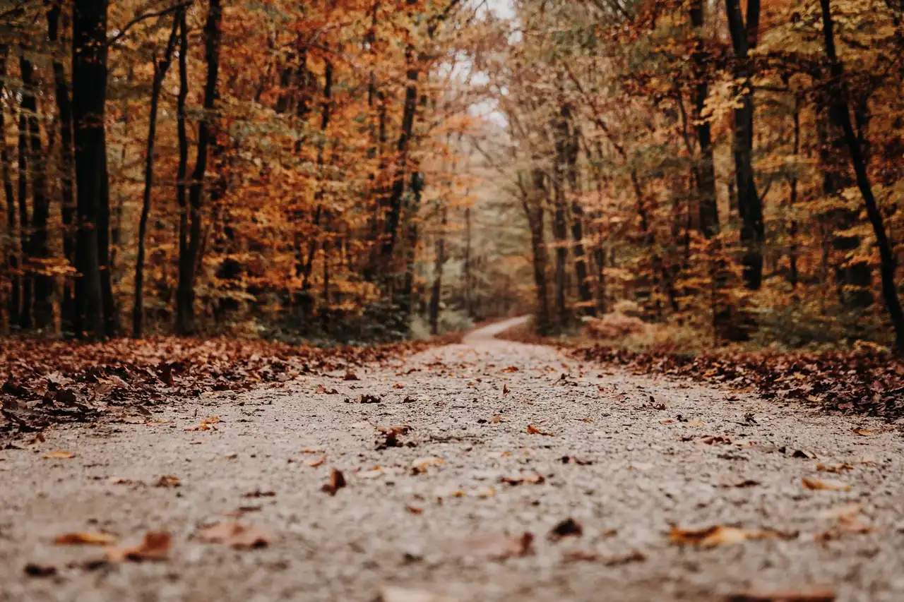
Indiana has a trail network far broader and more varied than its agricultural landscape might suggest. Former railway corridors, riversides, wetlands, forests and urban paths give the state nearly 4,600 miles of public trails managed by local, state and federal agencies as well as nonprofit organizations. For runners, that variety means easy asphalt outings, endurance sessions on compact surfaces and natural routes where pace becomes secondary to the terrain.
The phrase Indiana trails is often used to find information about the state’s paths in the United States, although it does not identify one single route or race. The appeal of these trails lies precisely in their network character: there are short urban paths, railway corridors extending for several dozen miles and natural areas for walking, running or cycling. The right choice depends on surface, elevation, shade, services and permitted use, not only on the trail name.
A trail network with many faces
Indiana is not a mountainous territory in the classic sense, but its routes are not all alike. The southern part of the state has more visible hills, ravines and forests, while the north combines wetlands, prairies, lakes and areas near Lake Michigan. In the center, urban growth has created asphalt connections between neighborhoods, parks and municipalities. The result is a particularly useful geography for base running.
A large part of the network comes from former railway lines. These platforms generally have gentle gradients and straight layouts, two features that make it easier to maintain a steady effort during a long run. Yet not every rail trail offers the same experience. Some are completely paved and suitable for conventional running shoes; others retain gravel, compact dirt, grass or crushed stone, surfaces that require more attention and may change after rain.
There are also urban greenways, river walks and shared corridors used by cyclists, pedestrians, animals and, in some cases, maintenance vehicles. Sharing the space is part of the experience. On narrow sections, overtaking requires advance warning and a slower pace. On two-way trails, staying to the right and leaving room is as important as wearing suitable footwear.
The most interesting routes for running
The Cardinal Greenway is one of Indiana’s major references. It extends for approximately 61 miles and connects different points in the eastern part of the state along a former railway platform. Its paved surface and generally moderate profile allow everything from interval workouts to long runs, although the total distance requires advance planning for access points, water and starting areas.
Another important name is the Monon Trail, which crosses areas around Indianapolis and connects municipalities in the metropolitan region. It is a well-used paved path with many urban access points. Its main advantage for runners is simple logistics: transport, restrooms, shops and connections are easier to find. The drawback is heavier use by cyclists and pedestrians, especially on sections near urban centers.
The Nickel Plate Trail offers a different experience. Its approximately 43.8 miles cross rural areas between Rochester and the outskirts of Kokomo, with a gap around Peru according to available information. The landscape is open and the route follows a former railway, but exposure to the sun can be considerable. On long rural routes, hydration autonomy and heat protection are decisive factors, even when the elevation appears easy.
The Pumpkinvine Nature Trail covers more than 18 miles and links Goshen, Middlebury and Shipshewana. Its surface combines asphalt and crushed stone, making it suitable for a comfortable outing or for adapting to mixed surfaces. The route passes farms, trees and small communities, creating variety without requiring the technical skills associated with mountain trail running.
In the southern part of the state, the Monon South Trail stands out, covering about 22.2 miles across several segments. Its expansion project aims to extend the connection between Mitchell and Borden, but the condition of each section can vary. This type of route illustrates a basic rule of hiking and running: the advertised length of a developing corridor does not always equal the continuous distance currently available.
Urban trails for regular training
Indianapolis has several useful options for runners seeking simple logistics. The Indianapolis Cultural Trail covers approximately 10.5 miles through downtown and connects different cultural districts. It is not isolated from traffic, but integrated into public space, with crossings, pace changes and varied users. It can work well for an easy run; for speed sessions, crossings and crowd levels may interrupt continuity.
The Fall Creek Trail offers around 13.9 miles alongside a wooded corridor in northern Indianapolis. The nearby water and tree cover create a more natural feeling than a conventional urban route. In warm months, that shade can make a noticeable difference. Even so, leaves, roots, branches and wet sections require runners to look several yards ahead, especially at dawn.
The Rivergreenway network in Fort Wayne and New Haven totals approximately 50 miles of connected paths. Its routes combine asphalt, boardwalks and riverside sections, with access to neighborhoods and parks. The terrain is generally friendly to runners of different levels, but the river setting means accounting for rain, flooding and maintenance. A comfortable trail is still a natural space exposed to changing conditions.
In Carmel and nearby communities, connections such as the White River Greenway and Hagan-Burke Trail provide short runs, active transportation and sessions that can be divided into several loops. Their value is not epic distance, but the ability to train near populated areas without giving up vegetation and open space.
Terrain matters more than the name
The word trail can suggest a technical path full of rocks and steep climbs. In Indiana, that interpretation is not always accurate. Many paths classified as trails are paved, shared-use routes designed for walking, cycling or travel between communities. Others are closer to natural paths, with dirt, roots and small changes in elevation. Before choosing shoes, it is important to identify the actual surface.
Asphalt provides a predictable stride and makes pace control easier, but it creates more repeated impact than softer surfaces. Crushed stone offers a middle ground: it usually drains well and remains firm, although it may shift underfoot on curves or uneven sections. Compact dirt feels pleasant when dry but loses stability in mud. The same route can feel completely different after a night of rain.
On grass or gravel, versatile daily trainers are usually enough if the ground remains stable. When roots, loose rocks or mud appear, a sole with more grip improves security. The goal is not to choose the most aggressive shoe, but to match protection and traction to the intended use. A very soft sole may feel awkward on asphalt, while a stiff, heavy shoe may be unnecessary on a flat rail trail.
Wear also changes with the surface. Stone can stress the midsole and upper, while asphalt accelerates wear on the outsole. Checking shoes after each run helps detect cuts, separation or loss of grip before they become problems. On long routes, technical socks and avoiding a first outing in new gear remain simple and effective precautions.
How to read maps, distances and access points
Trail maps often show a total length, but that number may refer to a section, an entire network or a route with disconnected segments. The difference matters when planning training. A 20-mile trail does not necessarily offer 20 continuous miles from the first parking area. It may include branches, urban interruptions, road crossings or sections still under construction.
The location of the access point also shapes the experience. Some trailheads have parking, restrooms, water fountains and information boards; others are simply entrances beside a road. A lack of services does not mean the trail is poorly maintained, but it does require more self-sufficiency. The full route should be studied on an updated map, including temporary closures, construction and detours.
Indiana’s state information systems collect data from agencies and organizations that manage the trails. That source is useful, although it does not guarantee that every detail is updated at the same time. Sections may have changed since the latest review, particularly on expanding routes. A map is a planning tool, not a replacement for local signs or observation on the ground.
For runners preparing a specific distance, the most reliable approach is to preview part of the route before completing a demanding workout. This reveals crossings, exposed areas, water points, shaded sections and possible turnaround locations. During a 90-minute run, knowing where the first section ends may be more useful than knowing the total length of the entire system.
Weather, safety and sharing the path
Indiana has warm, humid summers, cold winters and sharp changes during spring and fall. Humidity can make a moderate pace feel harder sooner, while cold reduces dexterity in hands and feet. Planning should account for temperature, wind, duration and how easily the runner can find assistance or return to the starting point.
On hot days, open paths and former railway lines may provide little shade. Light clothing, a cap and sun protection are as sensible as hydration. In wooded areas, shade helps, but it can also hide roots, fallen branches or mud. Running early does not remove every risk: visibility may be limited and wildlife is more active at certain times.
Indiana’s natural paths are shared with animals and other users. Runners may encounter deer, waterfowl, small mammals or insects, especially near rivers and wetlands. Keeping distance and not feeding wildlife protects both people and ecosystems. In areas where dogs are allowed, they should remain under control according to local rules.
Safety also depends on communicating the route. Telling someone which trail is being used, the expected return time and the access point is sensible when running alone. A charged phone, simple identification and a way to carry water take little space. Self-sufficiency does not mean running in fear, but reducing dependence on services that may not be available.
What former railway corridors offer runners
Rail trails have a distinctive physical character: they retain the geometry of former railway lines, with broad curves and limited gradients. They are valuable for endurance training because runners can focus on effort duration, breathing and stride consistency. The steady terrain makes it possible to maintain an even pace without constant elevation changes, which is useful during aerobic development.
Straight lines can also feel monotonous. On a long run, distance may seem harder when the scenery changes little. Dividing the route into time blocks, setting landmarks or alternating out-and-back sections can help maintain attention. Every workout does not need to become a speed test; the uniformity of the surface makes it easier to observe how the body responds.
These trails also have a historical dimension. Many routes follow former railway connections that carried goods and passengers for decades. Today, the same corridors are used for walking, running and cycling. Turning a transport route into a recreational space shows how infrastructure can acquire a second life without erasing its memory.
From a running perspective, that history comes with a practical advantage: access points often connect small communities with parks, schools or commercial areas. A workout may finish near a populated center rather than in an isolated location. Still, each section has its own rules, and activities are not permitted everywhere, so local information remains essential.
Natural routes and landscapes in the north and south
Northern Indiana offers trails near dunes, wetlands and forests around Lake Michigan. The Oak Savannah Trail, for instance, combines asphalt with prairie and natural areas between Hobart and Griffith. The Prairie Duneland Trail passes dune and prairie ecosystems, while the Calumet Trail includes crushed-stone sections and a wilder setting. These routes make the landscape as important as the workout.
In these areas, wind can matter more than elevation. Open routes have few natural barriers and may offer little protection on cold or hot days. Wetland trails can also collect water. A route that looks simple on a map may require more effort when the ground is soft or a headwind lasts for several miles.
The southern part of the state has more rolling terrain and a stronger presence of forests and ravines. The Whitewater Gorge Trail near Richmond is an example of a short route with trees and landforms that create a more natural hiking feel. Not every trail in this region is technical, but runners will encounter more pace changes and small climbs than on a central rail platform.
Paths beside lakes and rivers have a particular beauty, although they can also show a less friendly side. Wet ground, flooding and erosion can alter the surface. During a training run, it is sensible to accept that the planned time may change. The landscape is not a backdrop: it influences temperature, surface, navigation and effort.
A sensible way to prepare a run
Preparation starts with a basic decision: defining the purpose of the workout. A recovery run needs comfort and an easy way to leave the route. A long run requires water access, a return option and a surface that does not create excessive strain. A speed session needs continuity, few crossings and a sufficiently regular surface. The right trail changes according to the objective, even when the route remains the same.
It is also useful to separate distance from duration. On asphalt, many runners estimate time using their usual pace. On gravel, grass or uneven dirt, that reference becomes less accurate. The effort may be demanding at a slower speed. On natural surfaces, it is better to guide the session by effort and time than to chase asphalt figures that do not fit the terrain.
Nutrition depends on duration, temperature and individual tolerance. For short outings, arriving well hydrated may be enough; on longer routes, carrying water and easily digested food may be necessary. Fountains may not be working, and water from rivers, lakes or canals should not be consumed without treatment. The safest plan assumes autonomy and treats public fountains as an extra resource.
Clothing should match exposure. On a wooded trail, layers may feel too warm during the effort and become useful when stopping. On an open route, wind changes the perceived temperature. Reflective clothing improves visibility near roads and in urban areas, even when the path seems separated from traffic. A small vest or belt can carry essentials without significantly changing stride.
A network that also serves the community
Indiana’s trails are not only places to exercise. They connect neighborhoods, towns and facilities, provide alternatives to car travel and bring natural areas closer to people who do not normally practice sport. In cities such as Indianapolis, Fort Wayne and Carmel, greenways are part of everyday mobility, not merely leisure infrastructure.
That shared use means runners need a wider perspective. A child on a bicycle, an older person walking or someone using a wheelchair has the same right to enjoy the route. Speed cannot become a way of claiming the space. Slowing down in crowded areas and respecting crossings protects coexistence and improves the experience for everyone.
Maintenance depends on public agencies, volunteers, associations and users. Leaving no waste, avoiding shortcuts that cause erosion and respecting closures are small but cumulative actions. Signs and surfaces require constant work, especially after storms, floods or periods of heavy use. A well-kept trail is not maintained by inertia: it needs attention and shared responsibility.
For Spanish runners, Indiana’s network offers an interesting perspective. We often associate trail running with mountains, yet running in nature can also mean following a river, crossing a former railway or connecting two towns on an accessible path. Adventure does not always come from elevation; sometimes it appears in distance, quietness and the continuity of the route.
An open map for unhurried running
The main strength of Indiana’s trails is the variety of experiences covered by the same broad idea. There are urban routes where every mile mixes with daily life, rural paths that require carrying everything needed and natural spaces where weather matters more than the watch. The network adapts to different levels, ages and goals without reducing running to one surface.
Choosing well means looking beyond total distance. Surface, shade, wind, access, facilities, signs and user density create the real profile of a route. In that analysis, runners find a simple but powerful idea: a good trail is not necessarily the longest one, but the one that fits the effort and conditions of the day.
Indiana therefore preserves a map of paths where sport, mobility, nature and history meet. For those looking beyond familiar circuits, its former railways, riversides and green corridors offer a broad and flexible alternative. Trains once left lines across the land; those lines now support walking, cycling and running, turning memory into movement.



How to prevent thigh chafing: causes and real solutions

Women’s running windbreakers: seven jackets and how to choose

Do more workouts get rid of soreness? A guide for runners

Jaén Half Marathon 2026: Record 3,800 Runners Registered

Men’s short running tights: how to choose the right pair

World Triathlon confirms data breach involving medical data

Izan Edo targets podium at Miyazaki World Cup

María Pérez ranks ninth in World Athletics’ 2026 top ten

Dos Santos, Duplantis and Sawe: World Athlete of the Year finalists

San Silvestre Vallecana 2026: 42,000 places, prices and start times

 Races3 months ago
Valencia Half Marathon 2027: date and registration

 Races4 months ago
Valencia Marathon 2026: entry, ballot and course

 Reviews and Comparisons4 months ago
Asics Gel-Roadmiles 3 for men: review and current price

 Reviews and Comparisons4 months ago
Asics Gel Sonoma 8 Gore-Tex: complete analysis for trail and rain

 Sneakers3 months ago
Saucony Endorphin Pro 4: full review and verdict

 News5 months ago
Strava API 2026: what changes for clubs, challenges and runner apps?

 Reviews and Comparisons5 months ago
Nike Alphafly 3: opinions, sensations, and real key points

 Reviews and Comparisons4 months ago
Under Armour running shoes review 2025-2026: models and key features

 Sports Equipment4 months ago
Shoe sizes in cm: a clear guide to getting the right fit for your footwear

 Sneakers3 months ago
Skechers GO RUN Consistent 2.0 analysis: comfort and limits

 News5 months ago
Valencia Marathon 2026 route: key tips to train and run better

 Sneakers4 months ago
Adidas Adizero Boston 13 for men: review and verdict