News
Trail Running Routes in the Aragonese Pyrenees in November
Three Aragonese Pyrenees routes and five more under 15 km for running through beech forests this autumn.

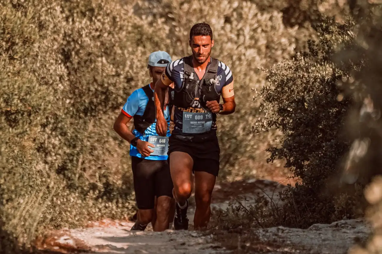
Image: RUN 4 FFWPU / Pexels
The Betato forest, in Piedrafita de Jaca (Huesca), offers a 4.4 km circular route with 198 m of positive elevation gain. It is the shortest of the three Aragonese Pyrenees routes that serve as a basis for planning trail running outings in November. The other two are the Llanos de La Larri, in the Pineta valley, and the Bosque del Señor, in Fanlo.
At this time of year the first snowfalls can appear at higher elevations, while the valleys keep their autumn colours and forest paths. For an outing like this, it is best to prioritise lower-altitude routes, with options to turn back and no exposed sections that could become tricky with ice or snow.
Betato forest, the circular beech wood in the Tena Valley
It is one of the best-known beech woods in the Tena Valley. The waymarked route starts in Piedrafita de Jaca and runs through a forest that is especially attractive in autumn: the beech trees and the leaf-covered ground make it a very photogenic outing.
The path has a few uphill sections and then joins a track that leads back to the village. Damp and leaves can make the ground slippery, so it is best to avoid fast descents.
Llanos de La Larri, in the Pineta valley
The Pineta valley offers one of the most recognisable landscapes in the Aragonese Pyrenees. The route, in Bielsa (Huesca), is an out-and-back from the valley floor and climbs from the area around the Parador along a path through a forest of beech and fir trees.
The climb leads to open meadows at the foot of the great mountain walls, with a striking contrast between forest and high mountain. The reference time is about an hour and a half of climbing on foot, that is, walking rather than running. In November, check whether snow or ice affects the route.
Bosque del Señor, a point-to-point route in Fanlo
This is a lesser-known option in the Fanlo area, in Sobrarbe, away from the big peaks and the busiest routes. It is 6.5 km long and the reference time on foot is 2 h 20 min, also intended for hiking.
As it is a point-to-point route, you need to organise your return and check the condition of the path before setting out.
Five more routes under 15 kilometres across Spain
Outside Aragon there are more forests to run in over short distances. The published times for these routes are for hiking, not running. All of them are circular:
- Faedo de Ciñera (León): 4.5 km and about 108 m of positive elevation gain, through an ancient beech wood in the Gordón valley with the Villar stream and giant’s kettles.
- Bosque Finlandés and El Paular (Rascafría, Madrid): 4.3 km and about 52 m of positive elevation gain, passing the El Paular monastery, the Puente del Perdón and the Bosque Finlandés, with its birch trees and riverside vegetation.
- Otzarreta beech wood (Bizkaia): 6.8 km and 124 m of positive elevation gain, linking the beech wood with the Uguna waterfall and the Saldropo wetland, in the Gorbeia Natural Park.
- Mura and Puig de la Balma (Barcelona): 10.4 km and 397 m of positive elevation gain, through the Sant Llorenç del Munt i l’Obac Natural Park, with Mediterranean vegetation, seasonal streams and traditional buildings.
- Monte Hijedo (Burgos and Cantabria): 11.4 km and 292 m of positive elevation gain, along the PRC-BU 30 trail through a mixed forest of beech, oak, yew, alder and birch, next to the Cabaña del Hijedo.
The Faedo has walkways and busy sections, so it is not advisable to treat it as a fast training run.
Precautions and kit for running in November
A simple route in October can have ice, snow or mud a few weeks later. Before setting out, check the weather forecast, look at the notices from the protected natural areas and check the condition of the access routes. If there is snow or ice, it is better to change the route or postpone the outing: these routes are no substitute for proper mountain planning, and conditions always depend on the weather.
In November, leaves hide roots and stones, rain reduces grip and fog can make navigation difficult. We recommend trail shoes with good grip, a waterproof layer and the route downloaded. Also take thermal clothing, a head torch and enough phone battery, because daylight disappears early and you need to allow time to get back. In protected areas, stick to the waymarked paths and respect any access restrictions.
The Aragonese Pyrenees in numbers
The Aragonese Pyrenees are concentrated in the province of Huesca, with Navarre to the west, Catalonia to the east and 136 km of border with France to the north. The three highest peaks in the Pyrenees are in Aragon: Aneto (3,404 m), Posets (3,375 m) and Monte Perdido (3,355 m).



How to prevent thigh chafing: causes and real solutions

Women’s running windbreakers: seven jackets and how to choose

Do more workouts get rid of soreness? A guide for runners

Jaén Half Marathon 2026: Record 3,800 Runners Registered

Men’s short running tights: how to choose the right pair

World Triathlon confirms data breach involving medical data

Izan Edo targets podium at Miyazaki World Cup

María Pérez ranks ninth in World Athletics’ 2026 top ten

Dos Santos, Duplantis and Sawe: World Athlete of the Year finalists

San Silvestre Vallecana 2026: 42,000 places, prices and start times

 Races4 months ago
Valencia Half Marathon 2027: date and registration

 Races4 months ago
Valencia Marathon 2026: entry, ballot and course

 Reviews and Comparisons4 months ago
Asics Gel-Roadmiles 3 for men: review and current price

 Reviews and Comparisons4 months ago
Asics Gel Sonoma 8 Gore-Tex: complete analysis for trail and rain

 Sneakers3 months ago
Saucony Endorphin Pro 4: full review and verdict

 News5 months ago
Strava API 2026: what changes for clubs, challenges and runner apps?

 Reviews and Comparisons5 months ago
Nike Alphafly 3: opinions, sensations, and real key points

 Reviews and Comparisons4 months ago
Under Armour running shoes review 2025-2026: models and key features

 Sports Equipment4 months ago
Shoe sizes in cm: a clear guide to getting the right fit for your footwear

 Sneakers3 months ago
Skechers GO RUN Consistent 2.0 analysis: comfort and limits

 News5 months ago
Valencia Marathon 2026 route: key tips to train and run better

 Sneakers4 months ago
Adidas Adizero Boston 13 for men: review and verdict