Races
Mad Marathon in 2027: date, course and distances in Vermont
Vermont hosts five race formats, with a marathon shaped by rolling hills, rural roads and historic covered bridges.

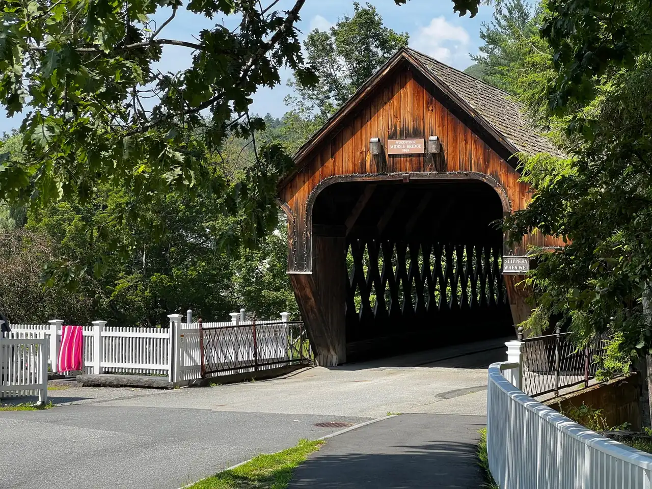
The Mad Marathon will hold its 16th edition on July 11, 2027, in Waitsfield, in the Mad River Valley of central Vermont, United States. The event brings together a marathon, half marathon, relay, 5K and 10K. Its main attraction also defines its difficulty: a rural course amid the Green Mountains, with back roads, dirt roads, covered bridges and terrain that links climbs with descents.
The marathon starts at Mad River Green in central Waitsfield. The date is confirmed, but the available information does not establish the start time, entry fees or eligibility conditions for each race. It also does not provide a sufficiently supported total elevation gain. This is a race with a distinctive landscape and physical demands, rather than a flat urban course designed solely around maintaining an even pace.
The main event covers the standard 42.195-kilometer marathon distance, described by the organizers as 26.2 miles. The half marathon provides a 21.0975-kilometer alternative, while the 5K and 10K expand the day to include shorter efforts. The relay allows runners to share the challenge, although the available information does not specify team size, leg distances or the rules governing exchanges.
That variety matters in a place where the scenery is more than a backdrop. Farms, historic barns and fields of cattle line a course that makes use of the valley’s network of rural roads. The experience is far removed from a marathon on broad city avenues: the horizon opens across farmland, narrows inside a covered bridge and shifts again after each rise.
Waitsfield is the host town, and Vermont is the U.S. state where the event takes place. This race should not be confused with other New England events or the marathon in Burlington, which has a different location and course. For runners traveling from Spain, correctly identifying the town hosting the start matters as much as choosing a distance: it shapes accommodation, transport and the time needed before putting on a race bib.
The opening section has a clear feature: from Mad River Green, the race follows Route 100 north for approximately 0.6 miles, just under one kilometer. It then leaves that road for a secondary route and crosses a covered bridge on Bridge Street. The atmosphere changes early, moving from the village center onto the roads that give the marathon its most recognizable character.
The first climb arrives approximately one mile, or 1.6 kilometers, after the start. The course heads up Joslin Hill Road, and the organizers’ description places an aid station along the climb and another at its top, around mile 2.2, or roughly 3.5 kilometers. The race therefore asks for a substantial effort before runners have covered much of the overall distance.
That opening changes how pace should be interpreted. Uphill, maintaining the same minutes per kilometer as on flat ground can demand considerably more effort; chasing that consistency from the start can prove costly later. The useful reference becomes the level of effort, not simply the number on a watch. A controlled start has a concrete justification here: the course introduces climbing while almost the entire marathon still lies ahead.
Joslin Hill Road joins North Road, where the course description outlines roughly another 2.5 miles, or four kilometers, of gently descending terrain. Passing through Pine Brook Covered Bridge leads toward another aid station at Meadow Road. Bridges and junctions provide useful course landmarks, but they do not replace the final map or the signage established by the organizers for the 2027 edition.
Around Neill Farm, the marathon moves onto dirt roads and through an agricultural area that captures the valley’s character. The description includes an out-and-back section at Meadow Road, followed by a continuation along North Road to a turnaround near Carpenter Farm, a little beyond mile six. That places runners just past approximately 9.7 kilometers, still only a little beyond the first quarter of the race.
Out-and-back segments create a different dynamic from a wholly circular course. They allow runners to see participants traveling in the opposite direction and preview some of the ground they will cover later. They also require attention to turns and instructions. In this event, the named course landmarks help explain the route’s logic, although the supplied information does not precisely establish every junction or the distance between them.
On the return along North Road, the description places the Common Road intersection around mile 9.4, approximately 15.1 kilometers. A short out-and-back on East Road comes before the course continues. Then Common Road introduces dirt amid barns, working farms and rural homes. This is not merely a visual change: the surface can affect foot placement and calls for more attention to the ground than consistently smooth pavement.
That section extends for just under three miles and joins East Warren Road beyond mile 12, near 19.3 kilometers. The race continues to link roads across the valley rather than seeking a succession of fast straightaways. By this stage, managing the hills already matters: runners have alternated between gradients, surfaces and turns, yet they have not quite completed half of the main race distance.
East Warren Road accounts for approximately the next three miles, or 4.8 kilometers, through rolling countryside. At Roxbury Mountain Road, a loop described as four miles, roughly 6.4 kilometers, begins, linking Roxbury, Senor, Fuller Hill and Plunkton. This loop on back roads keeps the course close to farms and scattered homes. For participants, its significance lies both in the views and in the sustained effort across changing terrain.
The description places the return to East Warren Road around mile 19, approximately 30.6 kilometers. From there, it describes a generally descending but still rolling section toward Bridge Street and the finish. Those details establish the character of the closing miles, but they do not independently reconstruct all 42.195 kilometers: there is not enough information to account for every distance. The final map and race instructions need to resolve that before race day.
That distinction prevents a scenic course description from being mistaken for a navigation file. Partial distances help locate key points, but they are not a complete route or a guarantee that every turn will remain unchanged in 2027. Nor does the supplied organizer information establish a verifiable total elevation gain. References to demanding climbs are supported; assigning them an exact number of meters without a reliable profile would imply certainty the evidence does not provide.
The combination of roads and dirt surfaces does not automatically make this a technical mountain race. The setting is rural and mountainous, but the description chiefly mentions secondary roads and tracks, not narrow trails, scrambling or exposed passages. The difficulty comes from the hills and the distance, together with changes in surface. Confusing mountain scenery with technical terrain can lead to equipment choices or expectations that do not match the race.
For runners accustomed to flat routes in Valencia, the most important contrast will be the lack of a similarly consistent pace. Regular training on promenades or avenues does little to reproduce the demands of a sustained climb followed by a descent. In general terms, preparation for a profile like this includes gradual exposure to hills alongside the endurance work required for the distance. The goal is not to add climbing abruptly, but to arrive familiar with its effects.
Descents deserve attention in their own right. Even when a watch shows a faster pace and the cardiovascular effort feels lower, muscles still absorb repeated braking forces and loads. After several miles, that cost can become noticeable in the quadriceps. The valley’s course demands saving the legs for later, not merely avoiding breathlessness. A favorable slope stops being helpful if it is used to claw back every second lost on the preceding climb.
Shoe choice depends on the actual road conditions and the runner’s experience. Compacted dirt does not automatically require a trail shoe; equally, not every road shoe provides the same confidence on gravel or damp ground. It makes sense to consider grip and stability alongside comfort and cushioning. The decision should reflect the expected surface, without introducing an unfamiliar shoe for the first time during a long-distance race.
Vermont’s summer landscape can feel very different from conditions associated with Mediterranean heat, but that does not guarantee a cool morning. The organizers highlight the valley’s summer appeal; that description is not a weather forecast for July 11. Planning should allow for temperature and humidity changes, as well as possible rain. Without specific weather information close to the date, promising ideal conditions would not be justified.
The course information mentions several aid stations in its early stages, including those on Joslin Hill and near Meadow Road. However, it does not establish the spacing between every station or what each will provide. For the marathon and half marathon, fueling during the race needs to fit the expected duration and what has been tested in training. Assuming that a particular gel, drink or food will be available can undermine that planning.
The marathon is presented with a USATF course certification identified as VT22002JK. That reference is more substantial than a general claim about course quality because it identifies the certification cited for the distance. Still, accurate course measurement and a fast profile are separate matters. A route can cover the regulation distance while remaining less favorable for a personal best because of its hills and surfaces.
Using a result to apply for Boston requires another distinction. Course certification does not mean automatic entry to Boston: the target edition’s rules, qualifying window, required times and admission process all matter. The supplied information does not establish those requirements for a result achieved in July 2027. Presenting this race as a guaranteed ticket to another event would confuse a property of the course with an entry decision.
The half marathon offers a shorter distance, but there is not enough information to assign it every climb or junction described for the marathon. The same applies to the 5K and 10K: sharing a date and town does not prove that their routes overlap. Additional references mention a category for walkers associated with the half marathon, though they do not detail its conditions for 2027. Availability and rules require specific confirmation rather than extrapolation from other editions.
The relay provides another way to take part, particularly for groups with different goals. However, the word relay does not establish the number of runners, the distribution of mileage or transport between exchange points. Nor does it demonstrate that every team member will run an equal leg. The composition of relay teams is one of the questions not resolved by the available information, alongside access arrangements for the exchange areas.
For registration, no confirmed prices, opening or closing dates, entry limits, minimum ages or cancellation policies are available in the supplied information. An announced race date does not by itself establish that entries are on sale. A sufficiently supported start time is also missing. These details awaiting confirmation have real implications for travel and participation, so filling them with typical fees from other marathons or times published without reliable context would be inappropriate.
For travel from Spain, the practical starting point is that the race takes place in a rural U.S. valley, not a large city with a start beside a transport terminal. Accommodation and arrival in Waitsfield need to be coordinated with the start location and time once those details are published. The final stage of the journey deserves as much attention as the international flight, especially when relying on someone else’s schedule or a shared vehicle.
There is no confirmed information here about parking, shuttles, road closures or bib collection for this edition. Nor is a pickup venue established that would allow precise planning for the preceding day. Staying near the valley may reduce travel, but it does not guarantee direct access to the start. Logistics need reasonable margins for delays, particularly on a long trip, without turning general recommendations into assumed services the organizers have not announced.
The trip also involves arrangements outside the sporting rules. U.S. entry documents and health care arrangements should be checked against the traveler’s circumstances and the regulations in force at the time of travel. It is not prudent to assume that all residents of Spain face the same requirements. Checking the scope of insurance coverage also matters, because a travel policy may set particular conditions for participation in sporting competitions.
Beyond race day, the valley offers an active travel setting. The reference information mentions cycling, golf, kayaking, canoeing and fly-fishing, as well as opportunities for walking. That helps explain why the race appeals to visitors interested in more than a finish time. Even so, the demands of the marathon make it sensible to distinguish gentle activities from physically strenuous days: a hard outing the day before may make itself felt on each of the first climbs.
The identity of this event lies in pairing a familiar distance with surroundings that change how it is run. The 42.195 kilometers remain the same as in any marathon, but the terrain introduces changes in cadence, footing and effort while covered bridges and farms shape the scenery. July 11 in Waitsfield provides a specific date for 2027; the schedule, registration arrangements and final details for each race are the pieces still needed to complete that picture.
For those who value the race for its views and rural character, the demanding profile is not a flaw to hide but part of the choice. For those chasing a time, it is a decisive condition. That distinction captures the Mad Marathon’s appeal: the landscape shapes the run. Seeing the Green Mountains from the road is only part of it; the valley’s rolling ground enters every stride and stays with runners long after they cross the first bridge.
Where to stay in Waitsfield
Hotels available 9–12 July 2027.
Affiliate links: if you book through this map we earn a commission, at no extra cost to you.



How to prevent thigh chafing: causes and real solutions

Women’s running windbreakers: seven jackets and how to choose

Do more workouts get rid of soreness? A guide for runners

Jaén Half Marathon 2026: Record 3,800 Runners Registered

Men’s short running tights: how to choose the right pair

World Triathlon confirms data breach involving medical data

Izan Edo targets podium at Miyazaki World Cup

María Pérez ranks ninth in World Athletics’ 2026 top ten

Dos Santos, Duplantis and Sawe: World Athlete of the Year finalists

San Silvestre Vallecana 2026: 42,000 places, prices and start times

 Races3 months ago
Valencia Half Marathon 2027: date and registration

 Races3 months ago
Valencia Marathon 2026: entry, ballot and course

 Reviews and Comparisons4 months ago
Asics Gel-Roadmiles 3 for men: review and current price

 Reviews and Comparisons4 months ago
Asics Gel Sonoma 8 Gore-Tex: complete analysis for trail and rain

 Sneakers3 months ago
Saucony Endorphin Pro 4: full review and verdict

 News5 months ago
Strava API 2026: what changes for clubs, challenges and runner apps?

 Reviews and Comparisons5 months ago
Nike Alphafly 3: opinions, sensations, and real key points

 Reviews and Comparisons4 months ago
Under Armour running shoes review 2025-2026: models and key features

 Sports Equipment4 months ago
Shoe sizes in cm: a clear guide to getting the right fit for your footwear

 Sneakers3 months ago
Skechers GO RUN Consistent 2.0 analysis: comfort and limits

 News5 months ago
Valencia Marathon 2026 route: key tips to train and run better

 Sneakers4 months ago
Adidas Adizero Boston 13 for men: review and verdict