Races
Nogueruelas Trails: complete guide to routes and races
Terrain, trails, mountain running, and useful information about Nogueruelas, in the Sierra de Gúdar-Javalambre.

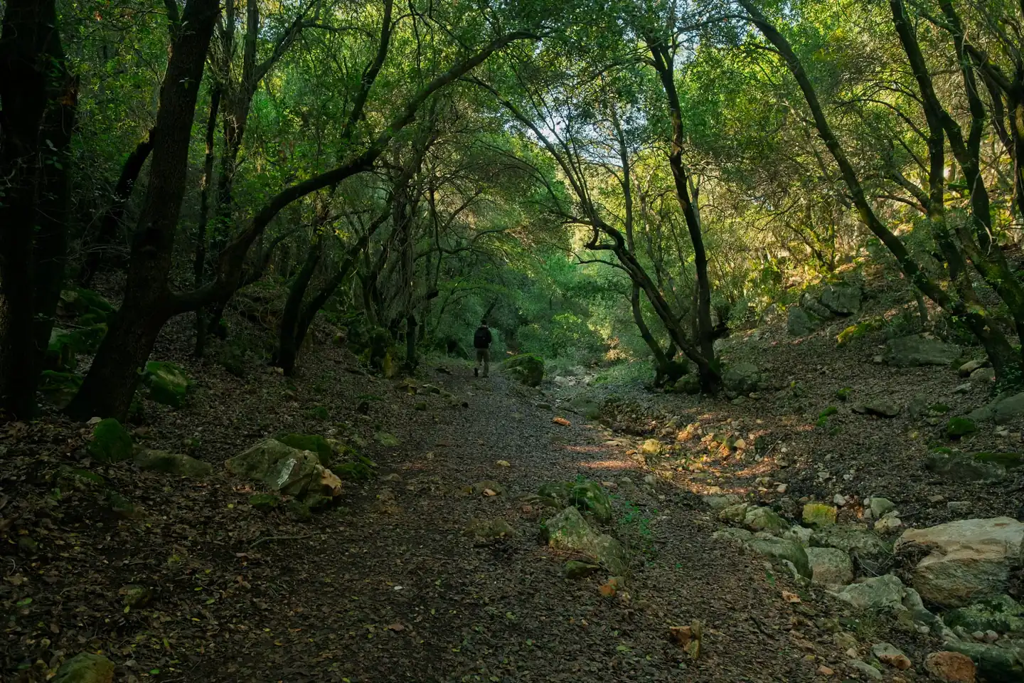
Nogueruelas brings together one of those geographies that on their own explain why the interior of Teruel has become a reference for hiking and trail running: elevation, extensive pine forests, ravines, springs, viewpoints, and small villages linked by paths that seem hand-drawn.
Around the municipality open up walking routes, running routes, and mountain races with very different profiles, from gentle outings around nearby villages to long, demanding routes with serious elevation gain. The result is a very complete outdoor map, where a quiet stroll, a full-day route, and competition all coexist.
A territory made to rack up elevation and landscape
The Nogueruelas area is part of the Maestrazgo of Teruel, with a mid- and high-mountain setting that alternates river valleys, gentle ridges, and pine forest masses. It is not a landscape of vast plains or abrupt peaks; its appeal lies in the continuity of the relief, in that succession of climbs and descents that forces you to read the terrain like someone deciphering a score.
That character explains why outdoor activities carry so much weight here. The paths connect rural settlements, allow you to link hermitages and castles, and head into areas where water marks the way: streams, ravines, springs, and pools. On clear days, the viewpoints also offer long panoramas over the Sierra de Gúdar-Javalambre, with a sense of openness that surprises in such a sheltered setting.
The area works well for much of the year, although the experience changes a lot depending on the season. Spring and autumn usually offer the most balanced combination of temperature, light, and color. Summer calls for an early start. Winter, on the other hand, demands more caution, extra layers, and attention to the condition of the ground, especially on shaded stretches and at higher elevations.
The routes that best define the experience in the area
The network of trails around Nogueruelas does not follow a single logic. There are circular routes designed to fill a morning, more ambitious traverses, and paths that connect nearby towns with clear scenic interest. That variety is one of the reasons the area often appears on route portals and specialized interactive maps.
Among the most cited routes are those linking Rubielos de Mora, Mora de Rubielos, Linares de Mora, Olba, and Alcalá de la Selva. These are not isolated names on a map, but pieces of the same mountain board. Each town adds a different nuance: medieval stone, wooded slopes, historic heritage, or open views toward the neighboring mountains.
One of the most representative routes is the loop from Rubielos de Mora to the hermitage of Santa Isabel, with about 14.8 kilometers, 4 hours and 22 minutes of walking, and roughly 410 meters of ascent. It is a clear example of a moderate route, substantial enough to feel like mountain terrain without entering extreme ground. Also listed is the circular route to the hermitage of Santa Isabel from Rubielos de Mora, a little shorter, with 10.3 kilometers and close to 270 meters of elevation gain, a balanced option for anyone looking for a long but not excessive day out.
In a similar register appears the route from El Molinete, with 12.2 kilometers and 250 meters of accumulated ascent, and the full circuit of Linares de Mora, already more serious, with 19.9 kilometers, 780 positive meters, and a duration of around 6 hours and 14 minutes. In that range also sits the circular itinerary from Rubielos de Mora, 4.36 kilometers long, designed for an easy and quick outing, useful as a walk or as a first contact with the terrain.
Beyond the length, the decisive element is the type of ground and the continuity of the elevation change. In the region, compact dirt roads, forest trails, and track sections are common, making progress easier, although there are also areas where the route narrows and calls for sure footing. It is not usually technical mountain terrain in the Alpine sense, but it is a landscape that rewards attention.
Trail running among pine forests, ravines, and high villages
The Nogueruelas area also has a very clear appeal for those who run in the mountains. The running routes around the municipality make use of the same relief as the hiking routes, but with a more dynamic logic: less time on long climbs, more attention to cadence, and a very marked use of runnable tracks and trails.
The most common routes in the area range from medium to medium-long distances, with profiles that combine fast sections and ramps that force you to pace yourself. The Rubielos de Mora circuit appears with 13.5 kilometers, 280 meters of elevation gain, and an estimated time of 1 hour and 39 minutes. Another notable route is the one through Mora de Rubielos and its castle, with 10.8 kilometers and 240 meters of ascent, a route very suitable for anyone looking to run with a scenic component and a reasonably steady pace.
Also worth noting are the loop starting from Camping Los Álamos, with 5.46 kilometers and only 50 meters of ascent, and the itinerary in Olba, more demanding, with 12.4 kilometers and 400 meters of elevation gain. In this kind of setting, the difference between a comfortable outing and a hard day often lies less in the distance than in the sequence of short climbs and in the quality of the footing under your shoes.
The sporting reading of the territory is completed by a simple idea: this is not a place to run fast without looking at the map. The variety of junctions, ravines, and changes in slope favors more attentive trail running, the kind that accepts that sometimes it is better to walk a few meters to save energy or avoid unnecessary wear. That mix of effort and observation is part of the local charm.
The community descriptions also mention very valuable elements for mountain runners: extensive pine forests, high points such as La Hoya or Cabeza de las Cruces, scattered springs, and areas with wide views over the sierra. These are references that help explain why this area works so well for training in nature and for long weekend outings.
The mountain race that puts the name on the map
Beyond leisure and training, Nogueruelas has a competitive presence through Nogueruelas Trails, a mountain event linked to the Gúdar Javalambre circuit and registered by the Aragonese Athletics Federation in its 2023 regional edition. The race is usually held in late March, a very suitable time in the calendar to compete in the mountains without summer heat or winter harshness.
The reference information places the race with two official distances: 12.7 kilometers and 30.1 kilometers. The first corresponds to a trail or CxM format of a more contained nature, with about 550 meters of positive elevation gain. The second is the main route, more ambitious, with 1,560 meters of accumulated ascent, a figure that places it clearly in demanding territory for any regular runner.
That contrast between two distances sums up the spirit of the race well: a more accessible entry point and a long version for those seeking a serious mountain challenge. In both cases, the setting adds prominence. The route is not understood as just a sum of kilometers, but as a way of crossing the landscape of the sierra with the right balance between performance and territory.
The presence of the race reinforces an important idea: Nogueruelas is not only a place to pass through, but to measure yourself against the terrain. The local mountain is not offered as a backdrop, but as an active stage, with slopes that force you to decide, to manage effort, and to read it with a clear head. That explains why the area attracts both hikers and mountain runners.
What makes these routes special compared with other areas of Teruel
The interior of Teruel has many attractive areas for walking or running, but the Nogueruelas surroundings add a very specific combination: small villages, visible heritage, and a gentle but constant relief. It is not the extreme toughness of continuous high mountains, nor the monotony of an endless forest road. It is something else, more nuanced, more human in scale.
The villages in the area add extra value that maps do not always capture. Rubielos de Mora, for example, offers a very recognizable medieval ensemble; Mora de Rubielos adds the silhouette of its castle; Alcalá de la Selva appears at high altitude and with a distinctly mountain feel. All of this turns the routes into more than exercise: they are also a way of reading the territory in layers.
The scenic variety is another decisive point. You move from stretches with dense vegetation to clearings where the horizon suddenly opens up. There are springs, ravines, water areas, and natural formations that break the rhythm. On a mountain outing that matters a lot, because the experience depends not only on physical effort, but on the way the eye rests and reactivates with each change of scene.
It is also worth stressing that the area suits different levels of preparation. There are easy options, moderate ones, and several hard routes. In practical terms, that means the area can work just as well for a family wanting to walk as for someone looking to gain elevation or prepare for a trail race. Versatility is one of its main virtues.
Signs in the terrain worth reading before setting out
In this kind of landscape, the map is not just a complement; it is a basic navigation tool. Ravines can disorient you, forest junctions are plentiful, and some tracks invite you to keep going straight when in fact the path clearly turns a few meters ahead. That is why the experience in Nogueruelas improves a lot when you pay attention to crossings and to the general orientation of the sierra.
Altitude also changes how effort feels. On long routes, especially those approaching or exceeding the threshold of 700 or 800 meters of positive elevation gain, the thermal sensation can change quickly. A sunny midday can turn into a cold descent in the shade, and the wind at higher elevations makes a light jacket not a minor accessory, but a sensible precaution.
Another useful element is the nature of the ground. Most of the paths are suitable for walking and running without major technical difficulties, but the irregularity of the terrain calls for shoes with good grip. You do not always need to think about deep mud or tricky rock; a loose stone on a descent or a bend with fine sand is enough to show that stability matters.
Logistics also matter. In a rural region, access may be less immediate than in an urban setting, and that makes it advisable to plan the trip with some margin. Circular routes solve part of that problem well, because they simplify both the start and the finish. Even so, it is worth assuming that the experience here depends a lot on going with time, not in a rush.
Heritage, viewpoints, and water: the added value of the walk
One of the reasons Nogueruelas and its surroundings appear again and again on hiking maps is the presence of natural and cultural attractions integrated into the route itself. The appeal is not only in the trail, but in what surrounds it: hermitages, castles, rock formations, springs, pools, and villages that act as visual stops along the way.
Among the most mentioned points of interest in the area are El Salto, the Fuente de la Salud, and the rock formation known as Peña Ojerada. These are names that come up in hikers’ conversations because they neatly condense the local mix of nature and relief. Water brings freshness and rhythm; rock brings character; the viewpoint brings distance. Together they draw a very rewarding geography for the walker.
On the historical side, the castle of Mora de Rubielos and the one in Alcalá de la Selva add context and depth. These are not isolated monuments, but landmarks that give meaning to the routes around them. The walker or runner senses that they are moving through a territory occupied, defended, and lived in for centuries, not just a scenic backdrop.
The community comments about the views from the sierra are also appealing. On clear days, the horizon line lets you make out other mountain ranges, ski resorts, and observation towers. That visual breadth turns every outing into an exercise in landscape reading, something much appreciated by anyone who values both the physical side of effort and the aesthetics of movement.
When it is best to go and what kind of outing fits best
The best choice depends on the goal. For walking at a relaxed pace, spring and autumn are usually the most rewarding seasons. The countryside is more alive, the light is cleaner, and the heat is less punishing. For running, those same seasons offer a very reasonable temperature range, especially on routes with moderate ascent and partial sun exposure.
If the idea is a short outing, routes under 6 kilometers around Rubielos de Mora or nearby areas are enough for a quiet morning. For a full day of hiking, circuits between 12 and 15 kilometers already let you fully enter the character of the region. And if sporting ambition is what matters, routes close to 20 kilometers or the 30.1-kilometer Nogueruelas Trails race raise the bar much higher.
The key, really, is understanding that this territory adapts well to different rhythms. It can be seen as a place for strolling, as a school of elevation gain, or as a natural arena for competition. That flexibility is rare and valuable. There are beautiful areas, hard areas, and comfortable areas; here, the ones that combine two or three of those qualities at once are plentiful.
That is why Nogueruelas cannot be reduced to a single label. It is a route base, a gateway to trail running, a landscape for unhurried walking, and a setting that, at certain times of year, becomes a reference for mountain athletics. In a map increasingly full of similar destinations, it keeps a simple and hard-to-copy advantage: the terrain still rules.
A small map with a lot of depth
The value of Nogueruelas is not in immediate spectacle, but in the sum of details that appear as you move along: a spring by the path, a change of light in the pine forest, a castle in the distance, a climb that forces you to slow down, an unexpected viewpoint. That fine weave is what makes the place memorable.
Anyone coming with a hiking mindset will find variety, heritage, and well-resolved routes. Anyone coming in trail shoes will find elevation gain, runnable tracks, and stretches where the body shifts into continuous work mode. And anyone following the competition trail will find a mountain race with clear distances, real demand, and a first-rate mountain setting.
Nogueruelas Trails is, in that sense, more than a proper name: it is the synthesis of a territory that is best explored on foot, with patience and with your eyes on both the ground and the horizon. That mix, so simple to say and so hard to find well balanced, explains why the area keeps gaining ground on the Aragonese outdoor map.



How to prevent thigh chafing: causes and real solutions

Women’s running windbreakers: seven jackets and how to choose

Do more workouts get rid of soreness? A guide for runners

Jaén Half Marathon 2026: Record 3,800 Runners Registered

Men’s short running tights: how to choose the right pair

World Triathlon confirms data breach involving medical data

Izan Edo targets podium at Miyazaki World Cup

María Pérez ranks ninth in World Athletics’ 2026 top ten

Dos Santos, Duplantis and Sawe: World Athlete of the Year finalists

San Silvestre Vallecana 2026: 42,000 places, prices and start times

 Races3 months ago
Valencia Half Marathon 2027: date and registration

 Races3 months ago
Valencia Marathon 2026: entry, ballot and course

 Reviews and Comparisons4 months ago
Asics Gel-Roadmiles 3 for men: review and current price

 Reviews and Comparisons4 months ago
Asics Gel Sonoma 8 Gore-Tex: complete analysis for trail and rain

 Sneakers3 months ago
Saucony Endorphin Pro 4: full review and verdict

 News5 months ago
Strava API 2026: what changes for clubs, challenges and runner apps?

 Reviews and Comparisons5 months ago
Nike Alphafly 3: opinions, sensations, and real key points

 Reviews and Comparisons4 months ago
Under Armour running shoes review 2025-2026: models and key features

 Sports Equipment4 months ago
Shoe sizes in cm: a clear guide to getting the right fit for your footwear

 Sneakers3 months ago
Skechers GO RUN Consistent 2.0 analysis: comfort and limits

 News5 months ago
Valencia Marathon 2026 route: key tips to train and run better

 Sneakers4 months ago
Adidas Adizero Boston 13 for men: review and verdict