Races
Otos Trail 2026: date and course
Otos’ autumn event combines a competitive sprint and a walking option on a mountain route starting at Plaça del Llaurador.

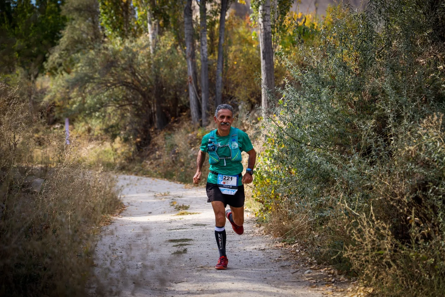
Imagen: Emrah Yazıcıoğlu / Pexels
The seventh edition of the Pujada al Castell de Carbonera is scheduled for October 25, 2026, in Otos, Valencia. The programme includes a competitive Sprint Trail and a non-competitive hiking walk, both on the same route, which covers approximately 10.3 kilometres with 479 metres of positive elevation gain. The start and finish will be at Plaça del Llaurador.
The race passes partly through the protected Ombria del Benicadell area and approaches Castell de Carbonera, although the route does not enter the inside of its walls for archaeological reasons. Participation is restricted to adults. For those considering the event, these details define its essentials: distance, elevation, formats and a natural setting whose protection shapes the course.
An autumn event in Otos
The edition’s full name, VII Otos Trail – Pujada al Castell de Carbonera, marks the event’s seventh year. It is organised by the OtosTrail volunteer group with support from Otos Town Council. This local collaboration makes the race part of the town’s life: an event that brings runners and walkers together and turns its mountain paths into shared ground for a few hours.
The announced date is Sunday, October 25, 2026. Available information identifies the town and the start and finish location, but does not specify the start time, entry fee or registration status. Those details can matter when planning travel, particularly for visitors coming from outside the Vall d’Albaida, so unlisted schedules or prices should not be treated as confirmed.
The start and finish at Plaça del Llaurador provide a clear reference point in Otos. Having both at the same location makes the basic logistics easier to understand than in an event with separate start and finish areas. Even so, the assembly time, access to town, possible traffic restrictions and race-bib collection instructions depend on the final information issued by the organisers.
A little over six miles, with meaningful climbing
The announced course covers approximately 10.3 kilometres and 479 metres of positive elevation gain. It is not simply a flat 10K transferred to a path: the elevation figure indicates accumulated climbing, although the available details do not explain how it is distributed. Distance alone therefore cannot predict the effort; gradient, surface and the sequence of climbs also affect finishing time and how the race feels.
Dividing the accumulated elevation by the distance gives an arithmetic average of about 46.5 metres of ascent per kilometre. That calculation offers a broad reference, but it does not mean the gradient is constant or reveal the course profile. Some sections may be gentler than others; without an official map or elevation chart, it is not possible to say where climbs are concentrated or what type of ground features each section.
The event is presented as a Sprint Trail, distinguishing it from longer mountain races on the calendar, but the label does not remove the demands of running off-road. Over a course of this length, effort management usually depends on adapting pace and paying attention to the terrain. The 479-metre elevation figure is useful for comparing the event with other races, provided it is understood that the complete profile also shapes the actual difficulty.
One route for running and walking
The programme offers two options: a competitive Sprint Trail and a non-competitive hiking walk. Both use the route of around 10.3 kilometres, so the main difference lies in the nature of participation, not in the published distance. The walk allows people to cover the area on foot without taking part in the sporting standings, while the sprint is intended for those competing as runners.
Sharing a route also means runners and walkers must follow the organisers’ instructions and observe the rules for using the paths. In events with simultaneous formats, sharing the course is part of the experience: staying alert, making room when needed and avoiding shortcuts helps keep the event orderly. The specific instructions for each format should be checked in the race information issued by the organisers.
Participation is limited to adults, according to the available event details. No age categories, medical requirements, mandatory equipment or separate registration conditions for each format have been specified. Nor is it clear whether the walk has a cut-off time or its own classification; these details should not be assumed and are for the organisers to set out in their regulations.
The route and its proximity to Castell de Carbonera
The race name points to one of its landmarks: Castell de Carbonera. The route approaches the site, but does not enter the inside of its walls. The restriction is due to archaeological reasons and is important for understanding the course: the castle forms part of the event’s setting, but participants do not pass through it according to the published information.
This decision highlights a familiar issue for races held near heritage sites: a sporting route must coexist with the preservation of the location. Archaeological protection is not a decorative detail or an invitation to look for shortcuts; it is a condition that must be respected throughout the event. Participants should follow the marked course and the organisers’ instructions, staying out of restricted areas and avoiding disturbance to the surroundings.
Available information confirms that the route passes partly through the Ombria del Benicadell protected area, but does not include a detailed track, full elevation profile or kilometre-by-kilometre description. It is therefore not possible to confirm the predominant surface, how long participants remain in the protected area or the point from which the castle can be seen. Those details require an official map or final regulations, if the organisers publish them.
Refreshment stations and confirmed practical details
The organisers plan refreshment points at kilometres 5 and 6.5, as well as at the finish. These are the service points listed in the reference information; it does not specify what food or drinks will be available or whether there will be other support on the route. The two intermediate stations are about 1.5 kilometres apart, although that figure alone does not show how effort is distributed through that section.
For a mountain race, knowing where refreshment points are located helps explain the event’s logistics, but it does not replace the regulations or confirm that every participant will receive a particular service. Water, food, cups and other provisions depend on what the organisers announce. It is also important to distinguish the stations listed for the race from any unrelated resources that may be available in town or along the paths.
Confirmed details include the date, town, approximate distance, positive elevation, two formats, age restriction and announced refreshment points. By contrast, the start time, entry fee and official website address are not included in the reference information. The maximum number of entries, registration deadlines, categories, full regulations and refund terms have also not been specified.
What the distance can and cannot tell you
The 10.3-kilometre distance places the race among shorter trail events, but the elevation gain makes it unwise to compare directly with a flat 10K. Distance and climbing together provide a more useful reference than either figure on its own. Even so, without details of the profile and surface, it is not possible to estimate the race’s difficulty, pace or duration precisely.
People with mountain-running experience often consider how the climbing is distributed, whether there are technical sections and what the ground is like. Those elements are not described in the available information for this edition. It is best to avoid predictions based only on the event’s name or the castle’s proximity: the official route, once published, will be the reliable guide to the shape of the climbs and the nature of the descents.
The walking option also helps define the scale of the day. This is not a pair of separate routes, but two ways to take part in the same course. That overlap may appeal to different people, from runners interested in competition to hikers who would rather complete the route on foot. The available information does not specify a cut-off time or withdrawal rules, so those details should be checked in the organisers’ communications.
A protected landscape shapes the event
The route’s passage through part of the Ombria del Benicadell gives the race a natural setting that is more than a backdrop. Because it is a protected area, participants’ conduct and event management matter as much as the course itself. Staying on the paths, following signs and taking rubbish away are basic ways to reduce the impact of an event that brings many people into a natural environment.
The reference to Castell de Carbonera adds a heritage dimension, while the restriction on entering its walls reminds participants that the site’s value sets limits on the competition. The race does not need to enter the enclosure to maintain its connection with the landmark. That balance between sport and conservation is part of an event held in a landscape with environmental and archaeological protections.
Details about environmental measures, waste management or specific restrictions are not included in the reference information. It would therefore be wrong to attribute unannounced protocols to the organisers. What can be said is that respecting the protected area and archaeological site is an essential condition of participation, consistent with the stated reason for keeping runners outside the castle walls.
An edition rooted in its local setting
The OtosTrail volunteer group is responsible for organising the event, with support from Otos Town Council, giving the race a close connection to the municipality. Small events often rely on coordinating people, places and local services; in this case, the available information expressly identifies that support, but does not describe the division of tasks or resources provided by each organisation. The confirmed detail is the involvement of the volunteer group and the town council.
Using Plaça del Llaurador as both start and finish concentrates the beginning and end of the day in one place. For participants and spectators, it provides a reference for finding the event’s central location, though it does not replace instructions on parking, access or traffic. As no information about these services is available, it is not possible to say where parking will be available or whether Otos’s streets will face special restrictions during the event.
The local character does not mean the event is intended only for residents. Participation is open to adults according to the available details, and the programme combines a race with a hiking walk. With no information about entry limits or the origins of participants, the expected size of the event cannot be described. What is clear is that it is a mountain-running day connected to Otos and its surroundings, with two formats on the same course.
Details still to be confirmed before race day
A race listing is not complete with just a date and distance. Planning to take part can also depend on the schedule, fees, regulations, route file, categories and registration conditions. For this edition, several of those details are not present in the available information, so they should not be presented as confirmed or filled in with information from previous events.
The start time is particularly important for arranging travel and deciding when to arrive in town, but it has not been provided. The entry fee, registration opening and closing dates, and any price changes by date or format are also unknown. Without those details, a specific amount or timetable would be a guess. The same applies to potential extras such as a bag drop, showers, transport or timing services, none of which are mentioned in the reference information.
The technical details of the route also remain outstanding. Its approximate length, elevation gain and partial passage through the Ombria del Benicadell are known, along with the exclusion of the castle’s interior for archaeological reasons. Without a track and regulations, the surface, gradients and control points cannot be described reliably. Information published by the organisers will be needed to complete those details without confusing them with information about other races.
A race connecting sport, landscape and heritage
The seventh Pujada al Castell de Carbonera combines a moderate distance with substantial positive elevation for its length, and offers two ways to cover the same course. Its autumn date, start and finish at Plaça del Llaurador and partial passage through a protected area define a locally rooted event with distinctive features. The castle gives it an identity, but also comes with a clear restriction: the route does not cross its walls.
Understanding the event accurately means separating confirmed facts from details that have not yet been provided. The date, town, approximate route length, elevation gain, formats, minimum age and refreshment points are among the published details. The start time, fee, registration information and full course profile are not included in the reference material. That distinction avoids turning a general description into a promise about services or conditions that remain unknown.
The event’s appeal lies in the connection between running or walking in the mountains and doing so in a natural and heritage setting that requires care. Participants may have different aims, but share one responsibility: follow the route and respect protected areas. In Otos, sport does not erase the landscape that makes it possible; the race depends on conserving it and respecting its limits.



How to prevent thigh chafing: causes and real solutions

Women’s running windbreakers: seven jackets and how to choose

Do more workouts get rid of soreness? A guide for runners

Jaén Half Marathon 2026: Record 3,800 Runners Registered

Men’s short running tights: how to choose the right pair

World Triathlon confirms data breach involving medical data

Izan Edo targets podium at Miyazaki World Cup

María Pérez ranks ninth in World Athletics’ 2026 top ten

Dos Santos, Duplantis and Sawe: World Athlete of the Year finalists

San Silvestre Vallecana 2026: 42,000 places, prices and start times

 Races4 months ago
Valencia Half Marathon 2027: date and registration

 Races4 months ago
Valencia Marathon 2026: entry, ballot and course

 Reviews and Comparisons4 months ago
Asics Gel-Roadmiles 3 for men: review and current price

 Reviews and Comparisons4 months ago
Asics Gel Sonoma 8 Gore-Tex: complete analysis for trail and rain

 Sneakers3 months ago
Saucony Endorphin Pro 4: full review and verdict

 News5 months ago
Strava API 2026: what changes for clubs, challenges and runner apps?

 Reviews and Comparisons5 months ago
Nike Alphafly 3: opinions, sensations, and real key points

 Reviews and Comparisons4 months ago
Under Armour running shoes review 2025-2026: models and key features

 Sports Equipment4 months ago
Shoe sizes in cm: a clear guide to getting the right fit for your footwear

 Sneakers3 months ago
Skechers GO RUN Consistent 2.0 analysis: comfort and limits

 News5 months ago
Valencia Marathon 2026 route: key tips to train and run better

 Sneakers4 months ago
Adidas Adizero Boston 13 for men: review and verdict