Races
Penya Migjorn 2026: date, distances and trail prices
Four routes, up to 2,030 metres of climbing and an early start shape the Oct. 31 event in Xixona.

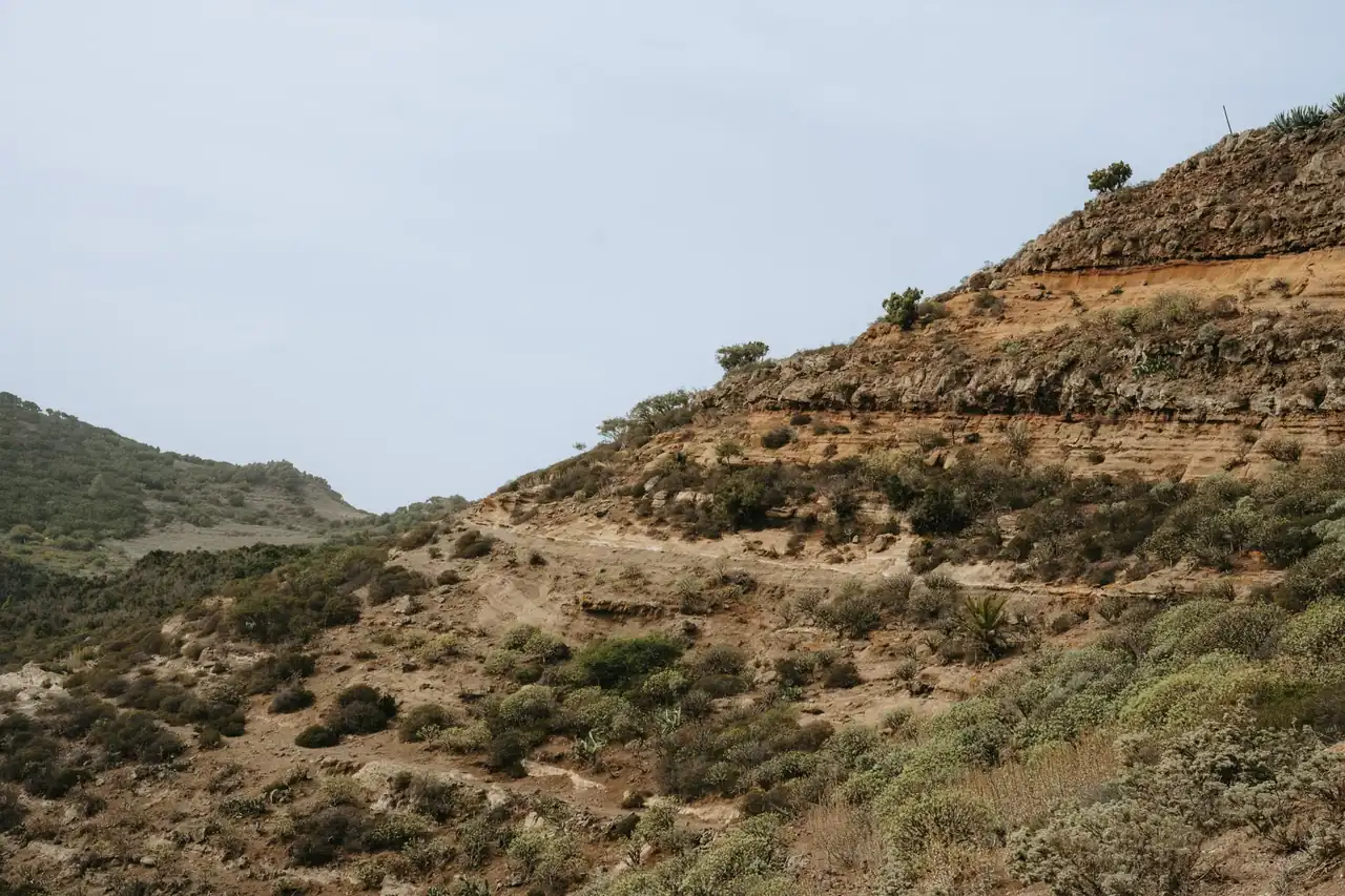
The Pujada a la Penya Migjorn will hold its 12th edition on Saturday, Oct. 31, 2026, in Xixona, with the start scheduled for 8 a.m. The mountain event offers four adult options: a 41-kilometre mountain marathon, a 23-kilometre trail race, a 15-kilometre sprint trail and a 15-kilometre hiking event. The programme therefore caters to different kinds of participants, from walkers looking for a day outdoors to experienced runners tackling a long, hilly course.
Published information places the event in the mountainous surroundings of Xixona, in Alicante, and links it to the Centre Excursionista de Xixona. Registration is handled through Mychip; the announced window runs from Sept. 1 to noon on Oct. 28, 2026. Published base fees are 39 euros for the mountain marathon, 20 euros for the trail and 18 euros for both the sprint trail and the hiking event. These figures help put the day in perspective, although the detailed course and other operational information should be checked through the organizers’ channels.
A mountain event with four race options
The format brings together very different challenges on the same date. The longest course covers 41 kilometres with 2,030 metres of positive elevation gain; the middle-distance trail offers 23 kilometres and 1,180 metres; and the two shorter options share a 15-kilometre route with 860 metres of climbing. The hiking event keeps the same distance and elevation gain, but is intended for participants travelling on foot rather than racing.
That variety does not make the four options interchangeable versions of one course. Duration, muscular load and preparation needs change substantially between a 15-kilometre outing and a 41-kilometre race. Positive elevation gain also accumulates throughout the day: it does not describe the gradient of each section or reveal the full elevation profile, but it is a useful measure of the climbing effort participants can expect.
The event takes place in Xixona and has a clear mountain-running character, but available information does not specify the route kilometre by kilometre, aid-station locations or highest elevations. For that reason, the official distance and elevation figures are a starting point, not a replacement for the course profile and rules for each option. Those documents provide a clearer picture of where the main challenges lie and which conditions participants should consider before choosing a route.
What each distance demands
The 41-kilometre mountain marathon is aimed at runners used to spending several hours on mountain terrain. Its 2,030 metres of positive elevation gain work out to about 50 metres of climbing per kilometre, a useful way to compare the overall load, although it does not show whether the climbs are evenly spread or concentrated. On a route of this length, aerobic capacity matters, as does leg strength for uneven ground and the ability to sustain effort as fatigue builds.
The 23-kilometre trail offers a shorter alternative, but its 1,180 metres of climbing still represent a substantial demand. That averages about 51 metres of ascent per kilometre, a proportion similar to the longer race. The comparison shows why total distance alone cannot determine difficulty: a shorter route can feel intense if it gains elevation quickly or if the terrain forces runners to slow down.
The sprint trail and hiking event cover 15 kilometres with 860 metres of positive elevation gain, or about 57 metres of climbing per kilometre. The distance may seem accessible beside the other options, but the elevation gain remains significant for anyone who does not regularly train on hills. The hiking event shares the sprint route’s distance and ascent, so the main difference is the participation format and expected pace, not a shorter course.
These ratios are indicative calculations based on published figures, not official difficulty ratings. Trail type, individual gradients, surface conditions and weather can all change the experience. Nor can cut-off times or mandatory equipment be inferred from distance and elevation alone. To make an informed choice, participants should compare the figures with the route track, elevation profile and event rules when those materials become available.
Date, start time and registration in Xixona
The event is scheduled for Oct. 31, 2026, with the stated start time at 8 a.m. An early start is particularly relevant for the longer options, which may continue for much of the day. The reference information does not say whether all distances begin at the same time or provide separate start schedules; that detail should be confirmed in the official programme before travelling.
Registration is handled through Mychip, and the announced window runs from Sept. 1 to noon on Oct. 28. As of Oct. 13, 2026, the event is still within that published registration period, although entries may also depend on participant limits or conditions set by the organizers. No information has been provided about field size, bib availability or possible surcharges, so participants should not assume the base fee is necessarily the only amount payable.
The published fees list three amounts: 39 euros for the mountain marathon, 20 euros for the 23-kilometre trail and 18 euros for each 15-kilometre option. These are the stated base prices. Before completing registration, it is sensible to check what each entry includes, the cancellation or transfer terms and whether handling fees apply. The reference information does not detail those items, so it is not possible to say whether they are included in the listed amounts.
The event is linked to the Centre Excursionista de Xixona, while Mychip is identified as the registration platform. Still, the payment platform does not replace notices from the organizing group: instructions on bib collection, parking, mandatory equipment or last-minute changes should be checked through the organizers’ channels. In a mountain event, those practical details can affect both logistics and safety.
Elevation changes how the course should be read
On the road, distance is often the first clue to how long a race might take. In the mountains, that estimate is less precise: positive elevation gain adds muscular work and time, while descents can also take a toll even though they do not add climbing. The 2,030 metres listed for the mountain marathon point to a demanding vertical element, but do not show how much is climbed at once or what kind of descents participants will encounter.
Surface matters, too. A smooth forest track, a narrow trail and a rocky section can demand different paces and footwork, even at similar gradients. Without an official route description, it would be unwise to assign a specific terrain type to the event or assume that it passes through particular places. Available information confirms the mountain nature of the event and the figures for its routes, but leaves details that only the official map can establish.
Autumn brings another variable. In late October, temperatures can change between the early morning and midday, while the condition of the ground depends on recent rain. No advance forecast is available to describe conditions on race day, and a reliable prediction will only be possible closer to the date. Clothing and equipment should be chosen according to that forecast and the organizers’ instructions, rather than a broad assumption about Alicante’s weather.
It is also important to interpret each distance label carefully. A route called a mountain marathon is not equivalent to a road marathon: this one covers 41 kilometres on mountain terrain with 2,030 metres of positive elevation gain. Typical road-running paces cannot reliably predict a finishing time. Experience on trails, effort management and the ability to handle climbs and descents matter more than a personal best over the same distance on pavement.
Choosing the right distance
Choosing between 15, 23 and 41 kilometres depends on more than general fitness. A useful benchmark is recent experience on comparable routes with similar elevation and surfaces. A runner accustomed to flat roads may need specific preparation before attempting a mountain race, while someone who regularly hikes on trails may find the 15-kilometre walking option better suited to their pace and goals.
The 23-kilometre route sits in the middle by distance, but its 1,180 metres of climbing mean it should not automatically be treated as an easy option. Participants considering it should assess whether they have completed long outings with sustained climbing and can manage their effort rather than starting too fast. The same applies to the sprint trail: although it is the shortest race, its 860 metres of accumulated ascent make familiarity with hills and uneven footing useful.
A mountain marathon requires a longer preparation period than a short race because of the time and elevation involved. Long trail outings help participants get used to the duration and terrain; strength work can help the legs cope with climbs and, especially, descents. Individual needs depend on each runner’s background and on the official course profile, which is not included in the available information. The kilometre figure alone does not prescribe a training plan.
The hiking event deserves consideration in its own right. Its 15 kilometres and 860 metres of positive elevation gain make it an active mountain outing, not necessarily a gentle walk. Hiking uphill reduces the impact of running but does not remove the physical load or the need for suitable water and equipment under the event rules. A noncompetitive format is not free of demands: gradients, duration and terrain still matter.
Details to check before race day
The main figures make it possible to compare the options, but several practical questions remain unanswered in the published information. It does not give the exact start and finish locations, bib collection times, aid-station details or cut-off times. There is also no information about mandatory equipment, hydration systems or arrangements for withdrawing from the race. Those details should be confirmed in the current edition’s rules, particularly for the mountain marathon and the 23-kilometre trail.
The route track and elevation profile are essential for a more accurate understanding of the course. A track helps participants review turns and the general route, while the profile shows where climbs are concentrated and how they alternate with descents. Neither replaces official instructions on race day, since the route can be subject to change, but both help put the published distances and elevation figures into context. Without these materials, a detailed description of the course would be speculation.
Logistics for an 8 a.m. start also require planning. Arrival times, parking and travel within Xixona depend on the exact start location, which is not specified in the reference information. It is therefore not possible to recommend an address or accurately estimate journey times. Organizers may publish directions for runners and spectators, and those should be followed rather than relying on an approximate location.
The entry fee does not represent the full cost of taking part. Depending on where participants travel from and which distance they choose, transport, accommodation or equipment may add expenses. There is not enough information to estimate those costs. What can be confirmed is that the published base fees range from 18 to 39 euros, with the highest price applying to the 41-kilometre route, and that the announced registration deadline is noon on Oct. 28.
An autumn test on the mountain
The 12th Pujada a la Penya Migjorn combines a specific date, four formats and distances ranging from 15 to 41 kilometres. That variety is one of its clearest features: the same event includes a hiking option, two trail races and a mountain marathon with more than 2,000 metres of accumulated climbing. A sensible choice begins with matching experience to the actual demands, rather than relying only on a race name or the kilometre count.
The calendar places the event in Xixona on the last day of October, with the scheduled start at 8 a.m. Registration is advertised as open until noon on Oct. 28, with base fees of 18, 20 and 39 euros depending on the option. The Centre Excursionista de Xixona is linked to the event, and Mychip is the stated registration channel. These details identify the event, but do not replace the rules or full operational information.
There is an important difference between knowing the headline figures and understanding the race in full. The precise route, terrain, aid stations and safety arrangements are all necessary to assess each option, and they are not described in the available information. Until organizers publish or confirm those details, the most accurate account sticks to what is known: Xixona, four options, up to 41 kilometres and 2,030 metres of positive elevation gain. In the mountains, the full map matters as much as the number printed beside a race bib.



How to prevent thigh chafing: causes and real solutions

Women’s running windbreakers: seven jackets and how to choose

Do more workouts get rid of soreness? A guide for runners

Jaén Half Marathon 2026: Record 3,800 Runners Registered

Men’s short running tights: how to choose the right pair

World Triathlon confirms data breach involving medical data

Izan Edo targets podium at Miyazaki World Cup

María Pérez ranks ninth in World Athletics’ 2026 top ten

Dos Santos, Duplantis and Sawe: World Athlete of the Year finalists

San Silvestre Vallecana 2026: 42,000 places, prices and start times

 Races3 months ago
Valencia Half Marathon 2027: date and registration

 Races3 months ago
Valencia Marathon 2026: entry, ballot and course

 Reviews and Comparisons4 months ago
Asics Gel-Roadmiles 3 for men: review and current price

 Reviews and Comparisons4 months ago
Asics Gel Sonoma 8 Gore-Tex: complete analysis for trail and rain

 Sneakers3 months ago
Saucony Endorphin Pro 4: full review and verdict

 News5 months ago
Strava API 2026: what changes for clubs, challenges and runner apps?

 Reviews and Comparisons5 months ago
Nike Alphafly 3: opinions, sensations, and real key points

 Reviews and Comparisons4 months ago
Under Armour running shoes review 2025-2026: models and key features

 Sports Equipment4 months ago
Shoe sizes in cm: a clear guide to getting the right fit for your footwear

 Sneakers3 months ago
Skechers GO RUN Consistent 2.0 analysis: comfort and limits

 News5 months ago
Valencia Marathon 2026 route: key tips to train and run better

 Sneakers4 months ago
Adidas Adizero Boston 13 for men: review and verdict