Races
Sierra de Aras Trail and Hike 2026: routes and entry fees
Two routes, separate start times and a 500-person limit shape this October mountain event in Lucena.

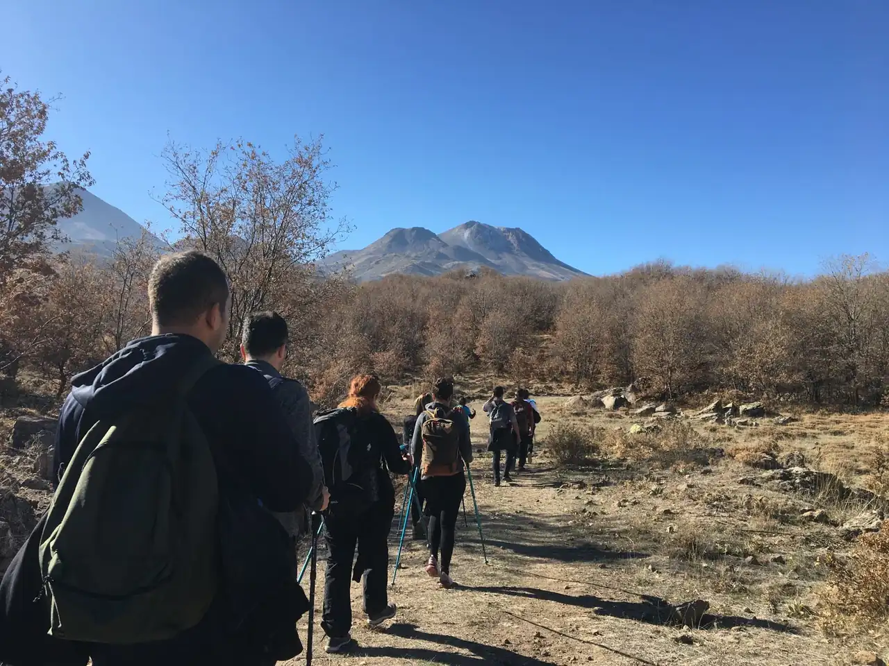
Lucena will host the third edition of its Sierra de Aras mountain event on Sunday, October 25, 2026, featuring a 22-kilometre race with about 1,200 metres of positive elevation gain and a 14-kilometre hiking route. Both start from Plaza de España on Paseo del Coso: runners set off at 9:30 a.m. and hikers ten minutes later. The finish closes at 1:30 p.m., and total participation is capped at 500 people.
The event, organised by C.D. Surco Lucena with support from OCR Hermes Training, is part of the Provincial Mountain Running Cup. Its courses follow footpaths, tracks and firebreaks around the mountain, with marked routes and support at several points. Published information covers fees, entry conditions and schedules, although some details about the hike’s distance and categories differ between sections and should be checked before registering.
A mountain event with two ways to take part
The programme brings together a demanding mountain race and an alternative for exploring the area on foot. The long course covers 22 kilometres and gains around 1,200 metres, a figure that points to substantial climbing and descending. Distance is only part of the effort: elevation also makes the challenge depend on terrain, pace and the ability to keep moving for several hours.
The second option is described as a 14-kilometre hike, starting at 9:40 a.m. It offers a way to take part without tackling the longer course, but should not automatically be treated as a short race: some sections of the event regulations distinguish hiking from a 14-kilometre short course. The option selected on the entry form should match the activity participants intend to do, particularly because fees and categories differ.
The two formats broaden the event’s appeal while sharing the Sierra de Aras setting and a start in central Lucena. The ten-minute gap staggers the departures. For spectators, activity will not be concentrated at a single start time; for participants, it makes checking their assigned start and arriving with enough time especially important.
Distances, elevation and expected terrain
The main figures for the competitive route are clear: 22 kilometres and approximately 1,200 metres of positive elevation gain. Positive elevation is the total of all climbs along a route, not the difference between its highest and lowest points. It therefore helps describe the physical demands better than distance alone, though it cannot reveal the difficulty of every section.
The route is described as a mix of footpaths, tracks and firebreaks. That combination can involve different surfaces and widths, but the available information does not give the proportion of each terrain type, a detailed elevation profile or the location of the most technical sections. Nor does it provide a kilometre-by-kilometre description. Those figures are not enough to establish a complete map or a reliable finish-time estimate; each runner must assess the distance and climbing in light of their mountain-running experience.
The hike is listed as 14 kilometres. However, another section of the regulations mentions a short course of the same distance and assigns the cadet and youth categories to it. The general information also sets a minimum age of 16, while the cadet category is listed as ages 15 to 16. These details should not be resolved by guesswork: the exact event format and permitted age should be confirmed in the current entry conditions.
An external calendar also differs, listing the race as 18.4 kilometres and the hike as 12. The organisers’ detailed event information instead gives distances of 22 and 14 kilometres. The event regulations are the stronger reference for describing the race, although a later official update could change the course. Checking the live event listing before travelling helps avoid relying on outdated distances.
The Sierra de Aras setting and the start in Lucena
The start is scheduled at Plaza de España on Paseo del Coso, in Lucena, in the province of Córdoba. From this urban starting point, both formats head towards mountain routes around the Sierra de Aras. The contrast between the town square and the paths crossing the surrounding hills shapes an event that begins in the city centre and moves into a landscape of trails, tracks and firebreaks.
The published details do not specify the exact route, checkpoints or spectator access points. They also do not say where the aid stations or medical teams will be located. It would therefore be unwise to recommend particular roads or paths as viewing spots when they are not identified in the regulations. The start and finish are the confirmed reference points for planning a visit to Lucena; other arrangements depend on the route map and instructions released by the organisers.
The event is part of the Provincial Mountain Running Cup, placing it within Córdoba’s mountain-running calendar. For participants, that gives the race a competitive context, but it does not make the hiking route a scored race simply because it takes place on the same day. The published information distinguishes between the formats and their conditions, so the selected entry determines which activity a participant joins.
Start times, aid stations and the finish cut-off
The long trail starts at 9:30 a.m., followed by the hiking group at 9:40. The finish closes at 1:30 p.m., four hours after the main race begins. This is a cut-off for completing the course, not a promise about how long each participant will need. On a route with substantial climbing, pace can change considerably between ascents, descents and easier stretches.
The organisers announce two aid stations on the course and another at the finish. The route stations are expected to provide water and pieces of fruit; liquids and solid food will be available at the finish. The event also includes medical assistance at various points and in the finish area, with ambulances and medical services among the entry benefits. The available information does not specify the precise locations of these resources.
The regulations require participants to follow the marked route and pass through the designated checkpoints. Organisers say the course will be marked with tape, signs and coloured stakes. This system helps runners stay on course, but does not remove the need to watch for directions, especially at junctions or shared sections. Taking shortcuts, missing a checkpoint or removing markers can lead to disqualification, as well as putting the participant and those behind them at risk.
Anyone who withdraws must tell the nearest control point so organisers know where they are. The regulations say that if someone cannot move because of a physical problem, they will be taken to the finish or an ambulance if necessary. If a participant withdraws by choice and is able to move, getting back to the finish is their responsibility. This distinction matters in a mountain event, where the distance between a trail and an accessible point can complicate assistance.
Entry, fees and dates to check
Entries are handled through DeporTime, and the announced limit is 500 participants. The regulations say there will be no race-day registration. The stated deadline for participants who want a T-shirt is October 9; for those entering without one, the deadline is October 16, unless capacity is reached sooner. Since the event takes place on October 25, the T-shirt deadline will already have passed by October 13, 2026, while the other deadline is still approaching and subject to availability.
Published fees vary by category. The long trail costs 16.50 euros for federated runners and 20.50 euros for non-federated runners. The short route is listed at 13.50 euros with a federation licence and 17.50 euros without one; hiking costs 12.50 euros. A T-shirt is available for an additional 9.50 euros. Since the regulations distinguish the short course from the hike, the correct fee depends on the format shown on the entry form; the two labels should not be assumed to mean the same thing.
The fee includes participation, civil liability and accident insurance, timing, on-course and finish refreshments, a participant bag, showers and a bag drop. The regulations also state that race numbers are personal and cannot be transferred, and that entry fees will not be refunded if a registered participant does not take part. If the event is cancelled because of force majeure, the stated refund will be reduced by expenses already incurred by the organisers up to the cancellation date.
The regulations also require entries to be completed using the payment methods available on the platform. Starting the process alone should not be treated as confirmation; the practical reference is a completed registration. The participant limit may be reached before the deadline, and the published details do not guarantee that places will remain available at all times. The dates are therefore final deadlines, not an automatic reservation of a race number.
Equipment, age and participation rules
Mandatory equipment includes a correctly displayed race number, a cup or reusable container for drinks at aid stations, suitable footwear and clothing, an emergency blanket and a whistle. Depending on the weather, organisers may also require a windproof or waterproof jacket, long tights, gloves and a hat or neck warmer. The required kit may be expanded if conditions warrant it, so the final regulations and any pre-race notices matter when preparing for the start.
The regulations require participants to be physically suited to the distance and difficulty of the route. They also say people of any nationality may take part, whether federated or not, provided they meet the stated minimum age. Since the same document appears to contain an inconsistency between the general minimum age and the age listed for the short-course cadet category, participants should check the applicable rule directly on the entry form before paying.
Grounds for disqualification include littering outside aid stations, failing to complete the route, missing checkpoints, using another person’s race number or ignoring instructions from staff and race officials. Participants must not block overtaking on narrow sections and are expected to assist anyone who has an accident or a serious health problem. These are not minor formalities: the rules protect everyone’s safety and help track each runner on the course.
Only vehicles authorised by the organisers may follow the event. Participants may not be accompanied by vehicles, people unaffiliated with the race or animals. Organisers also reserve the right to change the route or cancel the event because of adverse weather or force majeure. In a mountain setting, that provision allows the event to respond to conditions that could make a planned course unsafe.
More than a finish time
A mountain race is not measured only in kilometres. The climbing, changing surfaces and expected duration make the long course a different undertaking from an urban race. In Lucena, the programme combines a 22-kilometre competitive route with a 14-kilometre hike, bringing people with different aims together without blurring the distinction between racing and walking.
Course markers, aid stations and medical support are central to an event of this kind. They do not, however, replace personal attention to physical condition, equipment and route instructions. The regulations state that participants declare themselves fit to start and accept the event rules by taking part. Responsible preparation begins with knowing the actual distance, elevation and conditions for each format, not just the start time.
The event also has a local dimension: it starts from a central Lucena location and leads participants towards the Sierra de Aras, as part of a provincial cup. That connection between town and mountain brings runners, hikers and spectators together for the day. Practical details — places, schedules, categories and route information — turn that broad picture into a workable plan.
What to confirm before October 25
The key details for the third edition are its date, Sunday, October 25, 2026; two starts from Plaza de España; and two main distances: 22 kilometres for the long trail and 14 for the hike. The race’s announced positive elevation gain is around 1,200 metres, and the finish is scheduled to close at 1:30 p.m. Entries are capped at 500 and handled through DeporTime.
Two points merit an additional check: the distinction between the hike and the 14-kilometre short course, and the different distances shown by an external calendar. The apparent mismatch between the general minimum age and the published cadet category is also relevant. Checking the entry listing and current regulations helps resolve these questions using the rules that actually apply to the event, rather than relying on secondary information that may be incomplete or out of date.
With those details clear, the event offers a mountain day with options to run or walk, basic race services and a setting closely linked to Lucena and its surrounding hills. Its appeal is not limited to reaching the finish: it also lies in crossing terrain that changes in pace and character, within an event whose schedule, rules and participation limits are set in advance.



How to prevent thigh chafing: causes and real solutions

Women’s running windbreakers: seven jackets and how to choose

Do more workouts get rid of soreness? A guide for runners

Jaén Half Marathon 2026: Record 3,800 Runners Registered

Men’s short running tights: how to choose the right pair

World Triathlon confirms data breach involving medical data

Izan Edo targets podium at Miyazaki World Cup

María Pérez ranks ninth in World Athletics’ 2026 top ten

Dos Santos, Duplantis and Sawe: World Athlete of the Year finalists

San Silvestre Vallecana 2026: 42,000 places, prices and start times

 Races3 months ago
Valencia Half Marathon 2027: date and registration

 Races3 months ago
Valencia Marathon 2026: entry, ballot and course

 Reviews and Comparisons4 months ago
Asics Gel-Roadmiles 3 for men: review and current price

 Reviews and Comparisons4 months ago
Asics Gel Sonoma 8 Gore-Tex: complete analysis for trail and rain

 Sneakers3 months ago
Saucony Endorphin Pro 4: full review and verdict

 News5 months ago
Strava API 2026: what changes for clubs, challenges and runner apps?

 Reviews and Comparisons5 months ago
Nike Alphafly 3: opinions, sensations, and real key points

 Reviews and Comparisons4 months ago
Under Armour running shoes review 2025-2026: models and key features

 Sports Equipment4 months ago
Shoe sizes in cm: a clear guide to getting the right fit for your footwear

 Sneakers3 months ago
Skechers GO RUN Consistent 2.0 analysis: comfort and limits

 News5 months ago
Valencia Marathon 2026 route: key tips to train and run better

 Sneakers4 months ago
Adidas Adizero Boston 13 for men: review and verdict