Races
Las Dehesas de la Fuenfría Trail 2026: route and guide
Everything about the Cercedilla race: route, schedule, elevation gain, bib collection and key trail details.

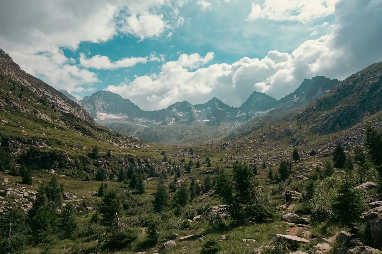
The Las Dehesas de la Fuenfría Trail will return to Cercedilla on Sunday, Sept. 27, 2026, with a 15.2-kilometre route, 680 metres of positive elevation gain and a start and finish at the municipal sports centre. The race runs through pine forests, streams, historic paths and the Guadarrama mountain range, offering an event designed for runners taking their first steps in mountain racing without giving up a demanding course.
The event programme also includes the Las Dehesas Cross, covering 29 kilometres and 1,900 metres of positive elevation, as well as the Las Encinillas Trail and the Río Pradillo Children’s Trail. The popular races calendar places the event within the mountain-running season, while the race map helps locate Cercedilla and its surrounding area.
A short race on paper, a mountain race on the ground
The 15.2-kilometre distance may look manageable to a runner used to road racing, but the mountain changes the effort completely. The course includes 680 metres of climbing and another 680 metres of descent, reaches a maximum altitude of 1,670 metres and has an average altitude close to 1,390 metres. This is not an urban race moved into the hills: elevation, rocks and pace changes are central to the experience.
The organisers estimate that technical terrain accounts for about 45% of the route. This includes sections where foot placement requires concentration, roots, rocks, uneven ground and descents where speed must give way to control. Runners do not face an extreme ultra or an alpine ridge, but they do need to read the terrain and save energy for the second half.
The course is especially suitable for runners who have gained experience on trails and want to try a mountain race over a contained distance. It may also attract faster participants looking for a lively race with concentrated elevation. The true difficulty will depend on weather, ground conditions and each runner’s confidence on technical descents.
Cercedilla, the start and finish point
The Cercedilla municipal sports centre, at 18 Calle Manuel González Amezúa, is the main venue for the day. Bib collection takes place there, together with the start and finish services and the awards ceremony. The Madrid mountain town becomes the gateway to a route that soon leaves the urban area and enters the Fuenfría Valley.
Cercedilla has a long relationship with mountaineering in Madrid. Its paths connect the town with old mountain crossings and a network of trails where Scots pine, granite, water and Roman remains coexist. This heritage is not just scenery: it shapes the surface, navigation and the way effort is distributed during the race.
Starting and finishing at the same venue makes logistics easier for participants and allows spectators to follow the event without complicated travel. Even so, being close to the mountains should not be confused with being easy. Within a few kilometres, runners move from the atmosphere of the town and sports centre into a quieter landscape, where the sound of shoes on the ground replaces the noise of the streets.
Course & elevation Edition 2026
Per-kilometre table
| Km | Elevation | Grade |
|---|---|---|
| 1 | 1,231 m | 6.6 % |
| 2 | 1,343 m | 11.2 % |
| 3 | 1,465 m | 12.2 % |
| 4 | 1,621 m | 15.6 % |
| 5 | 1,771 m | 15.0 % |
| 6 | 1,914 m | 14.3 % |
| 7 | 1,775 m | -13.8 % |
| 8 | 1,714 m | -6.2 % |
| 9 | 1,566 m | -14.8 % |
| 10 | 1,395 m | -17.1 % |
| 11 | 1,360 m | -3.5 % |
| 12 | 1,292 m | -6.8 % |
| 13 | 1,246 m | -4.5 % |
| 14 | 1,194 m | -5.2 % |
| 15 | 1,166 m | -2.8 % |
Plan your pace on this course →
Route source: OpenRunner
The route through the Fuenfría Valley
The course crosses some of the most recognisable landscapes in the Guadarrama range. Scots pine forests provide shade on many sections, although dense vegetation does not rule out heat in open areas or sudden temperature changes. Streams and historic paths add variety to a race that alternates compact surfaces with more demanding terrain.
The maximum altitude of 1,670 metres does not make this an extreme high-mountain race, but it introduces factors absent from sea-level competition. Breathing may feel harder on long climbs, the ground can retain moisture and temperatures may vary by several degrees between the town and higher sections. Late September often brings pleasant conditions, although the mountains do not guarantee a uniform forecast.
The elevation is distributed well enough to prevent a completely linear race. On climbs, runners may need to alternate between running and walking depending on gradient and fatigue; on descents, technique matters as much as strength. The terrain encourages looking several metres ahead, not only to choose the fastest line but also to avoid turning a root or rock into an injury.
The beauty of the route also imposes responsibility. The course crosses a valuable natural area and the race must coexist with hikers, wildlife and other mountain users. Staying on the marked route, respecting closures and keeping waste until authorised points are basic behaviours that ensure the runners leave the smallest possible footprint.
Schedule and race-day organisation
Bib collection for the Las Dehesas Trail begins at 9 a.m. on Sunday, Sept. 27, and ends at 10 a.m. Runners then enter the starting area and undergo the material check. The start is scheduled for 10:30 a.m., while the finish closes at 2:15 p.m. The general schedule therefore provides three hours and 45 minutes to complete the course.
The event shares the venue with the Las Encinillas Trail, which is due to start at 10:40 a.m. Participants must pay attention to the organisers’ instructions, especially in the minutes before the start and while the routes separate. The first Las Encinillas finishers are expected around 11:30 a.m., with the first Las Dehesas Trail runners due around 11:45 a.m.
The awards ceremony is scheduled for 1:45 p.m. around the start and finish area. The previous day, Saturday, Sept. 26, the Río Pradillo Children’s Trail will also take place, with bib collection between 5 and 5:45 p.m. This programme turns the event into a mountain weekend for different levels and ages, although every race has its own schedule and conditions.
Published times may change because of safety, weather or operational requirements. The valid reference before attending will always be the regulations and the organisers’ communications. In mountain racing, a seemingly small change may respond to a decision involving a crossing, damaged ground or the protection of a sensitive area.
Bibs, equipment and planned services
Bibs and timing chips are collected at the municipal sports centre. The chip must be returned after finishing, a logistical detail worth remembering before leaving the venue. Material checks and pre-race instructions are part of the safety process, not a minor formality: knowing the route and carrying what is needed reduces problems when the terrain becomes difficult.
The organisers plan two aid stations on the course, offering water, isotonic drink, fruit, nuts, chocolate and sweets, as well as a finish station with solid and liquid refreshments. Their presence does not remove the need to start with suitable reserves. Consumption should match expected duration, temperature and individual tolerance, rather than introducing an unfamiliar food on race day.
Announced services include a race bag, bag storage, showers, medical assistance, medicalised ambulances and accident and civil liability insurance. These resources improve the experience and response to incidents, but they do not replace prudent behaviour. A fast descent on tired legs, in particular, may require more concentration than an apparently hard climb.
The most logical equipment for this terrain includes trail shoes with sufficient grip, adaptable clothing and a way to carry water and any items required by the regulations. Road shoes may be inadequate on wet rock, roots or loose soil. In September, a light wind or rain layer takes up little space and can make a notable difference in the mountains.
Reading the profile without turning it into a formula
A sensible approach to a 15-kilometre race with 680 metres of positive elevation is not based solely on adding kilometres. The body needs to become familiar with the combination of climbing, uneven ground and changes in intensity. Hill sessions, trail runs and leg-strength work provide different stimuli, while recovery allows the body to absorb them.
The most common mistake in this type of event is tackling the first climbs as though they were a road section. The excitement of the start and the group can push runners beyond their limits. A controlled climb, however, leaves room for technical sections and descents, where a significant part of the final time is decided. Saving the legs from the beginning does not mean running slowly; it means avoiding an expenditure that cannot later be recovered.
Downhills deserve specific attention. The eyes should anticipate obstacles, the torso remain stable and the stride adapt to the gradient. Braking on every step overloads the quadriceps and reduces flow; charging without control increases the risk of falling. The most effective technique is usually a middle ground, with shorter steps on broken ground and greater stride length on clean surfaces.
Strategy also depends on the time limit. With three hours and 45 minutes available, the race offers a broad margin for a participant with basic mountain experience, although elevation and weather can change any prediction. The watch is useful for orientation, not for ignoring bodily signals or the instructions of race staff.
A history that goes beyond the 2026 edition
The Las Dehesas de la Fuenfría Trail belongs to a much longer competitive tradition. The Las Dehesas Race began in 1986 as an 18-kilometre traverse between Las Dehesas and the Cotos pass. Since then, the event has changed finishes, routes and formats, while maintaining its connection with Cercedilla and the mountain culture of Guadarrama.
The race joined the Iron Cup of the Royal Spanish Alpine Society Peñalara in 1992, one of the historic references for mountain racing in Madrid. In later years it hosted championships and regional events. The long course added the Montón de Trigo section in 2009 and, in 2017, Club Tierra Trágame took over the organisation with new distances and a broader structure.
The creation of the 15-kilometre Trail opened a different door within the same weekend. Not every participant seeks the difficulty of the 29-kilometre Cross with 1,900 metres of positive elevation. An intermediate distance makes it possible to approach the mountain-race environment without immediately taking on a route with almost two thousand metres of climbing. This coexistence between challenge and accessibility explains much of the event’s current identity.
The history is not only found in the names on the roll of honour. It is also present in volunteers, in the trails that receive course markings each autumn and in families who find a shared activity around the race. The continuity of an event depends on a quiet network of people and decisions: marking without damage, removing waste, managing crossings and maintaining a respectful relationship with the land.
The Cross and the other weekend races
The Las Dehesas Cross is the longer and more demanding version of the programme. Its 29 kilometres and 1,900 metres of positive elevation take participants through a mountain course with greater physical and technical commitment. It is also linked to the Madrid Mountain Racing Cup of the Madrid Mountaineering Federation and the Iron Cup of RSEA Peñalara.
The difference between the routes is not limited to 13.8 kilometres. The Cross requires more complex management of nutrition, longer exposure to weather and a greater ability to maintain technique when fatigue appears. The Fuenfría Trail concentrates the experience over a shorter distance and can serve as a way to discover the area before facing longer challenges.
The 5.5-kilometre Las Encinillas Trail broadens the programme for participants looking for a shorter course. The Río Pradillo Children’s Trail, with two distances of 1 and 1.7 kilometres according to the previous edition’s information, brings the event into family territory. This variety prevents the race from becoming a single spectacle reserved for specialists and brings the mountains closer to different audiences.
The coexistence of formats requires careful management of spaces and schedules. For spectators, it also offers a fuller view of the event: while some runners tackle high points and technical trails, others discover the pleasure of running beside a stream or sharing a finish with their family.
What makes the Fuenfría special in September
The Fuenfría Valley has a recognisable personality before the race even starts. Pine resin, pale granite, damp streams and cooler air than in lower areas create a sensory setting that changes with the light. On a September morning, the forest may welcome runners with shade and silence before opening into sections where the sun increases the perceived heat.
The landscape also has a historical dimension. The Roman road and old paths recall that the mountains were a place of passage long before bibs and timing chips appeared. Running those trails does not automatically make the race epic, but it adds context to every climb and turn on the route.
The mountains, however, are not a fixed backdrop. Heavy rain can turn rock into a slippery surface; a dry week can fill corners with dust and make descents less stable. Temperatures may fall noticeably at dawn and rise quickly once the sun reaches exposed sections. This uncertainty is part of trail running and calls for a flexible approach.
The appeal of this race lies precisely in that combination: a distance that allows intense competition, elevation that demands respect and an environment that preserves the character of the mountains. The Fuenfría does not give the route away, but neither does it hide it; every transition between forest, rock, water and path is clearly visible.
A mountain event built to continue
On Sept. 27, 2026, Cercedilla will once again bring together runners with different backgrounds around the same landscape. The Las Dehesas de la Fuenfría Trail will offer 15.2 kilometres, 680 metres of positive elevation, technical terrain and a time limit that allows the route to be completed sensibly. The available information places the start at 10:30 a.m. and the finish at the municipal sports centre.
Beyond the results, the race expresses a way of understanding mountain running: competing without erasing the place where the competition takes place. The forest, historic paths and volunteers are part of the outcome as much as the stopwatch. In an era of crowded calendars, the continuity of a locally rooted race shows that the mountains can still be the centre, not merely the setting.
The final image is not only that of a runner crossing the finish arch. It is also a valley returning to its rhythm after the pack has passed, shoes covered in dust and a town that has hosted a sporting celebration connected to its territory. That is where Las Dehesas draws its strength: the race ends at the finish line, but the relationship with the mountains continues.



How to prevent thigh chafing: causes and real solutions

Women’s running windbreakers: seven jackets and how to choose

Do more workouts get rid of soreness? A guide for runners

Jaén Half Marathon 2026: Record 3,800 Runners Registered

Men’s short running tights: how to choose the right pair

World Triathlon confirms data breach involving medical data

Izan Edo targets podium at Miyazaki World Cup

María Pérez ranks ninth in World Athletics’ 2026 top ten

Dos Santos, Duplantis and Sawe: World Athlete of the Year finalists

San Silvestre Vallecana 2026: 42,000 places, prices and start times

 Races4 months ago
Valencia Half Marathon 2027: date and registration

 Races4 months ago
Valencia Marathon 2026: entry, ballot and course

 Reviews and Comparisons4 months ago
Asics Gel-Roadmiles 3 for men: review and current price

 Reviews and Comparisons4 months ago
Asics Gel Sonoma 8 Gore-Tex: complete analysis for trail and rain

 Sneakers4 months ago
Saucony Endorphin Pro 4: full review and verdict

 News5 months ago
Strava API 2026: what changes for clubs, challenges and runner apps?

 Reviews and Comparisons5 months ago
Nike Alphafly 3: opinions, sensations, and real key points

 Reviews and Comparisons4 months ago
Under Armour running shoes review 2025-2026: models and key features

 Sports Equipment4 months ago
Shoe sizes in cm: a clear guide to getting the right fit for your footwear

 Sneakers3 months ago
Skechers GO RUN Consistent 2.0 analysis: comfort and limits

 News5 months ago
Valencia Marathon 2026 route: key tips to train and run better

 Sneakers4 months ago
Adidas Adizero Boston 13 for men: review and verdict