Races
Xeresa Mondúver Trail 2026: date and distances
Two race distances are listed for the December event in Xeresa, with the Mondúver massif as a striking backdrop.

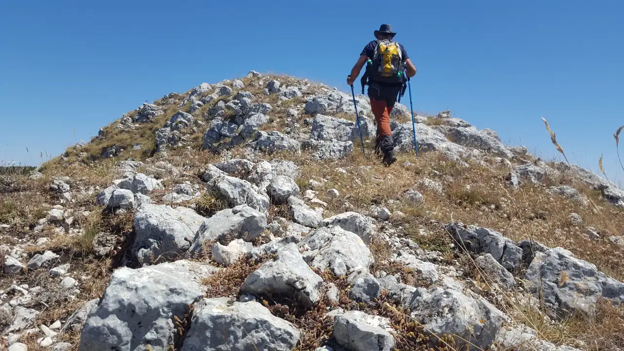
The next edition of the Xeresa trail race is scheduled for Dec. 13, 2026, with two advertised distances: a 21-kilometer long course and an 11-kilometer short course. The event takes place in Xeresa, in Valencia province, at the foot of the Mondúver massif. The date is confirmed in the available information, although essential details such as the start time, exact starting point and entry fees have not yet been provided.
The published information also associates 470 meters of positive elevation gain with the 11-kilometer course. There is no equally reliable figure for the longer distance, so elevation from earlier editions should not be carried over to 2026. The mountainous landscape suggests a trail race with climbs and uneven ground, but the specific route, aid stations and regulations require confirmation from the organizers.
Confirmed date and available race details
The event is scheduled for Sunday, Dec. 13, 2026, in Xeresa, a town in the Safor region. The date comes from the information supplied for this edition and places the event among late-year mountain races in Valencia. However, no start time or precise address has been provided; the town name alone does not identify where runners will gather.
The available race listing includes two formats, covering 21 and 11 kilometers. These distances help explain the options, but they do not replace official technical information. The route may change from one edition to another for safety, environmental conservation, permitting or weather reasons. For that reason, the published distance is not enough to infer the full course, its detailed elevation profile or each race’s cutoff time.
There is also no confirmed information about entry fees, registration dates, the maximum number of bibs, chip pickup or services at the start and finish. Such details are usually published in the race regulations and event channels as race day approaches. Until they are confirmed for 2026, it would be premature to say registration is open or to assign conditions from previous editions to this one.
Two distances for different runner profiles
The 21-kilometer course is close to half-marathon distance, although its mountain setting makes it very different from an urban race. In trail running, pace depends on gradients, surface, turns and technical sections; finish times cannot be directly compared with those for 21 kilometers on pavement. The long course may appeal to runners who already have trail experience and can manage prolonged effort over elevation changes.
The 11-kilometer option is shorter, but that does not necessarily make it easy. The available information assigns it 470 meters of cumulative ascent, a notable amount for a race of this length. Climbs can slow the pace and make walking necessary on some sections, while descents call for concentration and control. In this format, elevation and surface matter as much as distance.
Choosing between the two is not just a matter of the time a runner hopes to achieve. Familiarity with uneven ground, the ability to sustain effort on climbs and experience descending narrow paths all matter. Without an official 2026 profile, it is impossible to know where the steep sections are or how much of the route follows tracks or trails. The figures provide a useful starting point, but they do not replace the course map and regulations once published.
The Mondúver as a mountain setting
The Mondúver is a distinctive massif in the Safor region, where rugged terrain, Mediterranean vegetation and broad coastal views meet. From Xeresa, the landscape quickly shifts from the town to slopes and paths leading to higher ground. For a mountain race, that transition creates a very different setting from a flat circuit: surfaces may alternate between firm ground, trails and slopes where every stride calls for a careful foot placement.
A well-known hiking route in the area, the PR-CV 153 toward the Font del Mondúver, is described as demanding, with steep climbs. That reference helps explain the mountainous character of the region, but it should not be mistaken for the race route. A hiking trail does not prove that the race passes through the same places or shares its distance, elevation or direction. The 2026 race needs its own official map.
Routes in the massif are described as crossing varied terrain, including Mediterranean woodland, ravines and forest tracks, as well as uneven trails. These are general features of the local landscape, not a verified description of each section of the race. The distinction matters if runners want to avoid preparing based on assumptions: the Mondúver provides the geographical context, while the official course determines actual race conditions.
What is known about elevation and what remains unconfirmed
The 470-meter positive elevation figure appears alongside the 11-kilometer format in the available information. If it remains in the final listing, it offers a useful way to assess the challenge: it represents accumulated climbing over the course, although the total does not reveal the gradient of each ascent. A route with one long climb feels different from one with several short rises, even when both gain the same amount of elevation.
There is no confirmed positive elevation figure for the 21-kilometer course in 2026. Figures circulated for the 2024 edition listed 22 kilometers and 1,350 meters of ascent for a long course, along with 12 kilometers and 530 meters for the shorter option. The distances listed for 2026 are different, so those historical figures cannot be presented as current race details. They only show that the formats can vary from one edition to another.
The elevation profile, surface type, checkpoints and time limits all affect how demanding a race is. Without those details, distance provides only part of the information runners need. It is also useful to know whether there are technical sections, whether the course is circular or point-to-point, and what equipment the rules require. Until those details are available, the responsible approach is to separate confirmed facts from references to earlier years.
Registration, start times and services: details still pending
The information provided does not specify the entry fee, when registration opens or closes, or whether prices change in stages. It also gives no details about age categories, transfer policies, refunds or bib pickup requirements. These matters can affect planning as much as the distance, especially for people traveling from outside the Safor region. For now, there is no 2026 fee that can be treated as confirmed.
The start time and exact location are also unconfirmed. For a December race, knowing the start time helps with travel planning and with anticipating daylight and temperature, but it should not be inferred from schedules used in previous years. Likewise, the town listed does not establish whether the start will be at the town hall, a square or a road leading into the hills.
Services such as a bag drop, showers, parking, aid stations and medical support also remain unknown. It would be wrong to assume they will be available simply because they featured in other races or previous editions. The regulations and event logistics published by the organizers will resolve those questions. Until then, the date and two advertised distances are the most solid details available.
How to interpret race standings and results
Searches for race standings often appear alongside event information, but a race scheduled for Dec. 13, 2026, cannot yet have results for that edition. The reference listing shows links or pending statuses associated with the courses, which is not the same as a final classification. Times and placings only become meaningful after participants finish and the organizers validate the data.
An official classification generally ranks runners by time and category, and may include overall position, gender placing, age-group position and average pace. In mountain races, checkpoints can also help verify that runners completed the course. If a timing issue arises, organizers should publish any necessary corrections. Provisional results may differ from the final standings, particularly before withdrawals, checkpoints and possible penalties have been reviewed.
The available information includes no participant names or times, which is consistent with a future event. It also does not confirm the timing system or when results will be posted. To avoid confusing information from other editions, the most reliable reference will be the classification explicitly identified with the 2026 date and edition. Historical results may provide context, but they cannot predict who will win or what times will be recorded.
December weather and trail conditions
A December race takes place when days are shorter and weather can change quickly. Winter in the Safor does not necessarily mean extreme cold, but temperature, wind and rain can vary between the town and higher parts of the massif. An exposed slope can feel very different from a section sheltered by vegetation. For that reason, a forecast issued close to race day matters more than a seasonal average.
Rain can leave mud on trails and increase the risk of slipping, while wet rock calls for more careful footing. In dry conditions, dust or loose stones can also make descents challenging. The ground conditions for the 2026 edition have not been published, and they cannot be known months ahead. The weather forecast and organizers’ guidance will provide a more useful picture as the date approaches.
Suitable equipment will depend on the final route and race rules. In general, trail running calls for shoes with enough grip for uneven surfaces, clothing appropriate to the weather, and sensible management of water and energy. Without details about aid stations or regulatory requirements, it is not possible to give a definitive equipment list. Gear choices should reflect the actual terrain, not just the race name.
A local race shaped by its mountain landscape
The combination of a distance close to a half marathon, an 11-kilometer option and a mountain setting gives the event appeal beyond the stopwatch. The Mondúver is part of Xeresa’s landscape and offers a setting where changing pace, elevation and direct contact with the terrain shape the race. Competitors must manage their effort, while spectators can see why trail events cannot be understood through distance alone.
The 2026 edition already has one central detail: its date, Dec. 13. The two advertised distances are also known, along with the elevation figure associated with the shorter course, but the technical and logistical picture remains incomplete. Keeping those facts separate prevents 2024 figures or a hiking route from being presented as promises about the upcoming race. The final information will need to confirm the course, schedule, registration and services.
In a mountain race, the landscape is not a backdrop; it is part of the challenge and character of the event. Knowing the massif is not the same as knowing the course, just as a published distance does not tell the whole story of a climb. The Xeresa race is taking shape as a late-year trail event in Valencia, with two formats and details still to come. For now, the clearest and most useful fact is Dec. 13, 2026, with the Mondúver on the horizon.
Where to stay in Xeresa
Hotels available 11–14 December 2026.
Affiliate links: if you book through this map we earn a commission, at no extra cost to you.



How to prevent thigh chafing: causes and real solutions

Women’s running windbreakers: seven jackets and how to choose

Do more workouts get rid of soreness? A guide for runners

Jaén Half Marathon 2026: Record 3,800 Runners Registered

Men’s short running tights: how to choose the right pair

World Triathlon confirms data breach involving medical data

Izan Edo targets podium at Miyazaki World Cup

María Pérez ranks ninth in World Athletics’ 2026 top ten

Dos Santos, Duplantis and Sawe: World Athlete of the Year finalists

San Silvestre Vallecana 2026: 42,000 places, prices and start times

 Races4 months ago
Valencia Half Marathon 2027: date and registration

 Races4 months ago
Valencia Marathon 2026: entry, ballot and course

 Reviews and Comparisons4 months ago
Asics Gel-Roadmiles 3 for men: review and current price

 Reviews and Comparisons4 months ago
Asics Gel Sonoma 8 Gore-Tex: complete analysis for trail and rain

 Sneakers4 months ago
Saucony Endorphin Pro 4: full review and verdict

 News5 months ago
Strava API 2026: what changes for clubs, challenges and runner apps?

 Reviews and Comparisons5 months ago
Nike Alphafly 3: opinions, sensations, and real key points

 Reviews and Comparisons4 months ago
Under Armour running shoes review 2025-2026: models and key features

 Sports Equipment4 months ago
Shoe sizes in cm: a clear guide to getting the right fit for your footwear

 Sneakers3 months ago
Skechers GO RUN Consistent 2.0 analysis: comfort and limits

 News5 months ago
Valencia Marathon 2026 route: key tips to train and run better

 Sneakers4 months ago
Adidas Adizero Boston 13 for men: review and verdict