Routes
Chiva trail soft route: strength training outside the city
Clear guide to running in Chiva without pushing to the limit: distance, terrain, elevation gain, and practical tips.

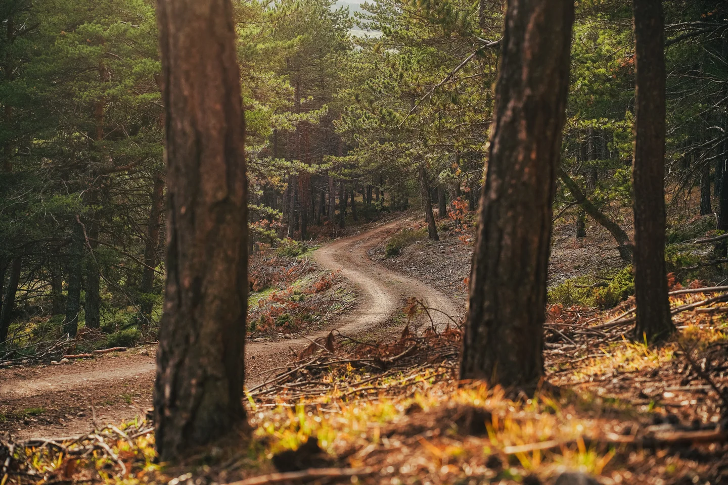
Chiva concentrates one of the most rewarding landscapes for getting started in the mountains in the province of Valencia: dry ravines, wide tracks, paths linked between pine groves and ridges that let your stride work without forcing an endless climb. In that mix lies its appeal for those looking for an easy mountain run, closer to a fluid workout than to a fight with the clock or the gradient.
The range of routes in the area is broad, but not all of them fit a relaxed outing. The gentlest option usually sits around 8 to 16 kilometers, with elevation gains of about 400 to 500 positive meters, a reasonable range for runners with some base who want to cover ground without getting into aggressive profiles. In the Sierra de Chiva area, too, the trail is usually well defined and orientation is relatively intuitive if you choose a simple circular route.
A terrain that rewards a steady pace
The value of an easy outing in Chiva is not in the total absence of elevation, but in how the effort is distributed. The area combines short ramps with runnable sections, and that allows the session to keep flowing. There is none of that feeling of endless climbing that empties the legs in the first kilometers, but rather a succession of small pace changes that force you to manage your energy wisely.
That character makes it useful for base runs, for regaining sensations after a demanding week or for adding mountain hours without the muscular load shooting up. The access tracks, the connecting paths and the dry ravines add variety, but they rarely turn the route into a highly technical, demanding trail. That is why Chiva often appears in the community’s tracks as a space for very balanced training.
The type of ground also matters. When the terrain is dry, footing is usually clean and predictable. After rain, some areas become more lively and mud can appear in spots, but it is not an environment where technical difficulty depends on big exposed steps or awkward scrambling. It is a Mediterranean mountain setting, more runnable than alpine, with a backdrop of stone, earth and low pine that invites you to run without too much drama.
Where to stay near Chiva
Accommodation in the area, with prices. Choose your dates on the map.
Affiliate links: if you book through this map we earn a commission, at no extra cost to you.
The most sensible route for running comfortably
Among the routes shared by the community, a circular loop of about 15.7 kilometers and 424 meters of positive elevation gain, starting and finishing in Chiva, stands out. Its profile is well distributed: it begins with warm-up kilometers, strings together a progressive climb toward the heart of the effort and then offers a descent long enough to recover without demanding exquisite technique. It is the kind of route that fits a session of between 1 hour 25 minutes and 2 hours, depending on each runner’s level.
Another, even more compact alternative is around 8.8 kilometers and 430 positive meters, also circular and passing through the GR 233 area. Although the elevation gain is not negligible, the short distance makes it a very interesting option for those who want a compact outing, without stretching the time commitment too much. It is a useful formula for days with little time or for runners who prefer to concentrate the work into fewer kilometers.
The difference between the two is not just length. The short route tends to be more direct and with fewer transition zones, while the 15.7-kilometer one offers more room to settle into rhythm and enjoy the scenery. In both cases, the runner moves within a moderate difficulty range, far from the big ultras of the Sierra de Chiva and also from race profiles that easily exceed 1,000 meters of elevation gain.
What you find along the way
Chiva’s charm lies in its landscape landmarks. Springs such as La Alhóndiga, La Cabra or the Enebro appear in several of the best-known routes, along with passes, summits and ravines that serve as orientation points and visual breathing space. You do not need to link them all to feel the character of the sierra: one or two landmarks are enough to understand that here the terrain rules, but it does so on a human scale.
The Church of San Juan Bautista, in the town center, often appears as a passing point in some recent tracks. There are also itineraries that cross the area around Fuente el Forraje Seca or approach zones near Barranco Grande. They are simple, almost familiar references that help keep the start and the return to the village in sight. On an easy route, that matters more than it seems, because it removes mental tension and leaves room to run freely.
On the more natural side, the Sierra de Chiva gains value through its scale. The municipal natural area is the largest in the Valencian Community according to information released by the Town Hall itself, and that shows in the diversity of settings. There are bare ridges, more closed shady slopes, narrow ravines and open track sections where the sky opens wide. The feeling is that of an accessible, close and wild enough sierra for the run not to lose its flavor.
Why this area works well for runners looking for something gentle
An easy route does not always mean flat. In trail running, smoothness usually comes from the sum of several factors: contained gradient, predictable terrain, good continuity and a manageable distance. Chiva brings those ingredients together quite naturally. The mountain does not disappear, but it lets itself be run. That difference is decisive for those who do not want to turn a short outing into a full-on grind.
The terrain also favors a clear reading of effort. The climbs are noticeable, but they rarely require walking for long minutes if your fitness level is basic or intermediate. The descents, for their part, allow you to recover without getting into very aggressive downhill technique. That means the runner can work on cadence, breathing and stability without being trapped by overly rough ground.
In addition, the Chiva area benefits from a network of marked trails and tracks that have been well tested by the community. The presence of the GR 233 and several local routes makes it easier to choose routes with less improvisation. In practice, that reduces the feeling of uncertainty. For a relaxed outing, the predictability of the route is worth almost as much as the elevation gain.
What it feels like to run there throughout the year
The best window usually comes in spring and autumn. Between March and May, and from September to November, temperatures are usually more manageable and the terrain is pleasant for running. In summer, the inland heat can make a session that looked light on the map much harder, especially if you head out late in the morning or with residual humidity. In winter, by contrast, the air can feel sharp in the higher areas, although the sierra remains perfectly passable most of the time.
The period after heavy rain changes the experience. Some ravines carry water, the paths become more pleasant and the ground gives a little, but mud can also appear, along with small changes in the surface or sections affected by recovery work. After intense episodes, it is wise to assume the landscape may shift under your feet, something common in Mediterranean areas hit by storms.
At sunrise or late in the afternoon, the route gains a lot. The low light stretches the shadows, highlights the texture of the stone and turns the sierra into a succession of soft planes. It is not just an aesthetic matter: those time slots also reduce the thermal load, something especially valuable in an outing meant to be comfortable and sustainable.
The right distance according to your level
For someone coming to trail running from road running or brisk mountain walks, a route of between 8 and 10 kilometers in Chiva can be enough to start feeling the terrain without overloading the body. A gain of around 400 meters already forces you to measure your effort, but it is still a reasonable volume if you control the pace and do not try to squeeze every ramp.
For a runner with more base, the 15.7-kilometer loop offers a more complete workout. It allows you to refine your uphill stride, manage the descent with ease and finish with moderate fatigue, without the training leaving too heavy a toll. It is a very useful distance for adding gentle quality, that mix of endurance and mountain work that is so appreciated in normal training weeks.
Beyond those ranges, Chiva changes its face. The 19, 22 or even 30-kilometer routes that circulate in the area enter another league, with elevation gains that easily exceed 900 or 1,000 positive meters. At that point it is no longer an easy route, but serious mountain work. And that boundary matters, because it avoids confusing a pleasant outing with a session that requires experience and a solid physical base.
Terrain, orientation and small details that make the difference
On a comfortable mountain route, the details matter more than they seem. The type of footwear, for example, can change the feeling of stability quite a lot. Trail shoes with a versatile outsole and moderate lugs usually work better than a very aggressive model, because here what matters most is smooth transition, not extreme grip. The key is to run naturally, not to fight with every step.
It also helps to head out with a basic map or track reference. Even though the area is fairly logical, some junctions between tracks, paths and secondary branches can cause doubts, especially if you link local variants. The trail network in the natural area is well documented by the Town Hall of Chiva and by community platforms, so the runner has room to choose an option suited to the day.
Hydration deserves attention even on easy routes. On mild days, an outing of a little over an hour can be handled with a light bottle; in summer or with persistent heat, a small pack or a belt with extra capacity gives you more margin. In the Valencian sierra the problem is usually not the distance, but the combination of heat, exposure and sustained pace.
The sporting value of a pleasant outing
There are routes that impress because of how hard they are, and others that win the runner over through balance. Chiva belongs to this second family. It does not seek the epic of the great summits, but the usefulness of terrain where you can train well. That makes it valuable for working on basic technique, aerobic strength and pace management without overly compromising recovery.
In preparation for middle-distance races, this kind of route makes sense because it combines enough load with limited exposure. It allows you to repeat stimuli, observe how the body responds uphill and check whether the stride is still alive at the end. Gentle mountain also teaches: it teaches you not to overdo it, not to speed up where you shouldn’t, to read the terrain calmly and to save your legs for what comes next.
That is why Chiva appears in so many community tracks. It is not just a pretty destination; it is a functional setting. A place where the sierra does not bite, but neither does it fully forgive. And that exact measure, so unremarkable at first glance, is precisely what makes it interesting for running consistently.
A nearby sierra that still has plenty to offer
The Valencian trail map is full of better-known names, but Chiva keeps its own personality. Its natural area, its network of trails and its mix of ravines and ridges make it possible to build routes of different profiles without leaving a very recognizable setting. For an easy outing, few areas offer such a balanced combination of accessibility, scenery and room to maneuver.
That combination is what keeps it relevant. You do not need a remote summit or a triple-digit elevation gain for a session to work. Sometimes all it takes is a well-chosen loop, a gradient that helps and ground that lets you run. Chiva offers exactly that: a serene, useful and sufficient trail, the kind you remember not for the postcard, but for the way it leaves your legs and your head at the end of the day.



How to prevent thigh chafing: causes and real solutions

Women’s running windbreakers: seven jackets and how to choose

Do more workouts get rid of soreness? A guide for runners

Jaén Half Marathon 2026: Record 3,800 Runners Registered

Men’s short running tights: how to choose the right pair

World Triathlon confirms data breach involving medical data

Izan Edo targets podium at Miyazaki World Cup

María Pérez ranks ninth in World Athletics’ 2026 top ten

Dos Santos, Duplantis and Sawe: World Athlete of the Year finalists

San Silvestre Vallecana 2026: 42,000 places, prices and start times

 Races4 months ago
Valencia Half Marathon 2027: date and registration

 Races4 months ago
Valencia Marathon 2026: entry, ballot and course

 Reviews and Comparisons4 months ago
Asics Gel-Roadmiles 3 for men: review and current price

 Reviews and Comparisons4 months ago
Asics Gel Sonoma 8 Gore-Tex: complete analysis for trail and rain

 Sneakers3 months ago
Saucony Endorphin Pro 4: full review and verdict

 News5 months ago
Strava API 2026: what changes for clubs, challenges and runner apps?

 Reviews and Comparisons5 months ago
Nike Alphafly 3: opinions, sensations, and real key points

 Reviews and Comparisons4 months ago
Under Armour running shoes review 2025-2026: models and key features

 Sports Equipment4 months ago
Shoe sizes in cm: a clear guide to getting the right fit for your footwear

 Sneakers3 months ago
Skechers GO RUN Consistent 2.0 analysis: comfort and limits

 News5 months ago
Valencia Marathon 2026 route: key tips to train and run better

 Sneakers4 months ago
Adidas Adizero Boston 13 for men: review and verdict