Routes
Easy hiking trails in Gran Canaria for beginners
Simple walks around the island among volcanoes, coastline, and forests, with very accessible options and memorable scenery.

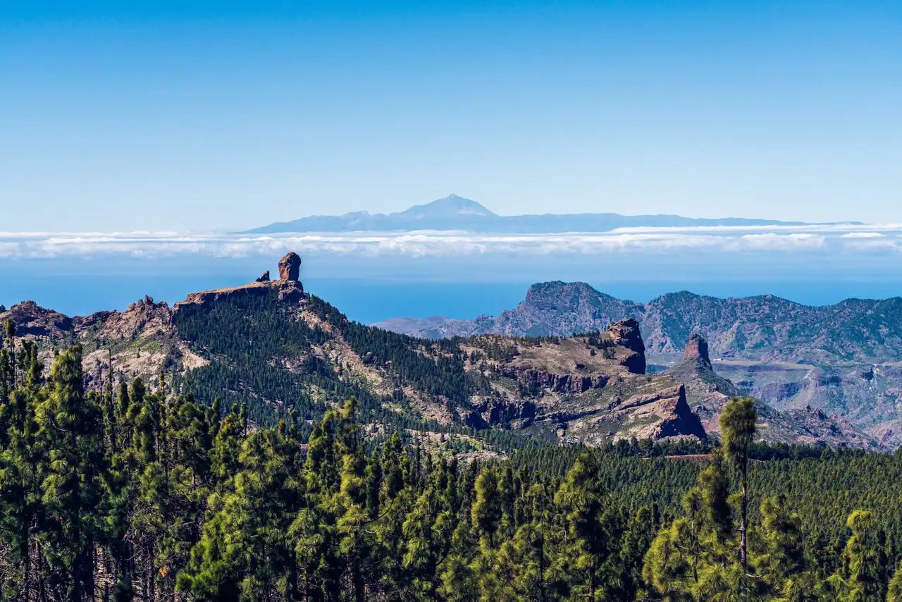
Gran Canaria packs a variety of landscapes into just a few kilometers that on the mainland would require several trips. That mix of open coast, ravines, pine forests, and volcanic relief makes the island an ideal destination for those who want to walk without getting into long treks or steep ascents. The easiest routes are usually well defined, have short distances, and offer an immediate visual reward: a lighthouse facing the Atlantic, a crater round as a sleeping wound, or a damp forest that completely changes the air.
The most comfortable options usually range between 2 and 6 kilometers, with times from one hour to just over two hours and moderate or low elevation gain. In practice, that means routes suitable for people who go hiking often, families with children used to walking, and visitors who prefer to enjoy the scenery without punishing their legs. The island also makes it possible to combine a gentle walk with heritage, viewpoints, recreational areas, and villages with their own life; the trail is not just the path, but a way of entering the territory.
Walks that open the door to the island without asking too much
The Canary Garden and the Bandama Caldera perfectly sum up what makes Gran Canaria special for easy hiking. The first offers a route that feels almost domestic, comfortable and shaded at times, where the flora is presented like a living museum; the second takes the visitor into a much more dramatic volcanic landscape, but with a short and manageable distance. Between these two extremes, the island’s logic becomes clear: you can walk at a relaxed pace and still feel as though you are traveling across several continents in a single day.
The Canary Garden walk, at about 3.7 kilometers, is one of the most pleasant routes to start with. The terrain is straightforward and the botanical interest compensates for every stretch with a succession of green textures, cacti, palms, and Canarian species. It is a leisurely route, where the noise drops several notches and the body quickly settles into walking mode. There is no mountain and no technical risk; there is observation, shade, mental benches for stopping, and a sense of refuge that makes it especially useful on mildly warm days or for those who want a short outing without giving up scenery.
Bandama, by contrast, changes the script with an almost lunar setting. The circular route around the crater rim, just over 3 kilometers long, allows visitors to look down into the caldera and understand the geological force that shaped the island. Although the descent into the interior adds some incline, it remains a very manageable outing if approached carefully. The contrast between dark rock, ochre tones, and vegetation clinging to the slopes is one of the area’s great attractions: it looks like a relief photograph, but with the smell of volcanic earth and clean wind.
Where to stay near Las Palmas de Gran Canaria
Accommodation in the area, with prices. Choose your dates on the map.
Affiliate links: if you book through this map we earn a commission, at no extra cost to you.
The coast also has its say when the trail is gentle
In the south, easy walks by the sea have one clear advantage: the elevation change almost disappears and the light does the rest. The Maspalomas Dunes and the area around the Maspalomas Lighthouse are two of the island’s most recognizable landscapes, and also among the most rewarding for walking without effort. The terrain is flat or very gentle, the route can be adjusted to the energy available, and the sea horizon acts as a natural compass that is more calming than orienting.
The dune route, at about 6.5 kilometers, is long in distance but light in effort. The secret lies in the consistency of the terrain and the openness of the space, which means the walk never feels enclosed. The sand, the undulating shape of the dunes, and the distant sound of the sea create a very different experience from the interior of the island. The best time is usually early, when the light is lower and the temperature has not yet risen; later on, the sun gets stronger and it is worth considering the exposure, especially if walking with children or people not used to continuous walking.
Very close by, the Maspalomas Lighthouse walk offers another view of the coast. Here the interest lies not in effort, but in the transition between the tourist coastline and the Atlantic edge, with a layout of about 5.2 kilometers that falls within the range of comfortable walks. It is a walk with clean lines, useful for understanding southern Gran Canaria without leaving the maritime setting. The presence of the lighthouse, the coastline, and the changing light at the end of the day turn this route into one of those places where walking feels like a way of looking more slowly.
Wet forests, water, and shade in the north
If southern Gran Canaria resembles a postcard of sand and salt, the north introduces humidity, shade, and denser vegetation. Los Tilos de Moya and the area around Los Chorros in Firgas or Teror belong to that green Gran Canaria that often surprises visitors. These are short routes, generally circular, with low difficulty and a very different atmosphere from the coast or the highlands. Here the body appreciates the shade and the ear fills with the sound of water, even when the flow is not abundant.
The circular route through Los Tilos de Moya is one of the most balanced for a broad audience. It barely exceeds 2 kilometers and runs through one of the island’s last laurel forest enclaves. That fact, which sounds almost academic, becomes tangible once you step onto the trail: the air cools, the leaves seem to absorb the light, and the walk takes on the feel of an ancient forest, almost a refuge. It is a very good option for anyone looking to walk slowly with little elevation gain, without losing the feeling of being in a special place.
Further south within the north, Teror and Firgas offer easy routes with a strong cultural component. The historic center of Teror and the Álamo Ravine form a pleasant combination for those who want to alternate between urban surroundings and light nature. In Firgas, the Los Chorros area adds the symbolic value of water, which is very present in local memory and in the town’s image. These are routes that require no technical preparation, but do require attention to details: a fountain, a water channel, a square, a stairway between white houses. Hiking here is not just exercise; it is also a reading of the territory.
Accessible volcanoes and ravines with history
The Bandama Caldera and the Cernícalos Ravine are two names that keep coming up because they combine beauty and accessibility. They are not hard mountain routes, although the terrain has character. In both cases, the visitor enters a landscape with a very strong identity: in Bandama, the volcanic mark dominates; in Los Cernícalos, water rules over the ravine walls. The low or low-medium difficulty does not take away their personality; on the contrary, it allows more people to enjoy settings that might seem reserved for longer hikes.
The Cernícalos Ravine deserves attention for its relationship with water, which is increasingly valuable in the experience of walking in the Canary Islands. The usual route is around 4 kilometers each way and can be extended somewhat further if you continue in search of the waterfalls. There are dirt sections that become a little more uncomfortable after the first cascade, but the route remains reasonable for a family outing with some hiking experience. What is interesting is not only the final waterfall, but the sequence: water channel, shade, rocky wall, the constant murmur of water, and a change in temperature that you feel on your skin.
The Bandama Caldera, for its part, functions almost like an open-air geology class. The caldera is about 216 meters deep and nearly a kilometer in diameter, figures that help explain the scale of the place, but that fall short when you are standing on the rim looking down. The trail around the rim is the easiest and most scenic; the descent into the interior adds interest, though it also requires a steady step. For beginner hikers, it is wiser to choose the upper section, where the visual reward is enormous and the terrain does not punish.
Short routes that fit well into a day of travel
Gran Canaria greatly rewards those who know how to choose the right length for a walk. Some routes are so compact that they can fit in before lunch or as an end-of-day outing, without requiring major logistical effort. Charco de La Paloma in Tejeda, for example, is almost a miniature excursion: just a few minutes there and back, a setting linked to rain, and the feeling of having found a hidden corner without straying too far from the car. That kind of route is valuable precisely because it does not compete with the day, but completes it.
Something similar happens with the approach to Roque Bentayga, a very short walk in distance but intense in context. The trail to the base of the monolith takes little time and its interest lies in the mountain landscape surrounding it, not in physical exertion. The island shows one of its most symbolic images here, with ravines and calderas magnifying the presence of the rock. It is a particularly valuable stop for those who want to combine nature and pre-Hispanic heritage in a single visit, without getting into long or complicated routes.
Also in the highlands, the Niñas Dam works as a serene and very versatile walk. The surroundings combine water, pine forest, and recreational spaces, and lend themselves both to a short walk and a peaceful day in the countryside. There is no need to turn it into a hike to enjoy it: the place invites you to slow down, sit, watch the light reflected in the reservoir when the water level is favorable, and understand why so many easy routes in Gran Canaria rely on these mid-altitude and highland landscapes.
What the most rewarding walks have in common
The island’s easy routes share a virtue that is not very spectacular and, precisely for that reason, very valuable: they let you enjoy the landscape without fighting it. Most do not require technical experience or special gear beyond comfortable footwear, enough water, sun protection, and common sense. On an island where the climate changes with altitude, an easy coastal walk can feel almost summery while, just a few kilometers away, a highland path calls for a light layer. That diversity means you need to look more carefully at the map than at the calendar.
It is also worth considering the sun’s orientation, the type of ground, and the actual use of the path. Some short routes become harder because of sand or a concentrated slope over just a few meters, as happens on certain descents in Bandama or at specific points in the Cernícalos Ravine. Others seem very easy on paper and yet become punishing because of the heat, as can happen in open areas of Maspalomas. The key lies less in the exact figure than in the combination of distance, exposure, and time of day.
For that reason, easy hiking in Gran Canaria should not be seen as a lesser version of hiking, but as a very rich gateway. Routes of just a few kilometers help you read the island calmly and often offer the best contrasts: forest in the morning, crater at noon, sea at sunset. That flexibility explains their popularity among first-time visitors and among residents who return again and again to the same stretches because each season changes the light, the smell of the earth, and the color of the landscape.
When the route is short, the landscape takes over
The power of these walks is not in epic grandeur, but in the clarity with which they show Gran Canaria’s character. A gentle route can be enough to understand why the island is so often described as a continent in miniature. In less than two hours, you can move from a botanical grove to a sand desert, from a laurel forest to the wall of a volcano. That visual density, almost cinematic, is what makes easy routes a privileged doorway into the territory.
There is also a practical advantage that should not be overlooked: these options fit better with short trips, children, or days when the body asks for moderation. Not every excursion has to turn into a day of effort. Sometimes it is enough to walk just far enough for the island to arrange itself before your eyes, as if the landscape could be read better at a slower pace. In Gran Canaria, that slow pace does not reduce the experience; it refines it. And that is probably the most lasting appeal of its most accessible trails.



How to prevent thigh chafing: causes and real solutions

Women’s running windbreakers: seven jackets and how to choose

Do more workouts get rid of soreness? A guide for runners

Jaén Half Marathon 2026: Record 3,800 Runners Registered

Men’s short running tights: how to choose the right pair

World Triathlon confirms data breach involving medical data

Izan Edo targets podium at Miyazaki World Cup

María Pérez ranks ninth in World Athletics’ 2026 top ten

Dos Santos, Duplantis and Sawe: World Athlete of the Year finalists

San Silvestre Vallecana 2026: 42,000 places, prices and start times

 Races4 months ago
Valencia Half Marathon 2027: date and registration

 Races4 months ago
Valencia Marathon 2026: entry, ballot and course

 Reviews and Comparisons4 months ago
Asics Gel-Roadmiles 3 for men: review and current price

 Reviews and Comparisons4 months ago
Asics Gel Sonoma 8 Gore-Tex: complete analysis for trail and rain

 Sneakers4 months ago
Saucony Endorphin Pro 4: full review and verdict

 News5 months ago
Strava API 2026: what changes for clubs, challenges and runner apps?

 Reviews and Comparisons5 months ago
Nike Alphafly 3: opinions, sensations, and real key points

 Reviews and Comparisons4 months ago
Under Armour running shoes review 2025-2026: models and key features

 Sports Equipment4 months ago
Shoe sizes in cm: a clear guide to getting the right fit for your footwear

 Sneakers3 months ago
Skechers GO RUN Consistent 2.0 analysis: comfort and limits

 News5 months ago
Valencia Marathon 2026 route: key tips to train and run better

 Sneakers4 months ago
Adidas Adizero Boston 13 for men: review and verdict