Routes
Calderona route for beginners: easy trails to start trail running
Simple trails and viewpoints to discover the Sierra Calderona calmly, at a good pace, and without complications.

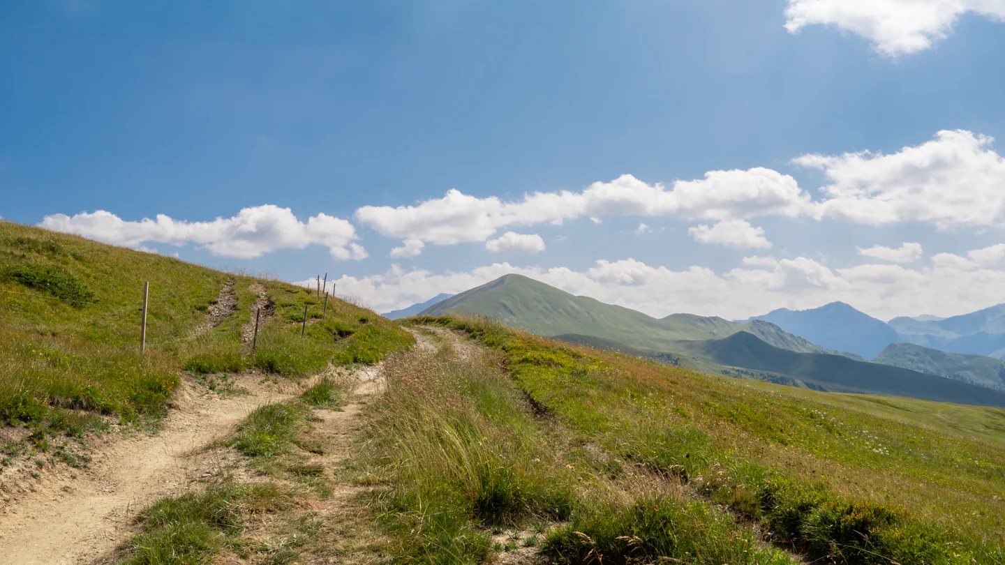
Imagen: Tina P. / Pexels
Sierra Calderona offers gentle terrain to start out in the mountains without leaving the Valencian Community. Just over half an hour from Valencia, this natural park combines forest tracks, short trails and modest elevation gains that fit well with a first outing. In the access points of Serra, Olocau, Gátova or the Portaceli area, several low-demand routes are concentrated, with typical durations of between 1 hour and a half and 2 hours, and distances that hover around 5 to 7 kilometers.
The most recommended options for a debut are circular, well marked along much of their route and with clear points of interest. The surroundings add carrasco pine forests, stretches of cool shade, views of the coastline and the occasional fortress or viewpoint that gives meaning to the walk. For a runner or walker who wants to alternate gentle training and nature, the Calderona works like an outdoor gym without machines or noise, but with hills, changes in surface and a real geometry that forces you to pace yourself.
A natural park that rewards a calm pace
The first virtue of this mountain range is how close it is. From Valencia city center you can get there by car relatively quickly, and that has made the Calderona a regular destination for short outings, both during the week and on weekends. The landscape is not that of a harsh, enclosed high mountain; here the mid-altitudes dominate, open ravines and a network of paths that alternate compact tracks with narrower trails. For someone just starting out, that mix reduces the feeling of technical vertigo and lets you focus on something simpler: walking calmly, observing and enjoying.
The terrain, though, does not fool you. Even if many routes are listed as easy, the ground includes short climbs, loose stone in some stretches and descents that punish more than they seem to when the legs still haven’t warmed up. That’s why it’s worth understanding the idea of an easy route in the Calderona as an accessible outing, not as an urban stroll. In practice, the simplest itineraries usually require a minimum attention to footwear and heat, especially from May to September, when the sun hits hard and shade is scarce on the more open tracks.
The best news is that there’s real variety. Between Olocau and Serra, for example, there are short circular routes that can be linked with viewpoints or historical remains; in Gátova, the presence of springs and shaded areas extends the feeling of freshness; in Portaceli, some stretches rely on wide, comfortable tracks. For someone who wants to get started, that diversity makes it possible to choose without falling into monotony and to adapt the outing to the day, the heat and your fitness level.
Where to stay near Serra
Accommodation in the area, with prices. Choose your dates on the map.
Affiliate links: if you book through this map we earn a commission, at no extra cost to you.
The most gentle routes to start without surprises
Among the most rewarding options stands out the red route in Olocau, with about 6.1 kilometers and around 1 hour and 51 minutes of walking. It’s a well-known circular route, moderately demanding but manageable for beginners with a bit of stamina. Its appeal is not only in the distance, but in the balance between uphill and downhill, and in the way the route enters a Mediterranean landscape that changes texture as it goes. There’s no need to run; in fact, what matters here is a steady pace more than speed.
Another very interesting option is the circular route from Serra with views of the Torre del Senyor, about 6.2 kilometers and 1 hour and 47 minutes. It’s a short outing, with limited elevation gain, that lets you discover one of the park’s most rewarding viewpoints. The panoramas over Serra and the castle surroundings repay the effort without requiring any special preparation. For someone arriving in the mountains for the first time and worried about running out of breath too soon, this kind of route builds confidence because it combines a reasonable climb with a descent that feels manageable.
The Camino de Potrillos, from the Reixo, also works very well, with 5.14 kilometers and barely 80 meters of positive elevation. That detail matters a lot for beginners, because it turns the outing into a gentle first contact with the mountains. In addition, several hikers highlight its partial shade and pine forest atmosphere, a detail that is far from minor in summer. Not every easy path needs a grand monument at the end; sometimes the value lies in moving through a cool ravine, hearing the pine needles under your boots and finishing the loop with the feeling of having done something useful for the body without emptying it out.
For those who prefer a route with a bit more character, the viewpoint of Puntal dels Llops, from Olocau, adds up to about 5.48 kilometers and 1 hour and 36 minutes. It’s one of those routes that show the Calderona in miniature: trail, slope, viewpoint and circular return. The elevation gain is not intimidating, but it is wise to keep some energy in reserve for the final climb and for the descent, which in the mountains always deserves respect. This route fits well with someone who has already done a short outing and wants to add scenery without making a sudden jump in difficulty.
The Serra area also offers itineraries that combine heritage and light walking, such as the loop to Castell de Serra. Some variants approach the castle by trails that then soften into more comfortable forest tracks. The historical reference matters because it breaks the idea that an easy route lacks interest; on the contrary, in the Calderona short outings often include towers, viewpoints, springs or defensive remains that add context and make the effort easier to remember.
What really makes an outing suitable for beginners
Length alone is not enough to measure difficulty. In Sierra Calderona, a 6-kilometer route can feel very gentle or much more demanding depending on the elevation gain, sun exposure and type of ground. A wide track with 150 meters of accumulated climb is not the same as a rocky trail over the same distance. That’s why, for a first experience, the safest choice is to look for itineraries under 2 hours, with positive elevation gains below 300 meters and a route that is easy to follow.
The type of surface changes the experience a lot. Forest tracks absorb effort better and let you regulate your breathing almost as if you were doing a very easy jog. Narrow trails, on the other hand, force you to watch where you step and slow the cadence. It’s not a problem, but it is a difference. Someone just starting out usually appreciates beginning on mixed tracks and saving the more technical stretches for later. In the Calderona, those bridge routes are abundant, a kind of intermediate step between a flat walk and more serious mountain terrain.
Orientation also matters. Shaded stretches, especially those crossing dense pine forests or ravines facing north, are much more bearable in warm months. By contrast, slopes facing south can turn into a small oven from mid-morning onward. That reality explains why many local hikers prefer to set out early. It’s not a trend: it’s common sense, especially when the route is meant for people who are just starting and still don’t know well how their body reacts to heat or continuous climbing.
Signposting deserves attention. In part of the park there are official routes with visible markers and panels, but not every turn explains itself. Some easy routes in the Calderona are intuitive; others, however, require a calm look at the junctions. The most sensible advice is not to get overconfident because of the easy label. A gentle route can still be confusing if you arrive distracted, with your phone in hand or without having checked the starting point beforehand.
Olocau, Serra and Gátova: three comfortable gateways to the mountains
Olocau concentrates several of the cleanest routes for those who don’t want complications. The climb to the Puntal dels Llops area, the circular routes around Cueva del Cavall and the paths around the town center let you leave the road quickly and enter the mountains with little initial strain. In addition, the landscape blends history and ravine very effectively: here the walk is not limited to exercise, but also includes archaeological remains, low orchards and passes from which the horizon opens up.
Serra offers an even more direct access to some of the Calderona’s classic images. The castle dominates the surroundings and turns any short route into a visual sequence that is easy to remember. The forest tracks leaving the town usually provide a gradual introduction, something very useful for anyone who still doesn’t know how much they can handle in a morning. And if the day is kind, the views over the Gulf of Valencia make the effort seem smaller than it really was.
Gátova, for its part, adds the value of water and shade. In the natural park, where summer hits hard, a spring or a grove changes the perception of the route completely. The routes around Tristán, the mills or the town’s springs move on a very reasonable scale for beginners who already want something more than a flat walk. They are paths that teach you to pace yourself, to measure your pulse and to appreciate the small breaks without turning the outing into an endurance test.
Choosing the starting point is not a minor detail. Easy access, clear parking and a circular return reduce logistical stress and leave more energy for the walk. In that sense, the Calderona has a notable advantage over other more remote mountain ranges: it lets you go out and discover it without turning the day into an expedition. That makes it especially valuable for those who want to start walking more seriously without straying too far from home.
What you see while walking: pines, red sandstone and balconies over the coast
The most repeated image in the Calderona is that of carrasco pine closing the horizon on both sides of the trail. That green is not uniform or flat; it changes with the light, becomes lighter on the dry hills and darker in the shade. Among the pines appear old terraces, clumps of rosemary, mastic and, in some areas, cork oak groves that remind you that this mountain range is Mediterranean to the core. For a beginner, that landscape is useful because it gives constant reference points and avoids the feeling of emptiness that other more bare mountains create.
The red sandstone adds character. The reddish shapes of the rock, especially in certain ravines, appear like a splash of color among so much green. It’s not a minor detail: it gives personality to the route and helps explain why the Calderona has inspired so much local hiking. The terrain has the patina of something old, like tree bark wrinkled by wind and time, yet it remains accessible. That combination rarely fails when you’re looking for a first serious relationship with the mountains.
The views over the Gulf of Valencia are another major draw. On clear days, from several high points you can make out the coastline, the plain and, beyond that, the urban outline of Valencia. That perspective has something pedagogical about it: it places the walker. You understand better the relationship between mountain and city, between refuge and plain, between the noise of traffic and the silence of the ravines. You don’t need to reach a great summit to feel that contrast; several intermediate balconies are enough, and the Calderona has more of them than it seems.
Fauna and flora complete the experience without needing grand displays. Birds of prey, wild boar, foxes, genet and ocellated lizards are part of the ecosystem, even if they don’t always show themselves. On the plant side, the park hosts more than 175 species of plants and medicinal herbs, a fact that helps explain the richness of the whole. For a beginner walker, that biological density has an advantage: the trail is never just a line on a map, but a living corridor breathing all around you.
When to go and how to read the Calderona’s weather
Spring and autumn are the best times to start. Temperatures are milder, daylight lasts less and the mountains feel more welcoming. In March, April, October or November, a short outing can become a very complete experience without the thermal punishment of summer. In addition, the green looks more vivid and the air is usually cleaner after some rain, something that amplifies the sense of openness from the viewpoints.
Summer calls for absolute caution. The proximity to the coast creates humidity, and that can make the heat feel heavier than the thermometer suggests. On muggy days, even a route labeled easy becomes tiring if there’s no shade. That’s why, in the Calderona, early schedules are not a romantic recommendation, but a practical way to prevent a pleasant outing from turning into unnecessary wear. Starting at dawn or first thing in the morning reduces stress and greatly improves the experience.
Winter offers another face, cleaner and harsher. Wind, fog or even frost can appear in the higher and shadier areas. It’s usually not a problem for a simple route, but it does mean dressing in layers and not underestimating wet ground. The advantage of the cold season is that the mountains empty out and silence gains weight. The downside is that a simple descent in the shade can cool the legs faster than expected.
Checking the weather forecast remains an essential habit. Not only because of rain, which can make trails more slippery, but because of the combination of wind and heat. In the Calderona, the same route changes a lot depending on whether the atmosphere is stable or low cloud comes in from the coast. For someone just starting out, understanding that game is almost as important as reading the map.
How to approach the mountains without making it harder than necessary
The basic gear is simple, but it’s worth not improvising. Shoes with grip or lightweight hiking footwear, enough water and some sun protection make all the difference on short routes. The backpack doesn’t need to look like a wardrobe: the essentials fit in a small space. Even so, a very useful rule in the Calderona is to carry more water than seems necessary, especially if the route has no reliable springs or if the heat is already pressing early on.
Pace matters more than strength. On a route for beginners, the most common mistake is setting off too fast. The mountains don’t reward sprints; they are better enjoyed at a steady pace, with controlled breathing and short steps on the climbs. That way of walking, so similar to how a prudent distance runner runs, prevents the effort from spiking in the first 20 minutes. The outing is more enjoyable when the legs still have something left at the final stretch.
Trekking poles can help, though they’re not essential. On routes with gentle slopes or long descents, they take some load off and stabilize the body. For someone just starting, their usefulness depends more on personal comfort than on any fixed rule. The important thing is not to turn equipment into a mental obstacle. The Calderona is within reach of a novice walker precisely because it allows simple solutions and doesn’t demand heavy logistics.
It’s also wise to leave some margin to come back with energy. There’s no need to push to the limit or chain several routes in the same day. A short, well-chosen itinerary is enough to gain confidence. That’s part of the mountain range’s charm: it lets you build a gradual relationship. First a small circular route, then a variant with a viewpoint, later a slightly more sustained climb. The progression feels natural because the park offers very clear intermediate steps.
What makes a first outing in this mountain range worthwhile
The Calderona teaches you to walk intelligently. Its trails don’t impose empty heroics or force you to conquer remote summits to feel the outing was worth it. A short route, a track among pines, a castle on the hill or a viewpoint open to the sea is enough for the day to gain depth. For beginners, that’s gold: the experience adds up without punishing too much.
It also helps you understand that not every easy route is flat or trivial. Mountains have nuances, and the Calderona offers them with a clarity that is very useful for someone starting out. There are ramps, shade, rocks, passes and descents that train the body without overwhelming it. Each outing works like a small laboratory of sensations: sweat, breathing, pauses and landscape. That combination usually hooks people because it doesn’t overwhelm, but it doesn’t bore either.
That’s why this mountain range has become one of the most cited spaces when talking about accessible hiking in Valencia. Its network of paths, its proximity to urban centers and the presence of very affordable circular routes place it in a privileged position for anyone who wants to start moving through the mountains with some sense. If the goal is a first route in the Calderona for beginners, the best options are those that combine short distance, moderate elevation gain, partial shade and a clear return. The rest is provided by the landscape, which here still has the courtesy of letting almost everyone in.



How to prevent thigh chafing: causes and real solutions

Women’s running windbreakers: seven jackets and how to choose

Do more workouts get rid of soreness? A guide for runners

Jaén Half Marathon 2026: Record 3,800 Runners Registered

Men’s short running tights: how to choose the right pair

World Triathlon confirms data breach involving medical data

Izan Edo targets podium at Miyazaki World Cup

María Pérez ranks ninth in World Athletics’ 2026 top ten

Dos Santos, Duplantis and Sawe: World Athlete of the Year finalists

San Silvestre Vallecana 2026: 42,000 places, prices and start times

 Races3 months ago
Valencia Half Marathon 2027: date and registration

 Races3 months ago
Valencia Marathon 2026: entry, ballot and course

 Reviews and Comparisons4 months ago
Asics Gel-Roadmiles 3 for men: review and current price

 Reviews and Comparisons4 months ago
Asics Gel Sonoma 8 Gore-Tex: complete analysis for trail and rain

 Sneakers3 months ago
Saucony Endorphin Pro 4: full review and verdict

 News5 months ago
Strava API 2026: what changes for clubs, challenges and runner apps?

 Reviews and Comparisons5 months ago
Nike Alphafly 3: opinions, sensations, and real key points

 Reviews and Comparisons4 months ago
Under Armour running shoes review 2025-2026: models and key features

 Sports Equipment4 months ago
Shoe sizes in cm: a clear guide to getting the right fit for your footwear

 Sneakers3 months ago
Skechers GO RUN Consistent 2.0 analysis: comfort and limits

 News5 months ago
Valencia Marathon 2026 route: key tips to train and run better

 Sneakers4 months ago
Adidas Adizero Boston 13 for men: review and verdict