News
Fire carts: complete guide to the crossing and its refuges
The Aigüestortes circular route connects refuges, passes, and lakes in a demanding and very complete trek.

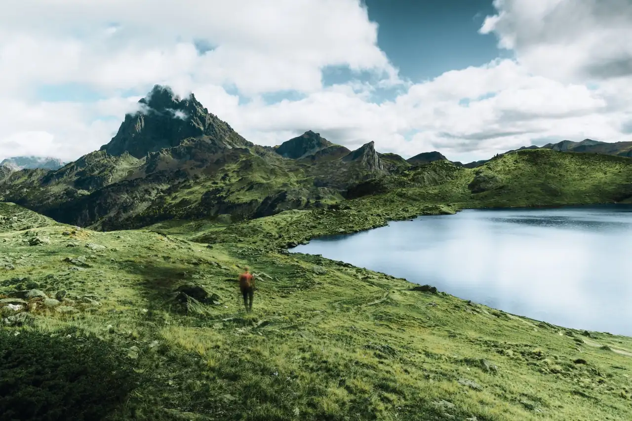
Carros de Foc remains one of the most recognizable traverses in the Pyrenees for a very simple reason: it brings together landscape, effort, and refuges in a single sequence, as if each day were a different shot in a mountain film. The route crosses the Aigüestortes i Estany de Sant Maurici National Park in a high-mountain circuit that links several staffed refuges and demands legs, head, and room for the unexpected. It is not just any long hike; it is a traverse that moves among granite, glacial lakes, and passes that force you to gain altitude patiently.
Its appeal does not depend only on the postcard view. Its history also carries weight, as does the refuge system, the possibility of varying stages, and the feeling of moving through a very alive territory, with water everywhere and a relief that changes with every step. In the most widely shared data for the route, the basic itinerary is around 55 to 65 kilometers, with a cumulative elevation gain of about 9,200 meters, and it is usually completed in five to seven days, depending on the chosen itinerary and the group’s fitness.
A traverse born among wardens and turned into a Pyrenean reference
The origin of the route is almost as powerful as the route itself. In the late 1980s, several refuge wardens in the park began visiting one another along the paths that today form the basis of the traverse. That spontaneous gesture ended up giving a name to one of the most famous routes in the Catalan mountains and, over time, to the set of services and modalities that now surround the brand. The traverse became official in 2000 and has since gained visibility inside and outside Spain.
The fame did not come from artifice. It came because the itinerary condenses a good part of what defines great alpine hiking: high passes, glacial valleys, granite blocks, tucked-in lakes, and refuges that function as small inhabited islands in the middle of a sea of rock. The highest point is usually the Contraix pass, at an altitude close to 2,748 meters, which already gives an idea of the traverse’s character. There is no gentle terrain here; there is altitude, elevation gain, and weather changes that can transform a day in a matter of hours.
The name, moreover, has contributed to its mystique. It evokes fire, movement, and energy, but the landscape that supports it is more mineral than fiery. In summer, water softens the visual harshness of the high mountains; on gray days, granite dominates and the traverse takes on an almost austere tone. That contrast is part of its identity and explains why so many mountaineers consider it a reference route.
What kind of route it really offers
Carros de Foc is a circular high-mountain route. That means two essential things: it can be started from several points and does not depend on a single mandatory direction, and the terrain requires some experience with elevation gain and uneven sections. The traverse is not built around a single perfect trail, but around a system of links between refuges, passes, and valleys that makes it possible to adjust the route. That flexibility is one of its strengths, although it also requires planning.
The classic route connects nine refuges within the park, although there are variants that add other stopping points, such as Pla de la Font or Gerdar, extending the route. The refuges sit at approximate elevations between 1,500 and 2,400 meters, which means spending several consecutive days at medium-high altitude. It is not just a walk between lodges; it is a continuous traverse through real mountain terrain, where the legs work as much as the navigation.
Water is one of its most visible features. Lakes, streams, waterfalls, tarns, and meltwater accompany much of the itinerary. In landscape terms, it is a very liquid traverse within a territory of stone. That balance gives it visual depth and also helps explain the park’s glacial geography, with U-shaped valleys, lake basins, and passes that act as hinges between watersheds.
The level of demand and why it should not be underestimated
The difficulty is high, although not necessarily technical in every section. The combination of distance, elevation gain, and uneven terrain places it above most marked mid-mountain routes. There are long stages, extended descents, and blocky areas where you have to move carefully. The body gets used to the load, but not without paying a price: hours of walking, a backpack on your shoulders, and successive days without full rest.
The most delicate section is usually the ascent and descent through Contraix, especially when there is rain, late snow, or wet rock. The feeling changes a lot between a clear July day and a September day with cold wind or fog. In the high mountains, weather is not scenery; it is part of the route. That is why the route is recommended between June and September, when the staffed refuges operate normally and the terrain usually offers better conditions.
The best way to understand its demands is to compare it with other multi-day traverses: here it is not enough to walk well for one day. You need to sustain the pace, sleep reasonably well, manage the weight of the backpack, and know how to give up a pass or a summit if the weather or the group is not cooperating. That ability to adapt does not diminish the achievement; on the contrary, it is part of the route’s logic. The mountain decides, and in Carros de Foc it decides clearly.
Refuges, stages, and the logic of sleeping at altitude
The refuges are the logistical heart of the traverse. Without them, Carros de Foc would lose much of its practical sense. Each refuge provides a roof, dinner, breakfast, and, in some cases, extra services such as a shower, wifi, or the possibility of leaving waste. But beyond comfort, what matters is their network function: they make it possible to break the itinerary into sections, organize more humane stages, and maintain a reasonable level of safety in a remote environment.
Among the most frequently mentioned refuges are Restanca, Ventosa i Calvell, Estany Llong, Colomina, Josep Maria Blanc, Ernest Mallafré, Amitges, Saboredo, and Colomers. Some guides and operators also include Pla de la Font and Gerdar in extended versions. The diversity of locations is part of the charm: some sit right beside dark-water lakes, others overlook high meadows or open valleys, and each one gives the following day its own rhythm.
The classic traverse is usually organized into five or six stages, although some people spread it over more days to make it more manageable. Six-day versions usually offer a more balanced distribution of effort; five-day versions mean slightly denser days and a more compact sense of the route. There are also four-day variants for very well-prepared mountaineers, but there the traverse enters another physical category, with less room for contemplation and more for performance.
Reservations, the pass, and the real map of the organization
Booking in advance is practically mandatory if you want to do the route with guaranteed refuge nights, especially in high season. Competition for beds is no small detail: the number of places is limited and demand is concentrated in summer. Reservations are usually handled through the Central de Reservas, which coordinates availability among the refuges. In practice, leaving it until the last minute greatly reduces your options and makes it harder to close a reasonable combination of stages.
The brand also works with a forfait or pass card that is stamped at the refuges. Its function is more symbolic and logistical than essential for walking, but it has ended up becoming part of the experience. In some versions it includes a map and small gifts, and in extended variants it may be linked to additional services or complementary routes. Its real usefulness depends on how the traverse is approached, but its presence helps structure the route and leave a record of passing through each refuge.
It is also worth understanding that access to the park and the traverse are not exactly the same thing. The park is an open natural space, but overnight stays in refuges and the use of certain services do require prior organization. In addition, in the Boí and Espot area there are 4×4 taxis and regulated access points that make entries and exits easier without having to retrace the entire itinerary on foot. That transport network makes an important difference when planning the starting point and the return.
How the route is experienced stage by stage
The first feeling is usually one of gradual ascent. Often you start in valleys that still keep a friendly scale and slowly enter the severity of the high mountains. The first sections may skirt lakes and climb along tracks or well-defined paths, but soon passes, scree slopes, and areas where the landscape becomes more vertical appear. The itinerary does not have a single face; it keeps changing, just as the light changes on the water.
There are stages remembered for their open beauty, such as the approaches to Colomers or Amitges, where the lake, the granite spires, and the glacial cirques create a very recognizable setting. Others are remembered for their toughness, such as the ascent to Contraix, where effort takes over the landscape until the pass gives way and the descent appears. And then there are the transition days, more discreet, which serve to link one great valley with another and allow the traverse to breathe.
Altogether, the route draws a very mountain logic: climb to see, descend to move forward, sleep to recover, and climb again. There is no monotony because the relief takes care of breaking it up. In fact, one of the great attractions of Carros de Foc is that the route never feels flat, neither physically nor visually. Each day changes the framing, the type of effort, and the relationship with the surroundings.
Gear, backpack weight, and mistakes that weigh more than they seem
Going light makes the difference. On a multi-day traverse, backpack weight is not a secondary detail; it is a tactical decision. The most balanced itineraries usually recommend backpacks of 30 to 40 liters and contents reduced to the essentials. Some operators place the ideal weight at around 6 to 8 kilos, not counting water and trail food. From there on, every extra kilo becomes a bill paid on every climb and every descent.
The basic kit includes mountain boots with good support, layered technical clothing, a waterproof jacket, headlamp, sleeping bag liner, gloves, cap, sun protection, and trekking poles. There is no need to carry a sleeping bag if the refuges provide blankets, but it is worth accepting that sleeping at altitude is not the same as hotel comfort. Refuge nights have their own noise, their own schedule, and their own temperature, even if the atmosphere makes up for many inconveniences.
There are mistakes that repeat often: overpacking the backpack, trusting the weather forecast too much, underestimating the need for poles, or thinking the terrain will always be comfortable. In Carros de Foc, fatigue and rock add up. The backpack digs into the shoulder when the slope goes on too long, and the skin feels the sun even on cool days. That is why material preparation is not a whim; it is part of safety.
What the traverse offers compared with other Pyrenean routes
Its value is not only in the landscape, but in the structure. Many Pyrenean routes offer spectacular views, but few combine refuges, circularity, accessibility, and a variety of settings so clearly. Carros de Foc allows you to get to know several valleys of the park at once and link very different sectors, from the Aigüestortes side to the surroundings of Sant Maurici, Colomers, or the Vall Fosca. That breadth turns it into a kind of synthesis of the park.
It also has a cultural component that often goes unnoticed. The refuges are not just places to sleep; they are nodes of mountaineering memory. Each one holds stories of wardens, weather changes, rescues, long seasons, and conversations at the end of the day. On a route like this, the natural landscape and the human landscape overlap. The result is not a catalog of views, but a complete experience of territory.
That is why it has attracted hikers, mountain runners, and those looking for a traverse with a touch of epic without falling into grandiosity. The old Sky Runner format, held between 2000 and 2014, made it clear that the route could be taken into the realm of extreme performance, although its original spirit was always something else: enjoying the mountain. That tension between adventure and restraint is still part of its identity.
A route that demands respect and gives back a very concrete reward
Carros de Foc gives nothing away, but it gives a lot back. It asks for physical fitness, planning, and attention to the weather; in return it offers one of the most complete traverses in the Pyrenees. The memory usually does not come from a single summit, but from the sum: water striking rock, the echo of boots on scree, dinner in the refuge, sunrise over the lakes, and the feeling of having crossed a territory that changes without ceasing to be itself.
In an era when many routes are consumed like quick content, this one still works as a deep experience. It forces you to slow down, carry only what is necessary, and accept that the mountain is not a static stage set. The park, its refuges, and its network of trails draw a traverse that has something of a sentimental map for whoever walks it. It is no coincidence that so many mountaineers repeat it or keep it marked as a pending debt.
The best way to understand it is precisely that: as a route that cannot be reduced to a number or a photo. It is a high-mountain itinerary with its own name, a classic that remains current because it preserves the right mix of beauty, effort, and authenticity. And in the Pyrenees, that combination is not as common as it seems.
You may also like: Trepitja Garrotxa: route, stages and key points of the high Garrotxa.
Este artículo contiene enlaces de afiliado: si compras a través de ellos, se genera una pequeña comisión sin coste adicional para ti. Más información.



How to prevent thigh chafing: causes and real solutions

Women’s running windbreakers: seven jackets and how to choose

Do more workouts get rid of soreness? A guide for runners

Jaén Half Marathon 2026: Record 3,800 Runners Registered

Men’s short running tights: how to choose the right pair

World Triathlon confirms data breach involving medical data

Izan Edo targets podium at Miyazaki World Cup

María Pérez ranks ninth in World Athletics’ 2026 top ten

Dos Santos, Duplantis and Sawe: World Athlete of the Year finalists

San Silvestre Vallecana 2026: 42,000 places, prices and start times

 Races4 months ago
Valencia Half Marathon 2027: date and registration

 Races4 months ago
Valencia Marathon 2026: entry, ballot and course

 Reviews and Comparisons4 months ago
Asics Gel-Roadmiles 3 for men: review and current price

 Reviews and Comparisons4 months ago
Asics Gel Sonoma 8 Gore-Tex: complete analysis for trail and rain

 Sneakers4 months ago
Saucony Endorphin Pro 4: full review and verdict

 News5 months ago
Strava API 2026: what changes for clubs, challenges and runner apps?

 Reviews and Comparisons5 months ago
Nike Alphafly 3: opinions, sensations, and real key points

 Reviews and Comparisons4 months ago
Under Armour running shoes review 2025-2026: models and key features

 Sports Equipment4 months ago
Shoe sizes in cm: a clear guide to getting the right fit for your footwear

 Sneakers3 months ago
Skechers GO RUN Consistent 2.0 analysis: comfort and limits

 News5 months ago
Valencia Marathon 2026 route: key tips to train and run better

 Sneakers4 months ago
Adidas Adizero Boston 13 for men: review and verdict