Routes
Routes in the Aragonese Pyrenees: trails, valleys, and peaks
Peaks, lakes, and canyons of the Aragonese Pyrenees explained with judgment to help you choose each outing well.

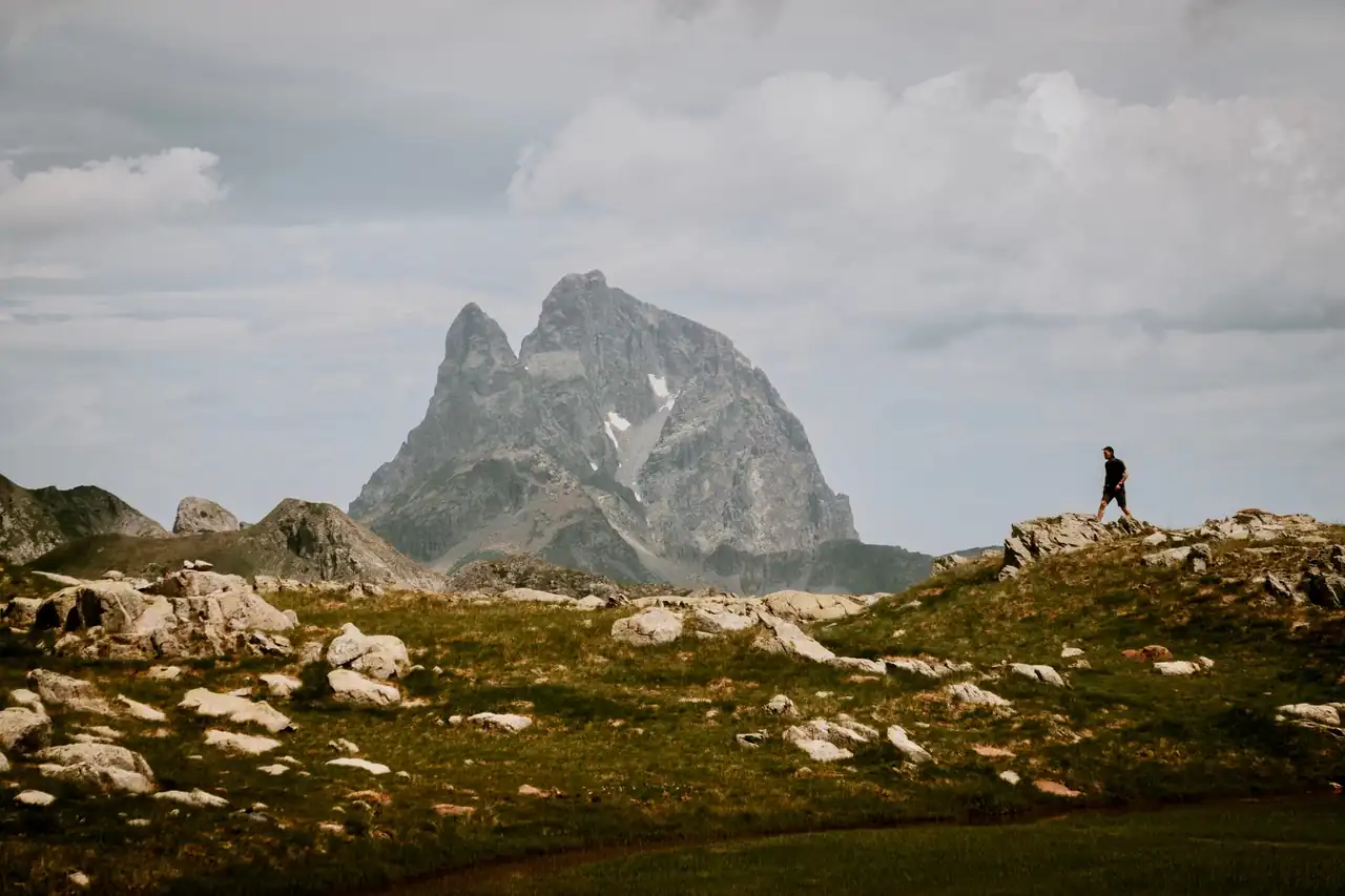
The Aragonese Pyrenees concentrate an unusually high density of landscapes within just a few kilometers of Spain. There are glacial valleys, moist forests, limestone walls, waterfalls crashing down with the clatter of iron, and summits that exceed 3,000 meters. That blend turns the area into a map of possibilities as broad as it is demanding, with routes for those seeking an easy walk as well as for mountaineers chasing real high mountains.
The key is understanding that not every outing calls for the same effort or the same preparation. In the same territory, family strolls, long crossings, technical ascents, and semi-equipped paths coexist. That is why the best outings are not only the most famous ones: they are the ones that fit the season, the weather, the experience, and the time available. On a clear summer day, an ibón can look like a mirror; in spring, a ravine can roar like an old engine.
A territory that changes its skin in every valley
Talking about trails in this mountain range means talking about contrasts. The Tena Valley, the Aragón Valley, Benasque, Ordesa, Sobrarbe, and the Sierra de Guara offer very different settings, even though they all share that frontier-mountain feel perceived in the silence, in the stone, and in the way the light breaks over the ridges. On one side, ski resorts and very lively villages; on the other, shelters, forests, and a sense of isolation that remains intact.
In practice, that variety translates into very different routes. Some are linear and long, like Aguas Tuertas and Ibón de Estanés, which is around 19 kilometers and can take between 6 and 7 hours. Others are short and accessible, like the Alquézar walkways or the San Julián gorges, designed for half a day and for broad audiences. And then there are the major ascents, where the terrain, snow, or ice can turn an apparently straightforward day into a serious undertaking.
That is why it is worth reading the landscape like a calendar. The same place does not mean the same thing in May as it does in August or October. At higher elevations, substantial snow can remain well into spring, while in the valley bottoms summer dries out the grass and reveals the full geometry of the relief. In autumn, by contrast, the beech forests and black pine slopes change color and the Pyrenees seem to light up from within.
Where to stay near Jaca
Accommodation in the area, with prices. Choose your dates on the map.
Affiliate links: if you book through this map we earn a commission, at no extra cost to you.
The ascents that define the character of the Pyrenees
Aneto remains the mountain range’s great namesake. At 3,404 meters, it is the highest peak in the Pyrenees and one of the most coveted in the peninsula. Its normal ascent, from La Besurta via the La Renclusa refuge, requires crossing glacial terrain and, under usual conditions, using an ice axe and crampons. Crossing the Bridge of Mahoma adds the final moment of tension: it is not a long passage, but it is very exposed and leaves a physical sensation that stays in the memory.
Monte Perdido, at 3,355 meters, has a different magnetism. Its great fame comes not only from its height, but from the combination of the Ordesa Valley, the climb via the Cola de Caballo, and the final stretch of La Escupidera, where snow or ice completely change the reading of the route. In cold season or with lingering snow, the use of technical equipment stops being a recommendation and becomes a clear necessity. It is a mountain that attracts with its beauty and, at the same time, reminds you that alpine beauty gives nothing away.
Posets and Vignemale complete that group of major peaks. The first, also called Tuca de Llardana, reaches 3,375 meters and is usually approached via the Ángel Orús refuge and the Fonda couloir, in a long, sustained climb with a steep gradient. The second, shared with France, reaches 3,298 meters and is usually tackled over several days, with nights in refuges such as Bujaruelo, Oulettes de Gaube, or Bayssellance. These are itineraries measured not only in kilometers, but in wear and tear, altitude, and ability to read the terrain.
Ibones, glacial valleys, and the pleasure of walking without hurry
The most rewarding routes are not always the hardest. In the Aragonese Pyrenees there are trails where the visual reward comes before the fatigue, and that explains part of their popularity. Aguas Tuertas and Ibón de Estanés are a good example: the path runs through a natural park of enormous landscape value, with about 740 meters of accumulated elevation gain and no noteworthy technical difficulty, although it does require good physical condition due to its duration. The softness of the valley, the water, and the breadth of the horizon create an almost hypnotic feeling.
The climb to Ibón de Plan also stands out, one of the most photogenic lakes in Sobrarbe. The access is relatively short, although it is worth remembering that the final track can be uncomfortable for low-clearance vehicles and that the area calls for respect as a sensitive mountain environment. Upon arrival, the water mirror, surrounded by pines and cliffs, draws that classic image one associates with the most intimate, least ostentatious Pyrenees.
In Benasque, the mountain becomes almost pedagogical. The valley makes it possible to combine very gentle walks with more serious ones, and that makes it one of the best natural laboratories for understanding the territory. The Three Waterfalls of Cerler, with about 7 kilometers and around 2.5 hours of hiking, are a good example of a circular route, well signposted and suitable for those seeking scenery without technical complications. Ardonés, El Clotet, and El Bom offer a procession of water, rock, and forest to be enjoyed at a leisurely pace.
Ordesa and Monte Perdido: the postcard that also demands respect
Ordesa is not just a pretty picture; it is a national park with rules, restrictions, and heavy visitor numbers in peak season. The route to Cola de Caballo is probably the best known in the area, with about 17.5 kilometers and nearly 400 meters of ascent. It starts from the Ordesa Meadow and links waterfalls, forests, and meadows in a very marked scenic progression. The Estrecho Waterfall, the Cueva Waterfall, and the Arripas Waterfall act as natural steps before reaching the final cirque.
Popularity, however, has a price. In summer, Holy Week, and some long weekends, vehicle access is limited and part of the mobility depends on shuttle buses. That does not reduce the value of the route; it simply requires better planning. The great advantage is that the trail allows you to understand the valley in an almost cinematic way, with the sound of water accompanying much of the way and huge walls closing off the horizon.
The Añisclo Canyon offers a different register, more enclosed and mineral. There the Bellós River has carved a deep, shaded gorge, where hiking blends with a very powerful sense of confinement. There are several possible routes, some easy and others longer, but they all share the same appeal: the feeling of walking inside a geological wound. It is an ideal area for understanding that the mountains are not only expressed in summits; they also speak through gorges, moist forests, and walls that seem to have been carved with a knife.
The Sierra de Guara and the less obvious Pyrenees
In the south of Huesca, the Sierra de Guara shows that the Pyrenees do not end at the great peaks. The Alquézar walkways are one of the most accessible and also most visited routes, with about 3 kilometers and around 2 hours of walking. The path starts near the old town of the medieval village and descends to the Vero River via sections equipped with walkways, stairs, and bridges. It is not a technical excursion, but it is a route with some uneven sections and fairly heavy foot traffic.
The San Julián gorges, more discreet, complete that other side of the Aragonese Pyrenees: less vertical, more welcoming, but no less attractive. They are about 5.2 kilometers round trip and only 150 meters of positive elevation gain, with easy access from the Guara golf area. The path leads to a spot where the water has opened a small gorge and where the rupestrian sanctuary of the hermitage adds a very particular historical and symbolic dimension.
That mid-mountain Pyrenean landscape is, in fact, one of the province’s great surprises. Aínsa, Alquézar, Broto, Torla, Jaca, and Sallent de Gállego are not only logistical bases; they are also part of the experience. Stone houses, arcaded squares, Romanesque churches, and streets that go up and down as if clinging to the terrain explain the territory just as much as a long route does. Anyone walking through the area ends up understanding that the mountain is also experienced in the morning coffee, in the conversation on the way back, and in the clean fatigue of the legs.
How to choose well according to the season, fitness, and terrain
A good choice starts with adjusting expectations. Not every outing is suitable for any time of year or any group. Ascents such as Aneto, Monte Perdido, Posets, or Vignemale require experience, proper equipment, and a careful reading of the snow. Valley routes, by contrast, allow you to enjoy yourself without taking on the same exposure. Between those two extremes lies a very broad range that includes family trails, several-hour crossings, and walks in protected areas where landscape interest matters as much as distance.
In summer, altitude acts as a refuge from the heat, but it also concentrates human traffic in very well-known spots. In autumn, many trails gain in silence and color, although the days get shorter and the weather changes faster. In winter, the mountains take on a severe beauty, but many high routes stop being simple excursions and begin to require winter mountaineering criteria. In spring, meanwhile, the combination of abundant water and residual snow creates spectacular settings, though not always comfortable ones.
Safety is not decided at the foot of the trail, but long before. Checking snow conditions, confirming access times, reviewing actual hiking times, and carrying basic equipment are just as important as choosing a beautiful route. In areas like Ordesa or Astún, it is also worth remembering that some accesses depend on the season or on complementary transport options. In the Aragonese mountains, improvising usually costs time and energy.
The value of routes that are not chasing records
The great mountains attract headlines, but the Aragonese Pyrenees are also sustained by more discreet excursions. A circular traverse through a valley, a waterfall near a village, or an ibón reachable in half a day can leave a more lasting impression than a famous summit. Not because they are less ambitious, but because they allow you to read the geography more calmly: the way water shapes the rock, how vegetation changes with altitude, the role of shelters and villages as life nodes in the middle of the terrain.
That is, at heart, the great appeal of this mountain range. It does not force you to choose between toughness and enjoyment, between postcard and depth, between sport and contemplation. It lets you move from a shaded canyon to an open ibón, from a waterfall to a summit, from a medieval village to a glacial valley in just a few kilometers. And that density of experiences, so concentrated, explains why so many people return again and again.
The Aragonese Pyrenees remain a real mountain, not a set. Those who venture onto its routes find beauty, yes, but also rules, elevation gain, planning, and a certain sense of restraint. That blend of splendor and rigor is precisely what makes it memorable: a territory where every step counts, where water has its own voice, and where the peaks, even when seen from afar, impose silence.
A map of possibilities to return in different seasons
The best way to understand this area is to accept that it cannot be covered in a single visit. There are routes for a weekend, for a full week, and for several consecutive seasons. On a short getaway, Cola de Caballo, the Alquézar walkways, or the Three Waterfalls of Cerler may be enough to create a solid memory. On a longer trip, Aguas Tuertas, Ibón de Plan, Añisclo, and some major ascent already make up a more ambitious story.
It is also worth leaving room for chance. A fog rolling in through the valley, a windy afternoon at altitude, or a drop in temperature can completely change the day. Far from spoiling it, they often make it more interesting. The Aragonese mountains have that ability: they do not always grant what was planned, but they almost always offer something that lingers.
In the end, the best route is not the most famous one, but the one remembered with precision. The roar of a waterfall, the smell of wet forest, warm stone under the sun, an immense view from a pass, or the stillness of an ibón at dawn. Those are the details that turn a route into an experience and a destination into a memory.
You may also like: Ruins of Arlekia Castle: route, history, and views in Irati.



How to prevent thigh chafing: causes and real solutions

Women’s running windbreakers: seven jackets and how to choose

Do more workouts get rid of soreness? A guide for runners

Jaén Half Marathon 2026: Record 3,800 Runners Registered

Men’s short running tights: how to choose the right pair

World Triathlon confirms data breach involving medical data

Izan Edo targets podium at Miyazaki World Cup

María Pérez ranks ninth in World Athletics’ 2026 top ten

Dos Santos, Duplantis and Sawe: World Athlete of the Year finalists

San Silvestre Vallecana 2026: 42,000 places, prices and start times

 Races3 months ago
Valencia Half Marathon 2027: date and registration

 Races3 months ago
Valencia Marathon 2026: entry, ballot and course

 Reviews and Comparisons4 months ago
Asics Gel-Roadmiles 3 for men: review and current price

 Reviews and Comparisons4 months ago
Asics Gel Sonoma 8 Gore-Tex: complete analysis for trail and rain

 Sneakers3 months ago
Saucony Endorphin Pro 4: full review and verdict

 News5 months ago
Strava API 2026: what changes for clubs, challenges and runner apps?

 Reviews and Comparisons5 months ago
Nike Alphafly 3: opinions, sensations, and real key points

 Reviews and Comparisons4 months ago
Under Armour running shoes review 2025-2026: models and key features

 Sports Equipment4 months ago
Shoe sizes in cm: a clear guide to getting the right fit for your footwear

 Sneakers3 months ago
Skechers GO RUN Consistent 2.0 analysis: comfort and limits

 News5 months ago
Valencia Marathon 2026 route: key tips to train and run better

 Sneakers4 months ago
Adidas Adizero Boston 13 for men: review and verdict