Races
Castro Valnera Vertical Kilometer 2027: date and distance
A 4.2-kilometer climb with nearly 1,200 meters of elevation gain, plus entry details and a date that needs checking.

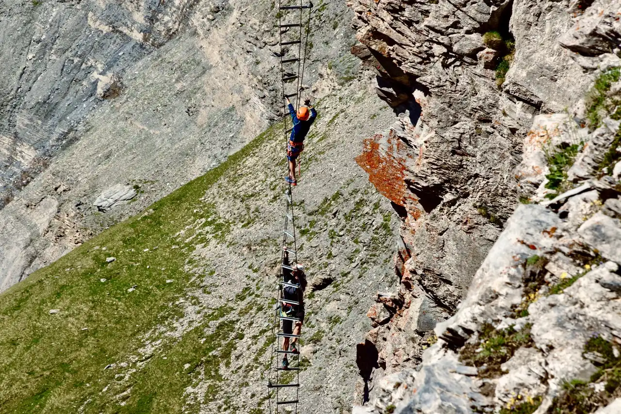
The next edition of the Castro Valnera vertical race is listed for May 30, 2027, in Vega de Pas, starting near Estribera and finishing at Alto los Dujos. The published course covers 4.2 kilometers with 1,189 meters of elevation gain: short in distance, but demanding because of the gradient and mountain terrain.
One detail deserves attention before making travel plans. The event listing gives May 30, while the transcribed regulations for the 2027 edition state May 23. Although the date supplied for this listing is May 30, the discrepancy between the two documents means runners should confirm the current schedule with the organizers before booking accommodation or transport.
A short climb with a mountain character
Castro Valnera rises above the Pas valley landscape and provides the setting for a race in which every kilometer packs in an unusually large amount of climbing. According to the available regulations, the course covers 4.2 kilometers and 1,189 meters of positive elevation gain, from approximately 520 meters above sea level to a finish around 1,709 meters. The distance should not suggest an easy event: the average elevation gain is far beyond that of a conventional road race.
The course description begins at Estribera, at the end of the Pandillo road, and climbs over paths and mixed terrain toward the summit. The route passes near the Helguerón and Culina huts before reaching the upper section, described as the toughest part. The document lists a maximum gradient of 72.3 percent, indicating how steep some ramps can be, although the real effort also depends on mud, moisture and trail conditions.
The event is a vertical kilometer race, a format focused on gaining altitude over a relatively short course. It is not the same as running a long distance with accumulated elevation: here, the climb dominates almost the entire experience and requires careful pacing from the start. On the steepest sections, many runners take short strides or power-hike. Speed gives way to effort management and balance on the mountain.
Date, start time and starting point
The date listed for the 2027 edition is Sunday, May 30. The regulations provided set the start at 10 a.m., with groups of four runners expected to begin at 45-second intervals. Staggered starts avoid a mass departure on a narrow trail and spread participants along the slope from the opening meters.
The start is planned at Estribera, at the end of the Pandillo road, within the municipality of Vega de Pas. The documents also place bib pickup at Plaza Doctor Madrazo in the town center. These are separate locations with separate purposes: the square is listed as the bib-pickup point, while Estribera is the starting area. The finish is at Alto los Dujos, although the regulations allow it to be moved if weather conditions make that necessary.
The calendar conflict matters: an event listing and the information supplied for this edition point to May 30, but the regulations include May 23, 2027. This is not a minor formatting difference; it is a full week. Until the organizers publish or confirm a consistent version, the prudent approach is to treat May 30 as the announced date and verify it directly before finalizing plans. Individual start times are not listed either; the regulations say they will be communicated to participants.
A 4.2-kilometer course with 1,189 meters of gain
The route description suggests a concentrated race with few long recovery sections. From an approximate elevation of 520 meters, the first sector gains around 300 meters over about 1.3 kilometers toward the Helguerón huts. The course then continues to the Culina huts, where the regulations place an aid station, before entering the steepest part of the climb.
In the second half, the document describes mixed terrain and a particularly sharp gradient. In less than two kilometers, runners would tackle the remaining elevation to Alto los Dujos, at roughly 1,709 meters. This combination — little horizontal distance and substantial vertical gain — explains why the 4.2-kilometer figure alone does not capture the difficulty. The climb gains nearly 1,200 meters over just a few kilometers.
The organizers may change the route or set an alternative for weather, administrative or safety reasons. In a mountain race, the summit may be exposed to wind, rain, fog or sudden temperature changes, even when conditions in the valley are milder. The published profile is therefore a useful reference, not an unchangeable guarantee. The finish location may also change if circumstances require it, according to the regulations.
Registration, fees and available places
The regulations set a maximum of 150 entries for the 2027 edition and say places will be assigned in registration order. The listed fees are 25 euros for runners registered with FEDME and 30 euros for those who are not. The document also provides free entry for children, cadets and youth categories, with a guardian’s authorization. A five-euro discount is mentioned for federated members of the organizing club.
These amounts are a reference from the available rules, but they do not confirm that registration is open or that the fees remain current. In the text reviewed, the opening and closing dates have not been filled in. No specific registration link or platform is given either. It is therefore not possible to confirm the current deadline, remaining places or final payment terms from the information in this reference.
Registration and bib pickup have document requirements. The regulations say participants must present official identification and, for those competing as federated runners in the relevant classifications, a federation card. Bibs are assigned to individual runners and cannot be transferred; they must remain visible during the race. Final categories and requirements should be checked against the organizers’ current information, particularly because the regulations still contain blank fields and the date differs across materials.
Aid stations and race equipment
The race document lists two intermediate aid stations in addition to the one at the finish. One is expected around kilometer 2, near the Culina huts, and another at a channel; the water is described as spring water. The organizers also recommend that each participant carry a personal bottle and reusable cup, reducing waste and reliance on disposable containers.
The regulations allow the use of poles because of the steep gradients on some sections. They are not listed as mandatory equipment, but as an option that can help distribute effort on the ramps. Another listing also mentions warm layers and a thermal blanket for the descent from the summit, but exact mandatory-equipment rules should be checked in the final regulations. In the mountains, temperature and exposure can change quickly with elevation.
The document sets cut-off times that may require runners who exceed them to withdraw. Listed limits include one hour to reach the Cabañas de Colina aid station and 90 minutes to reach the last channel. Place names vary across the available materials, so the updated rules should be checked for exact names and locations. Runners must also follow marshals’ directions and stay on the marked course.
The mountain shapes the race
A vertical race is not decided by leg strength alone. Gradient, surface and exposure affect pace at every step, and the weather can turn a firm trail into slippery ground within hours. At Castro Valnera, the start is in the valley and the finish is high in the mountains. That elevation difference makes it important to check the forecast at different altitudes rather than relying only on the conditions expected in the village.
The regulations allow the organizers to change the route or cancel the race if weather or force majeure requires it. They also state that the course has environmental approval and must comply with conditions set by the relevant authorities. Such provisions are common in mountain races, where participant safety and conservation may require decisions even on race day.
The listed course marking includes signs, banners and visible tape, with staff at key points. Still, following the route does not remove the need for concentration: on a steep climb, a poorly placed step can throw off balance; on a later descent, fatigue and uneven ground require even greater care. Good judgment is part of the race, as much as climbing pace.
Prizes and essential rules
The regulations offer cash prizes to the first three finishers in the men’s and women’s classifications: 300 euros for first place, 200 for second and 100 for third. Trophies and prizes by category are also planned. The available information does not detail every category or all conditions for each award, so those points should be checked in the final rules published by the organizers.
Reasons for disqualification include failing to complete the course, receiving outside assistance, wearing headphones, missing cut-off times or ignoring the organizers’ instructions. The rules also prohibit littering or damaging the environment, altering a bib or chip, and failing to help another runner in need. These rules protect sporting fairness and collective safety while limiting the race’s impact on the landscape.
The regulations say complaints must be submitted to the organizers and set a deadline for classification-related appeals: no later than 15 minutes before the awards ceremony. For competitors, knowing these terms before the start can prevent confusion once the race is underway. Official race-day instructions take precedence for operational matters, including safety-related changes or decisions by the race committee.
Vega de Pas and the Pas valley landscape
Vega de Pas gives the race a setting unlike that of an urban event: a mountain municipality shaped by the Pas valleys, with meadows, huts and sloping hillsides. The climb toward Castro Valnera begins in an inhabited area and soon reaches terrain where vegetation, gradient and the breadth of the views change with altitude. That transition from valley to mountain is part of the event’s identity, as much as the stopwatch.
For runners traveling from elsewhere, separating the logistics from the competition helps clarify the day. Bib pickup is in central Vega de Pas, while the start is in Pandillo. The finish is planned at altitude, at Alto los Dujos, so the race does not end where it begins. The available information does not specify a return system from the finish; that practical detail should be checked with the organizers before race day.
It is also worth remembering that the surroundings are not a backdrop but part of a natural area that needs care. The regulations prohibit leaving waste and allow disqualification for damaging the terrain. Carrying a reusable cup and following aid-station instructions are simple steps that suit a race held on mountain trails. The sporting experience also depends on protecting the place that makes it possible.
What to confirm before traveling
The published information provides the distance, elevation gain, planned starting point, general start time and fees listed in the regulations. It does not confirm the registration opening and closing dates, current availability, individual start times or the final category structure. These details may change, and some fields in the rules are still blank.
The priority is to resolve the difference between May 23 and May 30, 2027. May 30 appears in the event information and was supplied as the confirmed date for this listing; however, the mention of May 23 in the transcribed regulations creates a contradiction that should not be concealed. The organizers should be the final reference for setting travel dates.
It is also sensible to check for route changes, final equipment requirements, exact aid-station locations and the return procedure from the summit before race day. The finish may move if the weather worsens, and a staggered start requires participants to follow their assigned time. With these caveats, the race profile is clear: short on kilometers, demanding on the climb and closely shaped by the mountain.
A race defined by its gradient and calendar uncertainty
The Castro Valnera vertical race offers a direct ascent from Vega de Pas to a high-mountain finish, with 4.2 kilometers and 1,189 meters of gain according to the available regulations. Distance alone says little about the effort: gradient, altitude and trail conditions define the challenge. Poles are allowed and aid stations are planned, rounding out a concentrated race with specific safety and environmental rules.
The 2027 listing gives May 30 and sets the general start for 10 a.m., but the regulations consulted say May 23. Registration dates are also still blank in the available text. The sporting details provide a fairly clear picture of the challenge, while the date and administrative details still need consistent confirmation from the organizers before participants turn the calendar entry into a final travel plan.



How to prevent thigh chafing: causes and real solutions

Women’s running windbreakers: seven jackets and how to choose

Do more workouts get rid of soreness? A guide for runners

Jaén Half Marathon 2026: Record 3,800 Runners Registered

Men’s short running tights: how to choose the right pair

World Triathlon confirms data breach involving medical data

Izan Edo targets podium at Miyazaki World Cup

María Pérez ranks ninth in World Athletics’ 2026 top ten

Dos Santos, Duplantis and Sawe: World Athlete of the Year finalists

San Silvestre Vallecana 2026: 42,000 places, prices and start times

 Races3 months ago
Valencia Half Marathon 2027: date and registration

 Races3 months ago
Valencia Marathon 2026: entry, ballot and course

 Reviews and Comparisons4 months ago
Asics Gel-Roadmiles 3 for men: review and current price

 Reviews and Comparisons4 months ago
Asics Gel Sonoma 8 Gore-Tex: complete analysis for trail and rain

 Sneakers3 months ago
Saucony Endorphin Pro 4: full review and verdict

 News5 months ago
Strava API 2026: what changes for clubs, challenges and runner apps?

 Reviews and Comparisons5 months ago
Nike Alphafly 3: opinions, sensations, and real key points

 Reviews and Comparisons4 months ago
Under Armour running shoes review 2025-2026: models and key features

 Sports Equipment4 months ago
Shoe sizes in cm: a clear guide to getting the right fit for your footwear

 Sneakers3 months ago
Skechers GO RUN Consistent 2.0 analysis: comfort and limits

 News5 months ago
Valencia Marathon 2026 route: key tips to train and run better

 Sneakers4 months ago
Adidas Adizero Boston 13 for men: review and verdict