Races
Subida Vertical del Panadero 2027: date and course
Date, route, schedule and logistics for a mountain race linking Tamaimo and Arguayo in Tenerife.

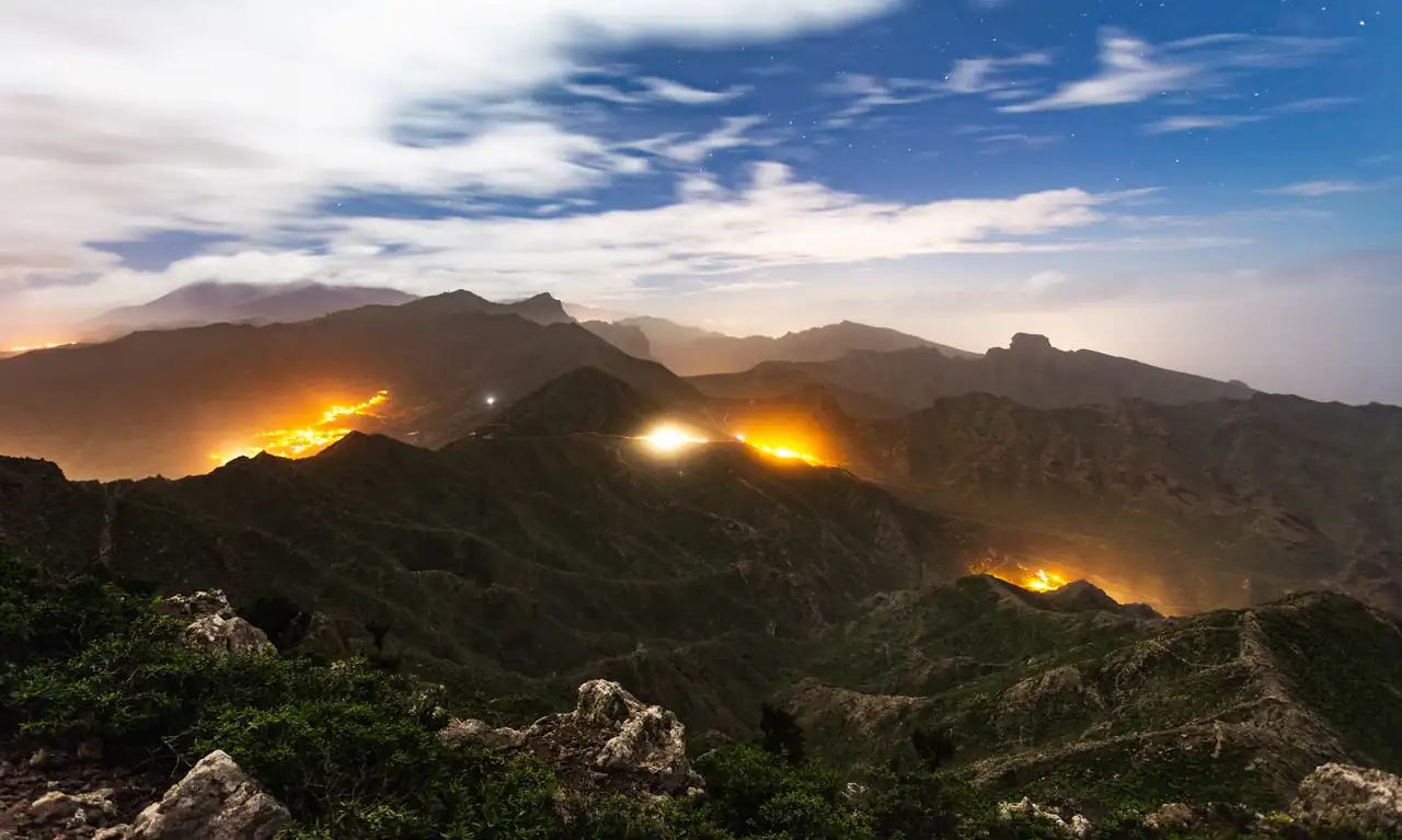
The mountain race linking Tamaimo and Arguayo is scheduled to return on Feb. 6, 2027, starting at Plaza Abelardo González and finishing at Plaza de Arguayo. Available information lists a course of about 5.7 kilometers, a water station around the third kilometer and a 4 p.m. start. The route climbs from Tamaimo and ends in Arguayo, so elevation gain and terrain, as well as distance, will matter to participants.
The general entry fee is listed as 10 euros, while local athletes are expected to take part free of charge, according to published details. Bib pickup is also scheduled for race day, between 2:30 and 3:30 p.m., at the Tamaimo Youth Center. Since some details may change before race day, particularly the route and registration process, it is worth distinguishing the information published so far from the organizer’s final rules.
A winter date between Tamaimo and Arguayo
The event is scheduled for Saturday, Feb. 6, 2027, in the Tenerife municipality of Santiago del Teide. It connects two communities in the municipality: the start is in Tamaimo and the finish in Arguayo. This point-to-point format gives the race its character and affects logistics, since runners, spectators and equipment will not remain in one place throughout the day.
Available information sets the start at 4 p.m. One description pairs that time with the word morning, which is incompatible with the stated hour, so the cautious reading is a 4 p.m. start, pending confirmation in the official schedule. The date appears in more than one event listing, although the edition number is inconsistent across the available material. Identifying the race by its name and date avoids using an ordinal that could be wrong.
February offers an alternative to the usual summer mountain races, but the season alone cannot predict conditions on the course. Temperature, wind, rain and trail conditions can vary, and no published details allow a reliable description of what the route will be like on race day. The most useful reference for participants will be the forecast close to the event and any updates issued by the organizer.
A course of about 5.7 kilometers
The announced route is approximately 5,700 meters long, linking Plaza Abelardo González in Tamaimo with Plaza de Arguayo. The distance is given as an estimate rather than an exact measurement. The available information does not include a complete elevation profile, total climbing or a detailed description of the surfaces. Those details matter in a vertical race because two events of the same length can require very different effort depending on the gradient and terrain.
The word vertical describes the challenge’s climbing character, but it does not mean that every section rises continuously. The 2026 edition was described as a route through Tamaimo, El Retamar, Las Manchas and Arguayo; for 2027, however, a different approximate distance is published: 5.7 kilometers, compared with the 5.3 kilometers cited for the previous year. It is not safe to assume the earlier route remains unchanged: the organizer must confirm whether the difference reflects a new course or a different measurement.
Finishing in a village square also sets this race apart from courses that start and finish at the same venue. Participants should account for the travel between the two ends and should not plan the day as if they could simply walk back to the start in a few minutes. Until an updated map or technical guide is published, the approximate distance and the start and finish locations are the most reliable references, not a detailed reconstruction of the route.
Start, bib pickup and planned services
Bib pickup is scheduled for Saturday, Feb. 6, from 2:30 to 3:30 p.m., at the Tamaimo Youth Center, also described as the race start location. With a 4 p.m. start planned, that window leaves limited time to resolve registration issues, attach the bib and organize equipment. Runners should watch for updates about required documents, venue access or the pickup deadline.
Available information mentions a return shuttle to Tamaimo for participants who want to use it after the race. It also says a gear-transport vehicle will take runners’ backpacks to the finish at Plaza de Arguayo. Those services are particularly relevant in a point-to-point race: they reduce the need for each runner to arrange separately for belongings or a ride back to the start. Their precise operation, capacity and schedule should be checked against the final instructions.
Trophies are scheduled to be awarded after the race. The information reviewed does not specify the categories receiving awards, the classification system, approximate timings or whether other finish-line services will be available. It also does not say whether return transport and bag transfer are included for everyone who enters. This lack of detail does not mean those services will not be provided; it means the published terms do not yet allow them to be described with certainty.
Registration and the listed entry fee
The stated entry fee is 10 euros, with free participation for local athletes. The reference information describes payment by bank transfer and uploading proof of payment to the registration form. These details, published alongside information for the 2027 edition, offer a useful guide to the planned process, but they do not replace the current conditions issued by the organizer when registration opens or is updated.
Before completing the process, participants should check how the organizer defines a local athlete, which documents establish eligibility and whether the fee waiver still requires all fields in the form to be completed. A fee exemption does not necessarily mean automatic registration. Similarly, a bank transfer alone may not secure a place if the form requires proof of payment or other steps. The stated general entry fee is 10 euros, but the number of available places and registration opening or closing dates cannot be verified from the information provided.
The material also includes an instruction to fill in form fields using lowercase letters and a request to attach proof of payment. If that remains in the official form, following the requested format may prevent registration errors. The bank account number cannot be confirmed here, and runners should not transfer money based on a third-party listing. For any payment, the reliable reference is the current official channel, where bank details and entry terms for that edition should appear.
Water station and managing effort
The organizer plans a water station around kilometer 3, near the old school in Las Manchas. This approximate location places the aid point around the middle of the route, although its exact distance from the start and the service provided could change if the course is modified. The information mentions water only, so runners should not assume food, sports drinks or other products will be available.
On a roughly 5.7-kilometer uphill race, the relatively short distance does not remove the physical challenge. The gradient can raise intensity quickly, while total climbing—which has not been specified—would help runners estimate the workload more accurately. Participants will need to adjust their pace to their experience and the conditions on race day, rather than relying on distance alone. The effort depends on the terrain as much as the distance.
The presence of a water station also does not establish whether runners must carry their own containers or whether cups will be provided. Such rules are usually included in race instructions and are worth checking before traveling. In a race with separate start and finish locations, planning in advance what to leave with the gear-check service can prevent confusion, especially if access to the finish and return transport operate separately.
A mountain race in the Santiago del Teide area
The route between Tamaimo and Arguayo places the race in Tenerife’s mountain landscape. The previous edition’s route description mentioned El Retamar and Las Manchas, as well as views toward La Gomera and the Santiago del Teide valley. This setting helps explain the race’s appeal, but those details belong to the 2026 course description and do not by themselves confirm the exact route for the following year.
The squares in the two communities provide clear reference points: Plaza Abelardo González in Tamaimo marks the announced start, and the village square in Arguayo is the finish. This layout may make it convenient for spectators to wait at the finish, although road access, parking restrictions or designated viewing areas should be checked once municipal instructions are published. There is not enough information to claim that specific traffic closures or public access conditions are in place.
The scenic value of a mountain race goes hand in hand with respecting the environment. Staying on the marked route, avoiding litter and following event staff instructions are basic practices in any race through natural areas or local trails. The 2026 description referred to vegetation-lined sections and open views; the final 2027 route must take precedence over descriptions from previous editions.
What is known and what still needs confirmation
The most consistent details for the 2027 event are the Feb. 6 date, a start in Tamaimo, a finish in Arguayo and an approximate distance of 5.7 kilometers. A planned 4 p.m. start, a water station around kilometer 3, bib pickup from 2:30 to 3:30 p.m. and a general entry fee of 10 euros have also been published. Free entry for local athletes, gear transport and a return shuttle are also mentioned in the available information.
By contrast, there is no complete 2027 rulebook to confirm the elevation profile, total climbing, surface, categories, minimum age, participant limit, registration deadline or requirements for minors. No race cutoff time or updated course map is available either. The 2026 edition accepted participants aged 16 and older, with parental permission required for minors, but that requirement should not automatically be applied to the 2027 edition without explicit confirmation.
There is also a discrepancy in the edition number: some material identifies it as the 21st edition, while another extract calls it the 22nd. That difference does not change the date or start and finish locations, but it is a reason to avoid stating an ordinal as fact until the organizer confirms it. Third-party listings may retain old details or display a status that does not reflect reality, so the official rules or municipal communication are more reliable for registration and last-minute changes than an outdated external calendar.
How to read the route before traveling
The difference between the 5.3 kilometers attributed to 2026 and the approximately 5.7 kilometers announced for 2027 deserves attention. A few hundred meters may seem minor in a short race, but on a climb they can change the time spent exerting effort, the location of the water station and pacing strategy. The 2027 distance is approximate, so it should not be used to calculate exact pace or compared directly with earlier results without checking whether the routes match.
The start and finish are in separate communities, a straightforward detail that can complicate race day if left until the last minute. Runners traveling with spectators should decide where to meet and how they will return, without assuming transport will be available to everyone. The shuttle mentioned for the return to Tamaimo is intended for participants who want to use it, but its capacity, frequency and operating time are not specified. Planning the return deserves as much attention as getting to the start.
Bib pickup takes place in a one-hour window and ends half an hour before the announced start. Arriving in Tamaimo early leaves room for delays and makes it easier to find the pickup location without a last-minute search. Still, the schedule should be checked close to race day: a change to the start time could affect bib pickup as well as shuttle and gear-check arrangements.
A short challenge that rewards reading the mountain
The race between Tamaimo and Arguayo combines a manageable distance with an uphill profile, a finish separate from the starting point and several logistical considerations. In this format, pace is not defined only by speed on flat ground: the ability to sustain effort, adjust to the gradient and save energy for the final section all matter. Without an updated official profile, it is impossible to predict where the steepest climbs are or how much of the route is runnable.
For runners who already know the event, the February edition may offer a different setting from the summer race in 2026. Any comparison, however, depends on confirmation of the route and race conditions. First-time participants can use the start and finish locations, provisional schedule and water information as practical reference points, but will need the rulebook to resolve essentials such as mandatory equipment, categories and on-course coverage.
The route’s appeal lies in the journey between two villages and the climb through the Santiago del Teide landscape. But a race is not measured only by the view at the finish: the published distance, services and rules must also be clear. The organizer’s final event information will turn these initial details into reliable race-day instructions.
Final details will shape the event
With a date scheduled for Feb. 6, 2027, and a route announced at about 5.7 kilometers, the race will again link Tamaimo and Arguayo in a day of mountain running in Santiago del Teide. The stated general fee is 10 euros, and published details describe bib pickup, water on the route, gear transport and a return shuttle. These are concrete references, although some operational details still need confirmation.
The main caution is to separate information for this edition from details belonging to previous years. The distance differs from the figure attributed to 2026, the edition number is inconsistent and the schedule includes a contradictory description. The elevation profile, categories and entry conditions are also not fully detailed. Checking the organizer’s official update before registering or traveling will help avoid confusion and clarify exactly which course and services will be offered.
In a point-to-point race, every detail is part of the route: where to collect the bib, what to leave with gear check and how to get back from the finish. The climb connects two communities, but the day is complete only when runners know the rules and logistics surrounding those kilometers. Until then, the date, approximate course and start and finish locations are the clearest basis for understanding the event.



How to prevent thigh chafing: causes and real solutions

Women’s running windbreakers: seven jackets and how to choose

Do more workouts get rid of soreness? A guide for runners

Jaén Half Marathon 2026: Record 3,800 Runners Registered

Men’s short running tights: how to choose the right pair

World Triathlon confirms data breach involving medical data

Izan Edo targets podium at Miyazaki World Cup

María Pérez ranks ninth in World Athletics’ 2026 top ten

Dos Santos, Duplantis and Sawe: World Athlete of the Year finalists

San Silvestre Vallecana 2026: 42,000 places, prices and start times

 Races3 months ago
Valencia Half Marathon 2027: date and registration

 Races3 months ago
Valencia Marathon 2026: entry, ballot and course

 Reviews and Comparisons4 months ago
Asics Gel-Roadmiles 3 for men: review and current price

 Reviews and Comparisons4 months ago
Asics Gel Sonoma 8 Gore-Tex: complete analysis for trail and rain

 Sneakers3 months ago
Saucony Endorphin Pro 4: full review and verdict

 News5 months ago
Strava API 2026: what changes for clubs, challenges and runner apps?

 Reviews and Comparisons5 months ago
Nike Alphafly 3: opinions, sensations, and real key points

 Reviews and Comparisons4 months ago
Under Armour running shoes review 2025-2026: models and key features

 Sports Equipment4 months ago
Shoe sizes in cm: a clear guide to getting the right fit for your footwear

 Sneakers3 months ago
Skechers GO RUN Consistent 2.0 analysis: comfort and limits

 News5 months ago
Valencia Marathon 2026 route: key tips to train and run better

 Sneakers4 months ago
Adidas Adizero Boston 13 for men: review and verdict