Races
Sierra Cazorla Trail: guide to the 65K Ultra and its routes
Route, schedule, elevation gain, support, and practical details of one of the most demanding events in Cazorla.

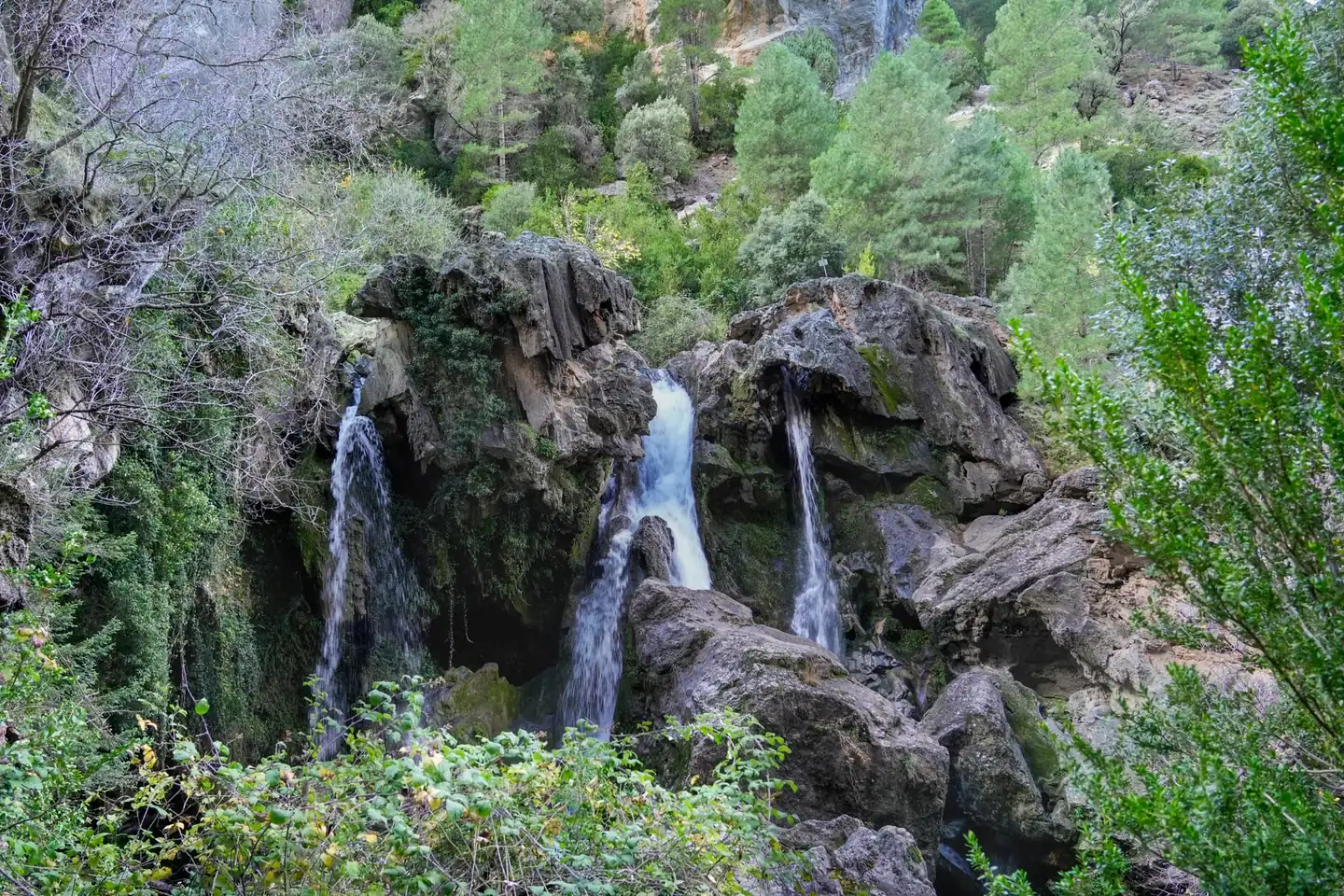
The Sierra Cazorla Trail has become a benchmark for those looking for a tough, varied mountain race with first-class scenery. The big 2026 event sets the start and finish in Quesada, with a 65-kilometer course and 3,700 meters of positive and negative elevation gain that runs through trails, tracks, paths, and technical sections inside the Sierras de Cazorla, Segura and Las Villas Natural Park.
The appeal of this race is not just about the distance. Its real attraction comes from the mix of physical demands and terrain: long climbs, fast descents, changing ground, and very recognizable checkpoints for any mountain trail enthusiast in Spain. In a single day, runners cross pine forests, gorges, mountain passes, and areas of great scenic value, with the Guadalquivir appearing at one of its most emblematic sources.
A course that tests both the legs and the mind
The race takes place on October 17, 2026 and starts at 7:30 in the morning from Constitution Square in Quesada. The first impact comes quickly, with an initial climb toward Collado Zamora that forces runners to pace themselves from the outset. This is not an event to be carried away by the adrenaline of the start; here, every kilometer is costly if you run above a reasonable effort.
The route combines 10% asphalt and path, 15% track, 65% trail, and 10% path or livestock route. That proportion clearly explains the race’s character: most of it runs on natural terrain, with technical footing and constant changes of pace. It is neither a comfortable-track ultra nor a pure flying race. It is more of an adaptation test, where runners alternate runnable sections with others in which power and patience matter almost equally.
One of the points that best defines the course is the sequence of emblematic places it passes through: El Chorro, Raya de Peñaflores, the Source of the Guadalquivir, Los Callejones, Pasá de Bosques, and Prao La Nava. That sequence, besides being visually appealing, shows the race’s logic: climb, brush past natural balconies, enter forest areas, and compress the effort again on a profile that offers no real rest. The first major technical block arrives around kilometer 14, where about 1,200 meters of elevation gain have already accumulated.
Quesada as the logistical and emotional center of the race
Quesada is not just a passing point. The town organizes, hosts, and gives meaning to the race. The start in the town center encourages interaction between locals, runners, and companions, while the finish brings the story back to the same place where it began. That circularity strengthens the bond between the race and the town, something in trail running that matters as much as signage or aid stations.
The official schedule concentrates activity at the House of Culture and Constitution Square. On Friday, October 16, bib numbers are handed out from 6:00 p.m. to 8:00 p.m., and the technical briefing takes place at 7:30 p.m. On Saturday, October 17, bib collection starts at 6:45 a.m. and ends at 7:15 a.m., with the start corral opening at 7:15 and the start half an hour later. The organization leaves little room for improvisation, which is typical in events of this profile, where punctuality is not a formality but an operational necessity.
There is also a local dimension worth highlighting. The race passes through areas very familiar to both runners and visitors: Quesada’s cuisine, the old town, Calle Adentro, the Tíscar Sanctuary, and the Water Cave appear as part of the surroundings that give context to the event. The result is a sporting experience that does not remain confined to the competition, but instead opens out to the territory and its identity.
Key facts for understanding the true toughness of the ultra
The numbers alone already point to a demanding event. Sixty-five kilometers and 3,700 meters of elevation gain place the Sierra Cazorla Trail in territory reserved for runners with mountain experience. In addition, the organization classifies it within 100K UTMB Index Race events, a relevant detail for those who follow the international circuit and use that index as a competitive reference.
The time limit is 14 hours and 30 minutes, with the finish closing at 10:00 p.m. That requires a smart approach to pacing, fueling, and effort management. It is not enough to run fast on favorable sections; you have to keep going when fatigue sets in and when the terrain stops being kind. In an ultra like this, minutes saved early can become hours lost at the end if the strategy falls apart.
The organization also limits the number of participants to 200 bibs, which gives an idea of the event’s controlled scale. It is neither a huge массовe marathon nor an athletic pilgrimage. Its scale is more compact and, precisely for that reason, more demanding logistically. There are also overall categories and age subcategories: senior, veteran A, veteran B, and veteran C. This structure reflects a classic competitive logic in Spanish trail running, where participation is organized without losing its grassroots character.
Aid stations, support, and drop bag
The race has three external aid stations: El Chorro, Puerto Lorente, and the Helipad or Pasá de Bosques. These are well-distributed points for a long-distance mountain race, although they do not replace the autonomy each runner must carry. The practical reading is clear: the organization helps, but performance still depends on how each runner manages hydration, nutrition, and pacing.
The drop bag is available at the Helipad or Pasá de Bosques, at kilometer 41. It is collected at bib pickup and left before the start in the van located in the square. This seemingly minor detail can make a difference on a long day. Dry clothes, specific nutrition, or an item that eases a particular discomfort can change the tone of the second half of the course. The drop bag, however, cannot include mandatory race gear and must be picked up on Saturday, October 17, with no later shipping by the organization.
The aid stations are not chosen at random. El Chorro and the Helipad are accessible by paved road, while Puerto Lorente is located after El Chorro, about six kilometers along a forest track toward the source of the Guadalquivir. That accessibility makes it possible for family members or companions to follow the runner without having to go into overly complex areas. In such a long race, seeing familiar faces at an intermediate point also has obvious psychological value.
Medical certificate and participation control
One of the clearest requirements for this edition is the submission of a medical certificate issued within the previous six months before the race. It must be signed and stamped by a doctor and certify that the person is fit to participate. This is not a decorative requirement. In an ultra with significant elevation gain, technical terrain, and prolonged exposure to effort, verifying fitness has a health rationale that should not be trivialized.
The race also includes cancellation and change options. There is an optional cancellation insurance for 12 euros. Without that insurance, cancellation costs 30 euros until September 7. Bib withdrawal is allowed until October 11, while transfer of the entry or a shorter distance change can be made free of charge until that same date. These are useful conditions for understanding the real margin runners have in an event of this type, where planning is usually done well in advance.
In terms of cost, the base price is 70 euros, or 75 euros for non-licensed runners. This is a reasonable range within the Spanish long-distance trail market, especially considering the mountain logistics, aid controls, and complexity of the race. As always in events of this profile, the value does not depend only on the bib, but on the entire setup that supports the competitive experience.
The terrain: trails, forest, and fast-to-read sections
The natural park provides a setting of enormous visual richness, but also of very specific technical reading. The course runs through clean trails, forest tracks, roads, and livestock routes, with an alternation that requires switching gears several times. There are areas where you can run with relative ease and others where you should focus on foot placement, traction, and movement economy.
That balance between toughness and flow is part of the race’s prestige. The Sierra de Cazorla does not offer artificial mountains with a clean, repetitive profile, but rather a landscape of curves, corridors, and slopes that break any idea of monotony. The climb up the Rayal slope or the livestock route tests the runner’s specific endurance, while other sections allow recovery without completely losing competitive rhythm.
For spectators, the route also offers several viewing points. Collado Zamora, El Chorro, Puerto Lorente, and Pasá de Bosques allow runners to be seen at points accessible by road or track. That relative ease of access is important in a mountain where moving around is not always simple. On a long day, the ability to see the race in several places helps build a more complete understanding of it.
What makes this event different within Spanish trail running
The geographical context carries a lot of weight. The race is held in one of the largest protected areas in Spain and Europe, within the Sierras de Cazorla, Segura and Las Villas Natural Park. That environmental dimension is not just a tourism credential; it changes the way the effort is experienced. Running here means doing so among forests, ravines, springs, and panoramas that remind you trail running still retains a part of exploration that other disciplines have already lost.
At the same time, the race has that feel of real mountain running that endurance athletes value so much. It does not seek spectacular scenery as mere photo backdrop. What it offers is an honest relationship with the terrain: long climbs, descents with muscular tension, sections of concentration, and moments when the landscape seems to expand the mind just as the body starts to contract. That mix explains why this kind of race creates such loyalty among those who finish it.
The presence of places like the Source of the Guadalquivir, Raya de Peñaflores, or Los Callejones helps show the symbolic weight of the route. These are names that do more than mark a course; they make up a kind of emotional map for the runner. Some races are remembered for the clock, others for the place. This one clearly belongs to the second group, even if the clock still rules at every aid station and every checkpoint.
What the runner can expect in the decisive stretch
If the first part organizes the race, the middle section usually separates those who merely manage energy from those who truly sustain it. Between the central kilometers and the drop-bag point, fatigue begins to appear in the form of small warnings: a less elastic stride, a pulse that takes longer to settle, the need to eat even when you don’t feel like it. That is where much of the result is decided.
The presence of the drop bag at kilometer 41 is no coincidence. It is the point where the day changes texture and where many runners will appreciate a bit of foresight. Changing wet clothing, reworking nutrition, or simply resetting mentally can provide a decisive boost. In the mountains, physical relief and mental relief often arrive together, and that is why this resource has such strategic importance.
From that point to the finish, the race requires disciplined effort management. There is no room for overconfidence. Every climb weighs more, every descent punishes more, and every fueling mistake is felt twice as much. The finish in Quesada, open until 10:00 p.m., brings the race back to the place where it began and closes a course that is understood not only by its numbers, but by the sustained tension it demands from start to finish.
An event that rewards experience and respect for the mountain
The Sierra Cazorla Trail is not meant for improvisation. Its toughness, length, and varied terrain make it a race for experienced runners who can read their bodies and interpret the relief. Anyone arriving with too much ambition and poor management will suffer quickly; anyone arriving with respect for the mountain, steady pacing, and organized fueling will have a better chance of completing a demanding and memorable day.
It also reinforces a recurring lesson in trail running: mountain races are not won with fast legs alone. They are won with judgment, patience, and a proper relationship with the environment. In Cazorla, that idea is especially clear because the landscape does not merely decorate the race. It defines it, shapes it, and ultimately elevates it above a simple list of kilometers and elevation gain.
That is why this event has gained such weight among trail enthusiasts in Spain. It does not need gimmicks or big slogans to justify its appeal. It is enough with a serious course, an extraordinary setting, and an organization that has structured it well with concrete rules, clear schedules, and well-placed support points. In a discipline where similar routes abound, Cazorla retains something increasingly valuable: its own personality.
You may also like: FalcoTrail 2025 in Cehegín: distances, profile and key details.



How to prevent thigh chafing: causes and real solutions

Women’s running windbreakers: seven jackets and how to choose

Do more workouts get rid of soreness? A guide for runners

Jaén Half Marathon 2026: Record 3,800 Runners Registered

Men’s short running tights: how to choose the right pair

World Triathlon confirms data breach involving medical data

Izan Edo targets podium at Miyazaki World Cup

María Pérez ranks ninth in World Athletics’ 2026 top ten

Dos Santos, Duplantis and Sawe: World Athlete of the Year finalists

San Silvestre Vallecana 2026: 42,000 places, prices and start times

 Races3 months ago
Valencia Half Marathon 2027: date and registration

 Reviews and Comparisons4 months ago
Asics Gel-Roadmiles 3 for men: review and current price

 Races3 months ago
Valencia Marathon 2026: entry, ballot and course

 Reviews and Comparisons4 months ago
Asics Gel Sonoma 8 Gore-Tex: complete analysis for trail and rain

 Sneakers3 months ago
Saucony Endorphin Pro 4: full review and verdict

 News5 months ago
Strava API 2026: what changes for clubs, challenges and runner apps?

 Reviews and Comparisons5 months ago
Nike Alphafly 3: opinions, sensations, and real key points

 Reviews and Comparisons4 months ago
Under Armour running shoes review 2025-2026: models and key features

 Sports Equipment4 months ago
Shoe sizes in cm: a clear guide to getting the right fit for your footwear

 Sneakers3 months ago
Skechers GO RUN Consistent 2.0 analysis: comfort and limits

 News5 months ago
Valencia Marathon 2026 route: key tips to train and run better

 Sneakers4 months ago
Adidas Adizero Boston 13 for men: review and verdict