Routes
Burujón Ravines route start: access, viewpoints, and route
Access, parking and a real walk through a reddish landscape beside the Tagus, very close to Toledo.

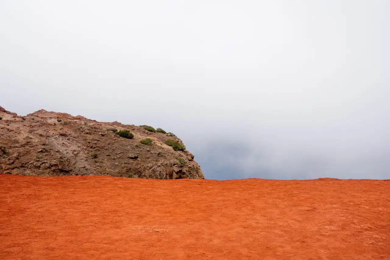
The start of the route at the Barrancas de Burujón often surprises visitors because of its contrast: a discreet dirt track that, in just a few minutes, leads to a steep edge of reddish clay, still water, and open horizons. Less than 30 kilometers from Toledo, the path leaves the plains behind and opens onto one of the most distinctive landscapes in Castilla-La Mancha, where the silence weighs as much as the view.
Access is easy, although it is worth arriving with some planning because the parking area can fill up on busy days. From the start of the track to the main viewpoints, the route alternates between stretches suitable for walking and others where the car moves slowly over an unpaved surface. The experience does not require advanced hiking skills, but it does call for attention at the edges and common sense in an environment with very little shade.
A landscape that seems carved with a knife
The Barrancas de Burujón, also known as Barrancas de Castrejón y Calaña or the gullies of Burujón, form a front of clay cliffs that in some places exceeds 100 meters in height. The erosion of wind, rain, and the waters of the Tagus has spent millions of years carving a wall of reddish and ochre tones that, seen from above, is reminiscent of a movie set, even though its origin is purely geological.
The value of the place lies not only in the height of its cliffs, but also in the combination of elements that follow one another effortlessly: bare earth, the Castrejón reservoir at the foot of the cliffs, birds gliding above the ravines, and light moving over the clay as if the surface were breathing. In 2010 it was declared a Natural Monument, a form of protection befitting a site that concentrates landscape, geology, and biodiversity in a relatively small area.
The feeling upon arrival is immediate. The Castilian plateau, flat and austere, suddenly gives way to a fractured relief that seems foreign to the land. It is precisely this visual break that has turned this corner of Toledo into a highly sought-after getaway for hikers, families, and travelers who combine a route with a cultural visit in the same day.
Where to stay near Burujón
Accommodation in the area, with prices. Choose your dates on the map.
Affiliate links: if you book through this map we earn a commission, at no extra cost to you.
How to get to the starting point
The most common access starts from the CM-4000 road, which connects Toledo with Talavera de la Reina. At kilometer 26, the turnoff appears toward the dirt track that leads to the parking areas and the Barrancas Ecological Trail. Those coming from Toledo will find the branch before the exit toward Burujón; from La Puebla de Montalbán, the access is on the other side of the bridge, and the turn appears a few meters farther on.
The most useful practical reference is this: there is no public transport that drops you at the door, so getting there requires a private vehicle. The track is generally in good condition, but it is still an unpaved road, dusty in summer and somewhat less comfortable after rain. That seemingly minor detail changes the visitor’s experience because it requires better planning of arrival time, clothing, and even footwear.
At the first stretch, there is usually a parking area near the road. If traffic is heavy, that space serves as a natural starting point; if visitor numbers are low, you can continue farther in to the Cambrón or Enebros viewpoints. In any case, the landscape begins before you start walking: even from the track, you can already make out the cut in the terrain and the color of the walls waiting above.
The route from the parking area to the viewpoints
The easiest way to understand the itinerary is to think of it as a sequence of viewpoints and track sections. From the lower parking area to the Cambrón Viewpoint there are approximately 1.3 kilometers, a gentle uphill dirt path that is easy to complete without strain, except on very hot days. The walk begins between farmland and continues until the horizon suddenly opens over the reservoir.
The Cambrón Viewpoint acts as the first major reward. From there, you can appreciate the scale of the whole and the change in texture between the plain and the cliff. From that point on begins the most enjoyable part of the visit, because the trail follows the ridge and strings together clear, almost theatrical views over the gullies. The progression is short, but highly visual: each turn in the path changes the framing and sharpens the sense of height.
The next stretch, a little over 1 kilometer to the Enebros Viewpoint, holds much of the photographic appeal. Here the ecological trail allows you to move without difficulty from one natural balcony to another, with the Castrejón reservoir below and the clay profiles standing out in the background. The distance is not great, but the place invites you to stop. The view does not move quickly; it stays hooked to the line of the cliffs.
From the Enebros Viewpoint, another option opens up: descending to the reservoir shore along a narrow, steep path. That descent adds about 100 meters of elevation loss on the way down and the same amount on the return, plus nearly another kilometer. It is not essential to enjoy the area, but it does broaden your understanding of the site, because it places the visitor between the water and the cliff, with a more intimate perspective of the relief.
The short route and the longer route, two ways to look at the same place
The visit can be completed as a short excursion of about 1.5 to 2.5 hours if you follow the most direct route between the parking area and the main viewpoints. This option works well for families, mid-morning outings, or afternoons when you want a walk without major physical demands. The distance is around 4.5 to 5 kilometers depending on the starting point, with moderate elevation gain and no significant technical sections.
There is also a longer version, close to 10 kilometers, linking farm roads, edge trails, and the upper area of the ravines before returning to the starting point. This itinerary does not change the nature of the route, but it does change its pace. It shifts from quick contemplation to a slower immersion in the landscape, with more time to observe the transition between crops, clay, and water.
Both options share the same logic: the landscape is in charge. This is not an excursion of dramatic elevation changes or complex navigation, but rather a walk in which the view and the light set the pace. That is why the route works so well at sunrise or late in the afternoon, when the red clay gains depth and the reservoir ceases to be just a blue backdrop and becomes a mirror that organizes the entire scene.
What you see along the way
The edge of the cliffs concentrates the main visual spectacle, but the interest of the place does not end there. Along the trail you will find Mediterranean scrub species such as rosemary, thyme, broom, and junipers, mixed with riverside vegetation in the sections closest to the water. This plant mosaic adds texture to the walk and softens the apparent aridity of the clay.
The wildlife tends to appear more discreetly, although the sky reveals much of the area’s life. Birds of prey such as the peregrine falcon or the Iberian imperial eagle take advantage of the thermal currents rising along the cliffs, while herons, cormorants, or ducks can be seen in the reservoir. Sightings are not guaranteed, but the place has that kind of energy that makes the walker more alert; any shadow in flight becomes a small event.
Geology is, in truth, the main star. The clay walls crumble with an almost tactile fragility, as if someone had shaped the edge of the plateau with wet hands. That impression helps explain why it is wise to stay on the paths and not get too close to the edges, especially if you are with children or if the ground is loose from erosion.
What to know before leaving the car
The first rule is obvious and not always followed: bring water. There are no shops or fountains along the route, and the lack of shade can turn a short visit into a harder experience than expected. In the middle months of summer, the heat can be intense, and the dirt surface amplifies the feeling of dryness.
The second precaution has to do with the edge of the cliff. Although some sections have fencing or better protection, others are more exposed. The visit is peaceful, yes, but peaceful should not be confused with risk-free. The clay ground can be treacherous if you step off the trail or try to go down unmarked slopes.
It also helps to choose the time wisely. Sunrise and sunset offer gentler light and more comfortable temperatures. In spring and autumn, the landscape gains nuance, the wind is usually more bearable, and the walk allows for a longer pause by the viewpoints. On foggy days, however, part of the visual spaciousness that defines the place is lost.
Burujón, La Puebla de Montalbán, and Toledo as a natural extension of the visit
The excursion to the cliffs is not usually experienced in isolation. Very nearby are Burujón and La Puebla de Montalbán, two towns that make it possible to round out the day with heritage, local history, and a stop for lunch. La Puebla adds the attraction of the La Celestina Museum, linked to the figure of Fernando de Rojas, while Burujón preserves the sober air of quiet Toledo villages, with a square and short streets.
Toledo city, at a reasonable distance, broadens the possibilities even further. The combination is almost natural: a morning of open landscape and an afternoon in the historic center, with the change of setting as the common thread. Few routes allow you to go in such a short time from a clay cliff to a monumentally important city of international standing.
That combination of nature and culture explains the place’s lasting success. The Barrancas de Burujón do not require a long trip or complex logistics, but they do offer an uncommon image on the plateau. They are a reminder that the most memorable landscapes do not always come from grandeur, but from contrast. Here, the earth breaks apart, the water waits below, and the walker remains in the middle, watching how erosion can also be a form of beauty.
A small enclave in distance, but great in presence
The visit works precisely because it does not overwhelm. The route is short, access is clear, and the visual reward comes quickly. Even so, the place leaves a bigger impression than its size suggests, as if the eye remained fixed on the geometry of the clay walls and the serene line of the reservoir. There are landscapes remembered for their difficulty; this one, instead, is remembered for its dramatic impact.
That is why the start of the route at the Barrancas de Burujón is so important. It is not just a logistical matter, but the key that organizes the whole experience: where to leave the car, how far to walk, which viewpoint to choose first, and when it makes sense to stop without adding more meters. In such an exposed space, stripped of artifice, getting that start right makes the difference between a quick visit and a well-measured day, with enough time for the landscape to do its work.
The reward does not come in the form of a summit or a major physical effort, but as a panorama. And in this corner of Toledo, that is enough. Enough for the red clay, the reservoir waters of the Tagus, and the light of Castile to compose a scene that stays in the memory with the persistence of a well-fixed image.
You may also like: Route to the Pozo de los Humos: trails, views, and tips and Enciso Dinosaur Trail: route, sites, and opening hours.



How to prevent thigh chafing: causes and real solutions

Women’s running windbreakers: seven jackets and how to choose

Do more workouts get rid of soreness? A guide for runners

Jaén Half Marathon 2026: Record 3,800 Runners Registered

Men’s short running tights: how to choose the right pair

World Triathlon confirms data breach involving medical data

Izan Edo targets podium at Miyazaki World Cup

María Pérez ranks ninth in World Athletics’ 2026 top ten

Dos Santos, Duplantis and Sawe: World Athlete of the Year finalists

San Silvestre Vallecana 2026: 42,000 places, prices and start times

 Races3 months ago
Valencia Half Marathon 2027: date and registration

 Races3 months ago
Valencia Marathon 2026: entry, ballot and course

 Reviews and Comparisons4 months ago
Asics Gel-Roadmiles 3 for men: review and current price

 Reviews and Comparisons4 months ago
Asics Gel Sonoma 8 Gore-Tex: complete analysis for trail and rain

 Sneakers3 months ago
Saucony Endorphin Pro 4: full review and verdict

 News5 months ago
Strava API 2026: what changes for clubs, challenges and runner apps?

 Reviews and Comparisons5 months ago
Nike Alphafly 3: opinions, sensations, and real key points

 Reviews and Comparisons4 months ago
Under Armour running shoes review 2025-2026: models and key features

 Sports Equipment4 months ago
Shoe sizes in cm: a clear guide to getting the right fit for your footwear

 Sneakers3 months ago
Skechers GO RUN Consistent 2.0 analysis: comfort and limits

 News5 months ago
Valencia Marathon 2026 route: key tips to train and run better

 Sneakers4 months ago
Adidas Adizero Boston 13 for men: review and verdict