Races
No Hay Pitera Trail 2026: date and distances
The Aragonese event crosses the Sierra de Santo Domingo with four options and a demanding mountain course.

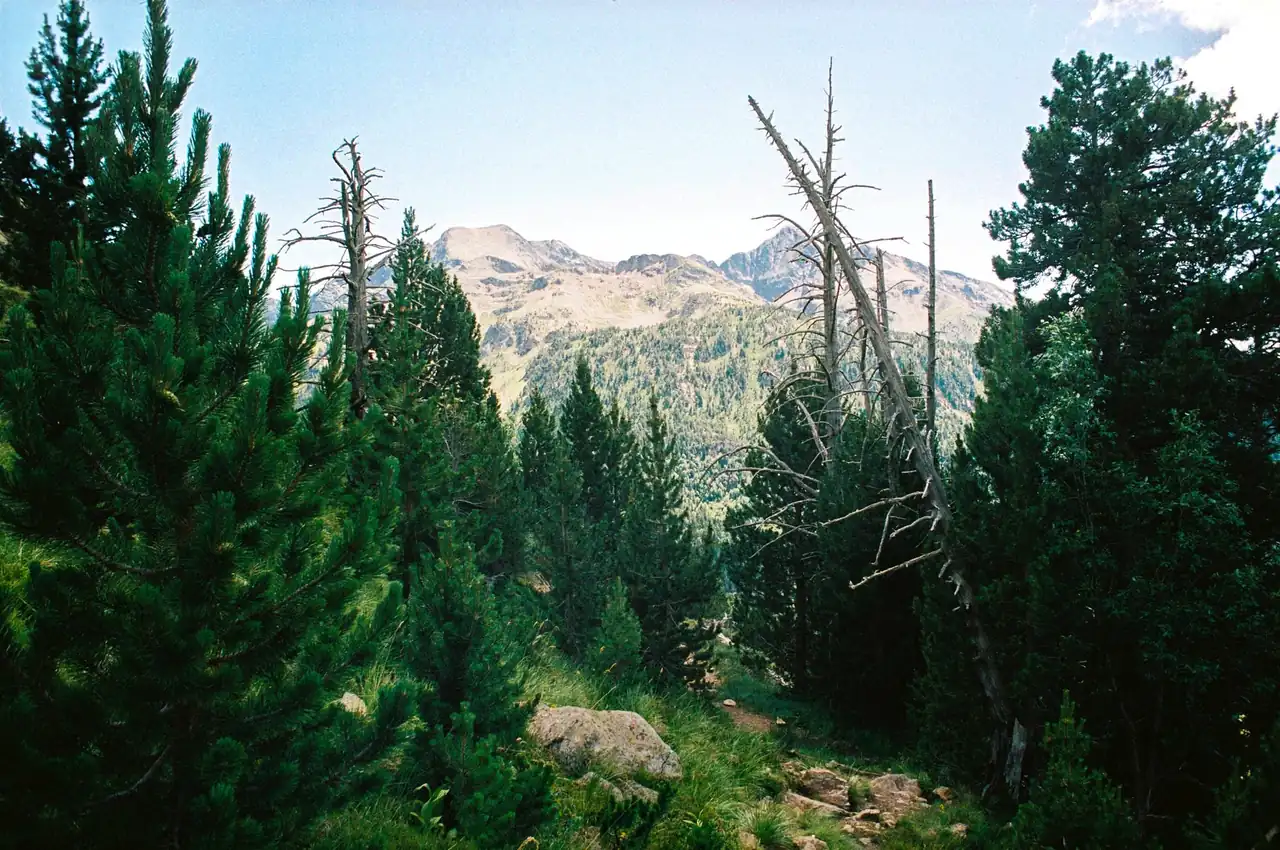
Longás will once again become a meeting point for Aragonese trail running on Saturday, Sept. 5, 2026. The 15th edition of the No Hay Pitera race, also known as Subida al Cielo de las Cinco Villas, will bring participants together in the Sierra de Santo Domingo with four proposals of varying difficulty. The race has a maximum field of 300 participants and offers 1K, 10K, 17K and 24K routes.
The day will begin on a staggered schedule, with starts planned between 9:30 and 10:15 a.m. depending on the distance. The main course runs through a mountain setting and combines a high proportion of trails with elevation gains reaching 1,250 meters on the 24-kilometer route. The event is organized by Longás Town Hall and the Chinela Cultural Association, with technical direction from Fartleck Sport.
Practical information about this event can be checked alongside the popular race calendar, which brings together events from across Spain. There is also a popular race map for locating events and planning travel.
A mountain race in the heart of the Cinco Villas
The appeal of this event is not limited to distance. Longás lies in the northwestern part of Zaragoza province, in a transition zone between the Cinco Villas and the foothills of the Pyrenees. The municipality sits at around 755 meters above sea level, surrounded by forests, ravines and ridges that change character with the seasons.
The Sierra de Santo Domingo provides the race’s most recognizable setting. The terrain alternates between narrow paths, wooded areas and mountain sections with gradients that demand careful effort management. On the longer distances, runners are not only racing the clock: they must read the ground, anticipate changes in slope and save energy for the roughest parts of the course.
According to the available information, around 90% of the route follows trails. That figure explains much of the event’s personality. This is not an asphalt race transferred to a rural landscape, but a competition built around the terrain and direct contact with the ground. Roots, loose stones and changing pace are part of the experience as much as the climbs themselves.
Dates, schedules and the 2026 format
The 15th edition will take place on Saturday, Sept. 5, 2026, in Longás, Zaragoza. The start of the main distances is scheduled from Chinela Street, while bib collection will take place at the Longás sports hall from 8 to 9:30 a.m. that same day. The short gap between bib collection and the first starts makes it particularly important to review the morning logistics in advance.
The schedule published by the organizers sets the 24K start at 9:30 a.m., the 17K at 9:45, the 10K at 10 and the 1K at 10:15. The latter is designed as a short climb, with approximately 15 meters of elevation gain listed in the race information. The staggered schedule helps organize runner flow and adapt each start to the nature of its route.
The race is linked to the Aragon Trail Long Championship of the Aragonese Athletics Federation. That reference adds a federated component to an event that retains an open spirit for different types of runners. Participation in a specific distance will depend on the rules and conditions set by the organizers, so the published schedule should be checked before traveling.
Four routes for measuring the mountain
The range of distances is one of the clearest explanations for the event’s continuity. The 1K route offers a short introduction to the race atmosphere, while the 10K, 17K and 24K courses progressively increase the physical and technical demands. They are not simply longer versions of one circuit: more kilometers also mean greater exposure to elevation gain and more complex effort management.
The 10K course accumulates approximately 480 meters of elevation gain. For a relatively contained distance, that figure creates a demanding profile, capable of turning a fast start into a test of muscular endurance. Runners will need to approach the climbs carefully and make the most of favorable sections without losing focus, because a downhill section also requires control when the ground is rocky or uneven.
The 17K option reaches around 900 meters of elevation gain and occupies an appealing middle ground. It may suit runners who already have mountain experience and want a substantial amount of climbing without committing to the longest race. On this type of course, effort distribution matters as much as fitness: starting above a sustainable pace is usually punished when the longest climbs arrive.
The 24K course reaches approximately 1,250 meters of elevation gain and represents the maximum challenge of the event. The combination of distance, elevation and trail terrain requires specific mountain preparation. Accumulated elevation stops being an abstract number when the legs tackle successive climbs, the heart rate stays high and every descent demands precise footing.
Public references also show occasional differences in how certain distances are expressed, with mentions of 22, 23 or 24 kilometers and 15 or 17-kilometer variants. The organizer’s page presents 10K, 17K and 24K as the official main routes, in addition to the 1K course. For safety, the final distance and profile should be confirmed in the rules and official tracks before preparing for the race.
What a trail-heavy course demands
Longás presents demands that differ from those of an urban race. On asphalt, a consistent surface allows runners to focus on pace; in the mountains, the stride changes every few meters. A wet rock, a tight bend or a sudden increase in gradient requires small, continuous decisions. The result is a less mechanical and more attentive race, almost like reading a text written across the ground.
Elevation gain also changes the strategy. On the steepest climbs, alternating running and brisk walking can be sensible without sacrificing efficiency. The key is to prevent breathing from becoming uncontrolled during the first kilometers. On descents, caution does not mean braking constantly, but maintaining a stable stride, looking several meters ahead and keeping a reserve for changes in surface.
General preparation should include sessions on uneven terrain, strength work and gradual exposure to similar elevation gains. It is also useful to practice eating and drinking during long training sessions, because tolerance for gels or sports drinks is not discovered on race day. In an event with up to 1,250 meters of gain, arriving fresh for the second half may matter more than starting fast.
Equipment should match both the terrain and the weather. Trail shoes with good grip offer more security than a model designed exclusively for asphalt, especially on descents and rocky sections. Socks, sun protection and a light layer for weather changes can also make a difference in a mountain area where the feel of the temperature changes quickly between a ravine and an exposed ridge.
Start, bib collection and race-day organization
The start will be located on Chinela Street, and bib collection will take place at the Longás sports hall. The published collection window runs from 8 to 9:30 a.m., overlapping with the start of the first events. Participants in the 24K should pay particular attention to this detail, as their start is set for the earliest time.
The organizers announce services typical of an established race, including bib distribution, results publication, awards and route information. Official merchandise and presentation videos have also been released. These elements help build the event’s identity, although the essential information for runners remains in the rules, schedules and access instructions.
The published entry fee is 26 euros. That amount may be tied to a particular phase or set of conditions and should not be interpreted as an unchanging rate. Places are limited to 300 participants, a field size that affects service management and availability but does not by itself prove that entries are sold out.
The event is organized by local entities and has specialized technical direction. That combination is often reflected in a race closely connected to its municipality, with volunteers, course marking and services concentrated in a small town. In Longás, the finish cannot be understood separately from the village: the course begins and ends in a place where landscape, streets and local life form part of the same sporting story.
Reaching Longás and planning the journey
Longás is about 150 kilometers from Zaragoza, and reaching it requires planning the final section. The main approach from the south is through Sos del Rey Católico, taking the A-2603. It is also possible to approach from Huesca or Jaca via the Santa Bárbara pass, joining the A-132 and then the regional road toward Longás.
The final access includes approximately 13 kilometers of unpaved forest track, according to information published about the municipality. That section may make the journey slower than the map distance suggests. Drivers should allow extra time, pay attention to the condition of the surface and avoid estimating arrival solely from the usual travel times on conventional roads.
Longás’ remote character is part of its appeal, but it also shapes the logistics. Accommodation is limited, and restaurant services do not have the capacity of those in a city. Booking ahead, arranging transport and preparing basic food for race day can prevent unnecessary travel. In the mountains, the race begins in a sense before the bib is pinned on: it begins when the road stops being fast.
The start on Chinela Street and bib collection at the sports hall should be integrated into the parking and walking plan. In a small municipality, a concentration of runners can change normal access times. The organizers’ latest information will be the best reference, particularly if parking areas, road closures or bib collection points are modified.
Longás beyond the race bib
The trip offers reasons to stay beyond the competition hours. Longás retains the character of a mountain municipality and serves as a gateway to a natural area of considerable interest. The Sierra de Santo Domingo is not only the sporting setting but also the reason the race has such a distinctive profile: the terrain dominates daily life and shapes every path through the area.
The Pico de Santo Domingo is among the landmarks mentioned in local tourism information and is a notable reference for visitors who want to explore the area’s high ground. Routes should be followed respectfully and natural-area rules observed, without turning training or walking paths into an improvised extension of the competitive course. A landscape enjoyed while running needs the same care as one viewed on foot.
The town celebrates local festivities associated with Saint Sebastian on Jan. 20 and Santo Domingo on July 25. Although neither coincides with the September edition, these dates help place the race within the cultural calendar of a community with a strong identity. The sporting event is not an isolated piece, but a day connecting visitors, organizers, volunteers and residents.
Accommodation and restaurant options should be checked according to real availability and distance from Longás. Some tourist references list establishments in other Aragonese municipalities, so it should not be assumed that every option is close to the start. This check is especially important for runners traveling from outside the province who need to rest the night before.
A race with tradition and local character
With its 15th edition approaching, the race already has enough history to form part of the sporting memory of the region. Previous editions have taken place on nearby September dates, consolidating an event that combines competition, landscape and community participation. In a calendar increasingly full of mountain races, the continuity of a small event carries its own value.
The race name and the reference to the ascent to the sky of the Cinco Villas capture its imagery: a physical climb tied to a specific territory. There is no need to exaggerate the epic to understand its appeal. It is enough to see how a hard-to-reach village becomes, for several hours, a meeting point for runners, spectators, volunteers and residents.
The 2026 edition brings together familiar ingredients: a protected natural area, a route dominated by trails, four distances, an associated regional championship and a limited field. This mix allows different goals to coexist, from completing a first short mountain experience to racing the long distance competitively. The mountain does not offer the same race to everyone, even when the starting arch is the same.
Before traveling, runners should review the official page, rules, routes and any notice issued by the organizers. Details about schedules, prices, elevation or distances may be updated during the registration period. In mountain racing, terrain and weather conditions can also lead to changes in a section for safety reasons.
Longás prepares another event shaped by the terrain
On Sept. 5, 2026, Longás will once again look toward the Sierra de Santo Domingo to welcome participants in this event. The proposal combines a short introductory distance, two intermediate courses and a long race with considerable elevation gain. The result is a day capable of bringing together different runner profiles without losing the mountain character that defines the event.
The lasting image is not a straight line or a uniform circuit. It is a trail climbing among trees, a small village preparing from early morning and runners adjusting their stride to the ground. In that balance between challenge and landscape lies the reason this race has retained its place on the Aragonese trail calendar.
Available information places registration at 26 euros, sets the field limit at 300 participants and identifies the main routes as 10K, 17K and 24K, alongside the 1K course. Final confirmation of every condition rests with the organizers. For runners looking for a mountain race with a strong territorial identity, the 15th edition offers a demanding, rural event deeply connected to Longás.
You may also like: Asto Trail 2026: routes, schedule and prizes in Garai and X Carrera Los Anejos 2026: date, course and distances.



How to prevent thigh chafing: causes and real solutions

Women’s running windbreakers: seven jackets and how to choose

Do more workouts get rid of soreness? A guide for runners

Jaén Half Marathon 2026: Record 3,800 Runners Registered

Men’s short running tights: how to choose the right pair

World Triathlon confirms data breach involving medical data

Izan Edo targets podium at Miyazaki World Cup

María Pérez ranks ninth in World Athletics’ 2026 top ten

Dos Santos, Duplantis and Sawe: World Athlete of the Year finalists

San Silvestre Vallecana 2026: 42,000 places, prices and start times

 Races3 months ago
Valencia Half Marathon 2027: date and registration

 Races3 months ago
Valencia Marathon 2026: entry, ballot and course

 Reviews and Comparisons4 months ago
Asics Gel-Roadmiles 3 for men: review and current price

 Reviews and Comparisons4 months ago
Asics Gel Sonoma 8 Gore-Tex: complete analysis for trail and rain

 Sneakers3 months ago
Saucony Endorphin Pro 4: full review and verdict

 News5 months ago
Strava API 2026: what changes for clubs, challenges and runner apps?

 Reviews and Comparisons5 months ago
Nike Alphafly 3: opinions, sensations, and real key points

 Reviews and Comparisons4 months ago
Under Armour running shoes review 2025-2026: models and key features

 Sports Equipment4 months ago
Shoe sizes in cm: a clear guide to getting the right fit for your footwear

 Sneakers3 months ago
Skechers GO RUN Consistent 2.0 analysis: comfort and limits

 News5 months ago
Valencia Marathon 2026 route: key tips to train and run better

 Sneakers4 months ago
Adidas Adizero Boston 13 for men: review and verdict