Routes
Buñol trail route: run between cool inland and lively trails now
Buñol concentrates ravines, springs, and viewpoints on very varied routes, with options ranging from 7 to 21 kilometers.

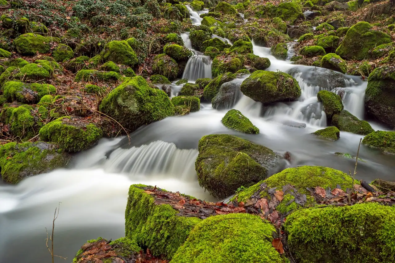
Imagen: HMCOF / Pixabay
Buñol has earned its own place on the Valencian trail map for a very simple reason: it concentrates water, rock, paths and elevation gain in a small radius, almost as if the mountain had folded the terrain to put everything within reach. In just a few kilometers you come across the Barranco de Carcalín, the Cueva del Turche, Charco Mañán, the Cueva de las Palomas, historic springs and viewpoints that open the landscape toward the Hoya de Buñol. That mix explains why the area attracts both those looking to run fast and those who prefer a more technical, unhurried day out.
The offer is broad and changes a lot depending on the season. There are short routes, of around 7 to 10 kilometers, designed for a midday outing or to rack up elevation without stretching the day too much; and there are also routes close to or above 20 kilometers, with more than 900 meters of ascent, which already demand legs, head and a good reading of the terrain. The appeal is not only in the effort: in Buñol the landscape changes with every turn, and the runner goes from open tracks to narrow paths, from pine woods to damp ravines and from loose stones to more runnable sections.
A terrain that concentrates water, ravines and views
Buñol’s sporting value comes from its geography. The area combines limestone relief, cut-in streambeds and a network of traditional paths that are still alive because they connect springs, caves, bathing spots and natural passes. That translates into a very complete trail experience: there is no monotony, and the feeling is that of moving through small scenes within the same route. In a single workout, you can alternate an open climb with views, a technical descent and a stretch beside the water where the air changes and the temperature drops several degrees.
That variety also explains why the surroundings are among the most visited in the province for hiking and mountain running. The water route, the Barranco de Carcalín and the approaches toward the Turche appear again and again in routes shared by the community, not because of fashion, but because they offer a rare combination of accessibility and character. It is not alpine terrain, but it is not just a simple walk either. It has enough elevation changes, uneven steps and path sections for the runner to feel the body working.
The network of paths also makes it possible to play with distance. Anyone wanting a short session can focus on the area around Parque San Luis and the Turche; anyone looking for a longer route can link Carcalín, Charco Mañán, Cueva Grande, springs and viewpoints until getting close to 20 kilometers. In trail running, that ability to modulate the effort is worth as much as the landscape itself, because it turns Buñol into a flexible destination, useful for different levels and times of year.
Where to stay near Buñol
Accommodation in the area, with prices. Choose your dates on the map.
Affiliate links: if you book through this map we earn a commission, at no extra cost to you.
The most representative routes and what they offer
The water route is the most recognizable gateway. The data that gets repeated most often places it at around 7.2 to 7.9 kilometers, with an approximate elevation gain of 210 to 250 meters and an average duration close to two hours and fifteen minutes. The route links very photogenic spots such as the Cueva del Turche and Cueva de las Palomas, and it is usually described as a loop suitable for a large part of runners who already move comfortably on track and trail. It is an especially rewarding option when the flow is good, because the sound of the water becomes part of the workout.
The Barranco de Carcalín offers a more mountainous and visual version. There are routes of around 10.5 or 12.5 kilometers, with elevation gains ranging from about 460 to more than 530 meters. On these routes you come across references such as Playa Fosil, Cueva Grande or La Jarra, and the terrain alternates runnable sections with more attentive steps. It is not usually an extreme proposal, but it is more complete than the water route in terms of elevation and variety of footing. For many runners, it is the exact point where training stops feeling like a walk and starts to feel like a small adventure.
The longer versions, of 20 to 21 kilometers, already change the tone. One of the most shared references is around 20.97 kilometers with 905 meters of ascent, while other proposals sit near 21.5 kilometers and 979 positive meters. In both cases, it is a serious effort, with prolonged climbs, descents that punish the quads and a duration that, depending on pace, can approach or exceed three hours. These are routes you do not choose by chance: you go after them when the goal is to work endurance, elevation and concentration at the same time.
There are also very useful intermediate routes, such as those of around 11 to 14 kilometers and between 250 and 430 meters of elevation gain. That is one of the keys to Buñol’s success among local runners and visitors: it does not force you to choose between a stroll or suffering. It allows you to build quality sessions with a reasonable progression, without turning every outing into an expedition. For the trail enthusiast, that means continuity. And continuity, in a sport so dependent on terrain, matters as much as the stopwatch.
Which points appear again and again on the routes
There are names that work as landmarks within the area. Parque San Luis often appears as a start or finish, partly for logistical convenience and partly because it connects well with several access points to the mountain. Fuente del Ciprés, Mirador de la Cruz, Mirador Parque San Luis, Fuente el Roquillo, Cueva Grande, Charco Mañán and the Cueva del Turche form a mental map that many runners already recognize almost by heart. That repetition is no coincidence: these are places that organize the terrain and help with orientation in an area with quite a few path crossings.
Water is the great thread running through the landscape. Not only as a scenic element, but as a practical reference. Pools, waterfalls and basins set the rhythm of the route, refresh the atmosphere and, in many cases, affect footing. After rainy spells the ground changes completely; in dry periods, some sections become drier and faster, but the surroundings lose part of their liquid character. That is why community descriptions insist so much on the fact that the flow varies. In Buñol, water is not a fixed backdrop, but a presence that changes the tone of the day.
There are also stretches where the history of the landscape shows itself without the need for signs. The caves, ravines and old connecting paths between areas show a territory shaped over centuries. You do not need to be a geologist to notice that the relief has been sculpted by erosion and by human use. The runner feels it in the shape of the walls, in the type of stone and in the way the path suddenly narrows to fit between rocks. That sense of a living terrain is part of Buñol’s personality and one of the reasons it is so addictive.
What level of demand it really presents
Buñol is not a high-mountain destination, but it does not give away meters either. The most visited routes move between moderate and difficult, according to the usual scale used by hiking and trail platforms. In runner’s terms, this means that most routes require a steady step, constant attention and some familiarity with stone, elevation gain and uneven ground. You do not need to be a specialist, but it is worth understanding that a loose descent can wear you down more than a short climb.
Short or medium routes are usually the most rewarding for those who want to run without taking too much of a toll on the legs. Between 7 and 12 kilometers, with 200 to 500 meters of elevation gain, Buñol offers enough stimulus to work on foot placement technique, uphill endurance and pace control. By contrast, routes of 20 or 21 kilometers already demand a more serious management of effort: starting too fast can turn the second half into a long negotiation with fatigue.
Technique also matters. In ravines with loose stones, eroded dirt sections or narrow passages, the runner loses the margin they would have on a forest track. The terrain rewards a short stride, anticipatory reading and the ability to adapt pace to each section. Buñol usually does not punish with extreme height, but with accumulation: it goes up, down, turns, tightens and climbs again. It is a mountain of persistence, not of a single blow.
How the experience changes with the season
The best side of these paths appears in spring and autumn. Temperatures are milder, the landscape is visually cleaner and the water usually brings more life to ravines and waterfalls. In those months, trail running is enjoyed with a very different intensity: the runner breathes better, the vegetation helps, and the effort is spread out without the extra harshness of the heat. The light also helps, because the rock walls and streambeds reflect sharper tones at dawn or late in the afternoon.
Summer changes the rules. The heat in inland Valencia hits hard and routes that seem friendly in other seasons become more demanding. Shade is not always abundant and hydration stops being general advice and becomes a decisive factor. In addition, some pools and basins drop a lot in flow, so part of the visual appeal is reduced. That does not prevent running, but it does require adjusting expectations and schedules.
After heavy rains, the terrain can become more delicate. In ravines and dry riverbeds, mud and erosion alter footing and difficult sections can appear. Observations from runners in 2025 and 2026 mention, precisely, areas with recent damage and stretches that depend a lot on the condition of the trail. In trail running this matters more than it seems: a short route can become hard if the surface is broken, and a long one can go from good to uncomfortable if several descents deteriorate all at once.
Buñol within the trail map of the Hoya
The municipality does not work in isolation, but as the core of a region with a lot of potential. The Hoya de Buñol adds ravines, mountain ranges, climbing areas, heritage routes and natural corridors that connect with Alborache, Yátova, Chiva, Macastre or Dos Aguas. That network broadens the menu for anyone traveling to the area with the intention of training for several days or combining running with hiking. Buñol, in that context, acts as a very logical starting point because it concentrates access points and nearby services.
The presence of official routes and marked trails reinforces that idea. The Ruta del Agua, the PRV 190 of Las Moratillas and the Alto Jorge and Barranco Carcalín circuit draw a fairly recognizable network for the runner who wants to move beyond improvisation. Not all routes are designed for high-speed running, but they do offer a reliable base on which to build varied training sessions. That balance between signage, landscape and distance is one of the area’s great virtues.
In addition, Buñol has something that sets it apart from other more famous natural spots: it does not depend on a single postcard. Its value lies in the sum of small elements. A natural bridge, a spring, a cave, a hollow, a viewpoint. Each one weighs little on its own; together, they form a very complete experience. For trail running, that accumulation of details is almost a signature.
The routes that best explain the character of the place
The water route sums up the most accessible and visual side of Buñol. It is ideal for understanding how water shapes the surroundings, how the caves are linked together and why so many descriptions repeat the word loop. It has a good balance between distance and elevation gain, and that is why it has become one of the most repeated options by the community. It is not intimidating, but it does not feel flat either, and that is where much of its appeal lies.
The Carcalín circuit, on the other hand, shows the more athletic side. Its climbs and descents make it a useful route for anyone wanting to work endurance with a bit more character. The landscape is not just a backdrop, but part of the effort. The runner does not only look at the surroundings; they negotiate them with every step. That more physical relationship with the terrain is what makes many place it among their favorite routes in the area.
The long loops around Buñol are the ones that come closest to a full trail run. With elevation gains around 900 or even 1,000 meters, they already demand strategy, nutrition during the outing and careful management of energy. These are routes that mix visible tracks with others that are more hidden, and where GPS can help, although it does not replace reading the terrain. In some community descriptions, there is even mention of a certain complexity due to damaged trails and less clear points, a reminder that the mountain changes and does not always agree with the map.
A destination that is better understood running than looking at it from afar
Buñol has an unusual quality: it reveals itself in motion. From the outside it may seem like just another inland landscape, one of many scattered across Valencia; in a run, however, its true personality appears. The runner discovers changes in pace, moisture in the air, rock walls, narrow shadows and valley openings that are not perceived in the same way on a short visit. Trail running here is not just sport: it is a way of mapping the place with your legs.
That is why the routes in the area have remained so alive within the running and hiking community. They do not depend on novelty, but on a very solid combination of landscape and effort. There is enough water to give character, enough elevation gain to force you to work and enough variety to avoid boredom. In a time when many routes are consumed quickly and forgotten just as fast, Buñol keeps something harder to find: routes that still say new things every time you repeat them.
Anyone looking for a trail with its own identity finds a clear answer here. There is no need to exaggerate or dress it up too much. Buñol offers ravines, springs, caves, viewpoints and elevation gain in a very well-balanced measure, with options for different levels and distances. And that, in a region with such a density of landscapes, is no small thing: it is exactly what turns a mountain outing into a day that leaves a mark.
You may also like: Nogueruelas Trails: complete guide to routes and races.



How to prevent thigh chafing: causes and real solutions

Women’s running windbreakers: seven jackets and how to choose

Do more workouts get rid of soreness? A guide for runners

Jaén Half Marathon 2026: Record 3,800 Runners Registered

Men’s short running tights: how to choose the right pair

World Triathlon confirms data breach involving medical data

Izan Edo targets podium at Miyazaki World Cup

María Pérez ranks ninth in World Athletics’ 2026 top ten

Dos Santos, Duplantis and Sawe: World Athlete of the Year finalists

San Silvestre Vallecana 2026: 42,000 places, prices and start times

 Races4 months ago
Valencia Half Marathon 2027: date and registration

 Reviews and Comparisons4 months ago
Asics Gel-Roadmiles 3 for men: review and current price

 Races4 months ago
Valencia Marathon 2026: entry, ballot and course

 Reviews and Comparisons4 months ago
Asics Gel Sonoma 8 Gore-Tex: complete analysis for trail and rain

 Sneakers3 months ago
Saucony Endorphin Pro 4: full review and verdict

 News5 months ago
Strava API 2026: what changes for clubs, challenges and runner apps?

 Reviews and Comparisons5 months ago
Nike Alphafly 3: opinions, sensations, and real key points

 Reviews and Comparisons4 months ago
Under Armour running shoes review 2025-2026: models and key features

 Sports Equipment4 months ago
Shoe sizes in cm: a clear guide to getting the right fit for your footwear

 Sneakers3 months ago
Skechers GO RUN Consistent 2.0 analysis: comfort and limits

 News5 months ago
Valencia Marathon 2026 route: key tips to train and run better

 Sneakers4 months ago
Adidas Adizero Boston 13 for men: review and verdict