Routes
Devesa El Saler Route: running among pine trees without punishing your legs anymore
A simple walk among forest, sand, and salt water, very close to Valencia, with practical tips to organize it.

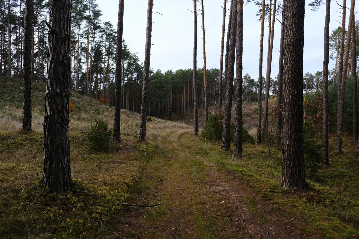
La Devesa de El Saler offers one of the most recognizable landscapes on the Valencian coast: a narrow strip of pine forest, dunes and wetlands that separates the Albufera from the Mediterranean. In that natural corridor several marked trails are concentrated, all with a gentle profile, allowing you to walk without any noticeable elevation gain and with constant references to the surroundings. The combination of sand, shade and water makes this area function almost like an open-air laboratory of the Mediterranean coast.
The Devesa El Saler route that is most often searched for usually links several of those itineraries, with a circular or almost circular route that can range between 11 and 19 kilometers, depending on the variants and detours. It is an easy walk in technical terms, very flat, designed for walking, cycling at a relaxed pace or a long family outing, always with respect for a fragile space where a small gesture can leave a mark. The appeal is not in the difficulty, but in the sequence of settings: pine forest, scrubland, malladas, dunes and beach, all in little more than a day’s stroll.
A natural corridor between the lagoon and the sea
La Devesa is the strip of sand that protects the lake of l’Albufera on its eastern side. It is about 10 kilometers long, around 1 kilometer wide and has an approximate surface area of 850 hectares. It is not just a simple coastal walk; it is the best-preserved part of a much larger sandbar, in which a dune system and a Mediterranean forest are still maintained with enough continuity to understand what this coastline was like before urban pressure.
That geographical value explains why the route is so interesting even though the physical effort is slight. Here the walk feels more like turning the pages of a living atlas than completing a climb. The hiker moves among the shade of Aleppo pines, clearings of scrub, waterlogged depressions and stretches where the sand forces you to slow down. Light filters in, the air smells of resin and salt, and each change in terrain marks a small shift in scenery, as if the landscape were changing its backdrop without asking permission.
El Saler and La Devesa also tell a recent story of conservation. In the late 1960s, much of the first dune ridge was altered by urban development projects, but social reaction and the later protection of the area halted the most aggressive transformation. That past is still noticeable: alongside restored spaces, traces of human intervention coexist, from old roads to recovered areas that today once again function as habitat. The route, therefore, is not only beautiful; it also has environmental and historical significance.
Where to stay near El Saler
Accommodation in the area, with prices. Choose your dates on the map.
Affiliate links: if you book through this map we earn a commission, at no extra cost to you.
What the route is like when linking the marked trails
The most complete way to explore this area is to connect several of the official Devesa itineraries, all clearly marked with colors and interpretive panels. Among the best known are the historic route of the Gola del Pujol, the botanical route, the landscape route, the senses route, the playful beach route and the historic route of El Saler. Together they form a mosaic that lets you move from a pinewood setting to an open seafront edge, with information stops that turn the walk into a slow reading of the territory.
The longest and most useful stretch for orientation is the landscape itinerary, with about 4 kilometers and an approximate duration of 1 hour and 45 minutes. It follows the Camí Vell de la Devesa and allows you to observe several malladas, those interdune depressions that fill with water in rainy periods and are one of the most distinctive features of the place. Around them are distributed plant communities that change with the salinity and moisture of the soil, from rush beds to saltmarsh vegetation.
The botanical itinerary, about 800 meters long, enters the Pla de Na Sanxa and shows the inner dune system, colonized by dense scrub and pine forest. The senses route barely reaches 300 meters, but it offers a good sensory summary of the surroundings. The historic route of the Gola del Pujol is around 730 meters and explains the role of that channel in the communication between the Albufera and the sea. The playful beach route exceeds 2 kilometers and follows the first dune ridge. The historic route of El Saler, for its part, adds a shorter stretch, of about 600 meters, with references to the village, the barraca and the traditional use of the space.
What you see while walking: dunes, pines and salt water
One of the great strengths of this excursion is that the landscape does not end in a single image. First comes the pine forest, with the Aleppo pine as the dominant species, and then the Mediterranean scrub, dense and somewhat tough, where mastic, aladierno, phillyrea, kermes oak, dwarf palm or myrtle coexist. Further on, the dunes emerge, with their low, creeping and resilient plants, capable of withstanding salty wind, intense sun and shifting sand. The result is a tense balance, almost fragile, that the walker perceives even without stopping.
The malladas add another layer. They are depressions between dunes that easily become waterlogged and, depending on salinity and moisture, host different plant communities. In some places the ground is bare; in others, rushes, plantains, glassworts or sea lavenders of the genus Limonium appear. This change in vegetation, visible to the naked eye, works as a natural map of the terrain conditions. It is enough to look a few meters to either side of the path to understand that here water rules more than geometry.
The Gola del Pujol and the Estany del Pujol add the presence of open water. The gola, with gates and channeling, regulates the communication between the lagoon and the sea; the estany, excavated during the urbanization of the 1960s and later naturalized, has become a refuge for birds and salt-tolerant vegetation. These are spaces that show how a work designed for another purpose can end up becoming habitat of high interest if time, protection and ecological dynamics align.
A landscape with memory: from traditional use to current protection
The route does not only show nature; it also reveals the way people have historically lived on this coastal edge. The name El Saler probably refers to the huts where salt from old salt pans was stored, and around that core the village developed. The Casa de la Demanà, the hunting areas and the old practices linked to the Albufera remind us that this space was for centuries a place of use, not contemplation. First it was exploited, then managed, and only much later did it begin to be preserved.
Material traces of those transformations have also remained. In some places you can see old roads, remains of interventions to dry out malladas, eucalyptus plantations introduced for drainage purposes and areas where ecological restoration has returned the land to a more original appearance. History here is not in a closed museum; it is underfoot. Every stretch of the trail recalls the tension between human use and conservation, a tension that explains both the current beauty and its vulnerability.
That is why La Devesa has a double reading. It is a pleasant place to walk, yes, but also a space where you can understand the evolution of the Valencian coast over the last century. The attentive visitor sees how aggressive urbanization gave way to partial recovery, and how the landscape has been rebuilt through containment works, the removal of old promenades, dune restoration and control of foot traffic. What today seems natural is, in many cases, the result of patient repair.
Which itineraries work best depending on the type of visit
The choice of route depends more on the time available than on physical condition. For a short and very educational outing, the botanical itinerary or the senses route are enough to capture the essence of the place. If the idea is to walk more continuously and get a broader view, the landscape route becomes the backbone of the visit. And if you want to add historical context, the Gola del Pujol route or the historic route of El Saler provide very useful pieces to complete the puzzle.
Families usually find an obvious advantage here: the terrain is flat and the trails are marked, although it is worth remembering that in several stretches there are crossings with roads and the presence of cyclists. By contrast, those who enjoy quiet observation get more out of the area at dawn or late in the afternoon, when the light softens the colors and movement is less. The same path changes a lot depending on the time; in the morning it smells more of moisture and resin, and as evening falls the sand holds a drier warmth.
Those looking for a longer outing often combine the trails with stretches of beach or detours toward the Casal d’Esplai and the area of the Gola del Pujol. In this way, you can build a walk of about 13 to 19 kilometers, depending on the variant, without entering technical terrain. There is no mountain, but there is a succession of visual planes that tires you in another way: the eye rests on the sea horizon, the pinewood provides shade and the sand demands a little extra effort at certain points.
Fauna, silence and signs that are not always obvious at first glance
La Devesa is discreet with wildlife, and precisely for that reason it deserves attention. Among the pines and shrubs you can hear birds such as the serin, great tit, Sardinian warbler or zitting cisticola in the more open areas. Near the water appear herons, gulls, terns and, with a bit of luck, kingfishers. You do not need binoculars to sense life; it is enough to walk slowly, stop talking for a moment and listen to the place’s background sound.
The dunes also shelter small species adapted to extreme conditions. Some beetles move at dusk, snails protect themselves from the heat by climbing up the stems and the red-tailed lizard takes advantage of the sand with an agility that almost seems like a choreographed survival maneuver. They are discreet presences, but they complete the portrait of the space. On a route like this, what is most visible is not always the most important; sometimes what matters most is a footprint, a song or a low plant close to the ground.
The aromatic flora also leaves its mark. Rosemary, honeysuckle, mastic and everlasting flower build an olfactory landscape that changes with the wind and the season. After rain, the smell of wet earth takes over and everything seems sharper, as if the forest were exhaling with relief. That sensory component is one of the reasons the route works so well even without major monumental landmarks: the memory is tied to sensations, not just photos.
Practical details that change the experience of the walk
The best way to read this route starts with assuming that it is not a demanding excursion, but rather a comfortable-paced itinerary. The elevation gain is practically nil, with values that rarely exceed 9 meters of ascent or descent in the longer versions. That makes it suitable for almost any type of walker, although the condition of the surface and the presence of sand can slow the pace more than the figures suggest. In the middle of La Devesa, theory always moves faster than the feet.
It is advisable to bring water, sun protection and footwear with good grip, because in several places sand gets into your step and the sun bounces strongly off the open surfaces. On windy days, the beach stretch can feel harder than expected, not because of technical difficulty, but because of exposure. In summer, moreover, shade is not continuous; the pines provide relief, but they do not cover the whole route. The thermal sensation changes a lot between pine forest, dune and beach, and that fluctuation is worth keeping in mind before setting out.
Access to the starting point is usually from El Saler, les Gavines or the surroundings of the Camí Vell de la Devesa, with parking in nearby areas depending on the chosen section. There are also stretches that connect with the beach and with recreational areas such as the surroundings of Las Dunas. The area is well connected for a short visit from Valencia city, although that same convenience means sharing it with walkers, cyclists and weekend visitors. Coexistence, in this environment, is part of the experience.
A place that is better understood when walked slowly
La Devesa de El Saler does not need grand gestures to impress. Its strength lies in the mix of natural continuity and historical scar, in the way the sea can be sensed behind the dunes and the lagoon hinted at behind the pines. Those who walk its trails discover that the Mediterranean landscape is not a static backdrop, but a living structure that changes with salt, wind, water and human intervention.
That is why the route works so well for those looking for a walk, nature and context all at once. There are no peaks or major ascents, but there is a clear sequence of ecosystems and a reading of the territory that few urban or peri-urban walks offer with such clarity. La Devesa, in the end, seems to say that what is essential is not always far away or requires extreme effort: sometimes it is enough to follow a flat path to enter one of the most delicate and valuable landscapes on the Valencian coast.



How to prevent thigh chafing: causes and real solutions

Women’s running windbreakers: seven jackets and how to choose

Do more workouts get rid of soreness? A guide for runners

Jaén Half Marathon 2026: Record 3,800 Runners Registered

Men’s short running tights: how to choose the right pair

World Triathlon confirms data breach involving medical data

Izan Edo targets podium at Miyazaki World Cup

María Pérez ranks ninth in World Athletics’ 2026 top ten

Dos Santos, Duplantis and Sawe: World Athlete of the Year finalists

San Silvestre Vallecana 2026: 42,000 places, prices and start times

 Races4 months ago
Valencia Half Marathon 2027: date and registration

 Races4 months ago
Valencia Marathon 2026: entry, ballot and course

 Reviews and Comparisons4 months ago
Asics Gel-Roadmiles 3 for men: review and current price

 Reviews and Comparisons4 months ago
Asics Gel Sonoma 8 Gore-Tex: complete analysis for trail and rain

 Sneakers4 months ago
Saucony Endorphin Pro 4: full review and verdict

 News5 months ago
Strava API 2026: what changes for clubs, challenges and runner apps?

 Reviews and Comparisons5 months ago
Nike Alphafly 3: opinions, sensations, and real key points

 Reviews and Comparisons4 months ago
Under Armour running shoes review 2025-2026: models and key features

 Sports Equipment4 months ago
Shoe sizes in cm: a clear guide to getting the right fit for your footwear

 Sneakers3 months ago
Skechers GO RUN Consistent 2.0 analysis: comfort and limits

 News5 months ago
Valencia Marathon 2026 route: key tips to train and run better

 Sneakers4 months ago
Adidas Adizero Boston 13 for men: review and verdict