Routes
Mountain route near me: how to choose the best one without failing
Tips for choosing a nearby trail with a good map, manageable elevation gain, and safety before heading out into the mountains.

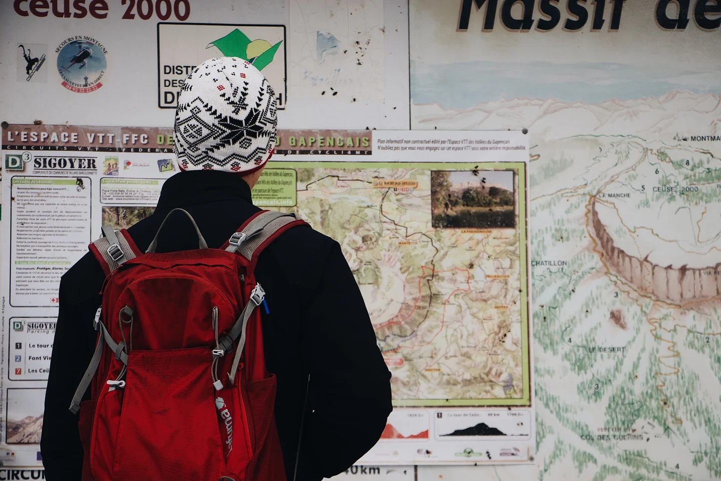
The phrase mountain route near me often appears on the phone just before setting off, when the need for fresh air weighs more than the desire to spend hours comparing options. At that moment, the decisive thing is not finding just any trail, but one that fits the available time, your actual fitness level, and the kind of landscape you feel like exploring. A good nearby route can fill an entire morning: from a short climb with a viewpoint to a longer circuit with forest, rock, and gentle elevation gain.
In practice, the best option is almost never the longest or the most famous, but the one that combines easy access, clear orientation, and a reasonable effort. That matters even more in areas like the Valencian Community, where within a few kilometers you can go from coastal paths and low mountain ranges to ravines, rounded peaks, and more demanding ridges. The nearby mountains are not a minor plan: chosen well, they offer the same sense of escape as a distant outing, but without the heavy logistics of a full-day trip.
What it really means to look for a nearby route
The search for an outing close to where you are starts from a very specific idea: making use of the terrain available without turning the excursion into an expedition. That means distinguishing between a walk, a trail, and a mountain route. There are nearby routes that are almost urban, with wide tracks and little elevation gain, and others that require sturdy shoes, free hands, and attention at every turn. The distance to the starting point does not tell the whole story; the terrain profile matters far more than the road map.
The appeal of these routes lies in their variety. In a relatively small area, a riverside path, an ascent to a mid-height mountain range, a circuit among pine trees, and a ridge with open views can all coexist. For anyone who runs, walks, or simply wants to move outdoors, that diversity is a clear advantage: it lets you match the outing to the day, not the other way around. There are routes to clear your head in 45 minutes and others that call for a full morning, snacks, and some patience with heat or mud.
In the Valencian Community, that geographical breadth is especially noticeable. The Serra d’Irta, the Serra Calderona, the Vall de Gallinera, the Montgó, or the interior of Castellón offer very different settings, yet all fit within the idea of a nearby outing. The key is to read the terrain the way you read an unfamiliar city: looking at slopes, shade, escape points, and orientation.
How to assess a route before setting out
The first useful filter is positive elevation gain. 200 meters of climbing spread over a gentle track is not the same as 200 meters packed into one kilometer. Over the same distance, a route can go from easy to demanding simply because of the way the mountain pushes back. A practical reference helps: up to 300 meters of elevation gain usually fits easy outings of a couple of hours; between 300 and 900 meters you are already in moderate territory; above that, the route calls for more stamina, more time, and better planning.
The surface also matters. A compact dirt path, a forest track, and a rocky section do not punish you in the same way. Asphalt or a smooth surface can make a nearby route suitable for running or for families, while loose stones, broken limestone, or muddy climbs force you to slow down. Technical difficulty does not always show up in the name of the route; often it appears in details like roots, natural steps, narrow sections, or descents with loose rocks that tire you more than they seem to at first glance.
Orientation is the third filter and, at times, the most decisive one. A well-marked route reduces surprises, but it does not remove the need to check the course before leaving. Nearby trails change frequently because of forestry work, fires, temporary closures, or erosion. It is worth checking whether the circuit is marked, whether it has complex junctions, and whether the return is along the same path or via a variation. A clear map is worth more than optimistic intuition in the middle of the mountains.
Nearby mountains in the Valencian Community: landscapes that surprise
Anyone thinking of mountain outings close to home usually imagines small ranges, but the Valencian reality is much richer. There are peaks with gentle profiles and coastal areas with an almost alpine character, albeit on a Mediterranean scale. The Serra d’Irta, for example, combines sea, ravines, and limestone ridges; the Calderona offers kilometers of forest and classic paths among pine trees; the interior of Alicante adds rougher formations, with exposed rock and viewpoints that seem to hang over the void.
That contrast completely changes the experience. On the coast, effort mixes with the brightness of the sea and with very clear light, almost white at midday. Inland, the mountains become drier, more aromatic, with rosemary, thyme, and mastic trees accompanying every step. And in the more enclosed ranges, sound takes over: a hum of insects, branches, wind, and stone under your shoes. They are different settings, but all of them work for a short, well-resolved outing without going too far.
In addition, nearby routes have a little-mentioned virtue: they let you repeat them. Returning to the same trail in another season transforms it. Where there is little shade in June, in November there is slanted light and firmer ground; where low bushes bloom in spring, dust dominates in summer and clean winter air opens up crisper views. Proximity turns the mountain into something less exceptional and more everyday, and that is no small thing.
Which routes usually work best for a day outing
The most balanced options are usually circuits between 4 and 12 kilometers, with moderate elevation gain and clear reference points. That range lets you enjoy the outing without turning it into an endurance march. For walking, it is comfortable; for running, it offers variety; for those taking it more slowly, it leaves room for breaks, photos, and taking in the landscape. Within that range you can find routes with viewpoints, ravines, chapels, towers, lakes, wetlands, or historical remains that add context without requiring special preparation.
Out-and-back trails with a clear destination also work well. A viewpoint over a valley, an accessible summit, or a waterfall make it easier to organize the day than a labyrinthine route. In a nearby setting, that simplicity is an advantage: it reduces the chance of getting lost and makes it easier to plan the return before the heat rises or evening arrives. For many people, this kind of route is the gateway to regular mountain outings, without too much complexity.
Circular routes, for their part, have an obvious appeal. They avoid repeating the same section and give a sense of a complete journey. In a well-marked area, returning by a different slope multiplies the feeling of having visited a place larger than it looked on the map. It is one of the reasons why so many popular trails around Peñíscola, Castellón, Alicante, or València continue to work so well: they are not exhausted by the walk; they also tell a geography.
Basic safety to avoid turning a short outing into a problem
Safety in nearby mountains starts before you set foot on the trail. Checking the weather forecast, sunset time, and the actual temperature of the terrain prevents more incidents than any last-minute advice. In Mediterranean areas, heat can multiply the effort during the central hours of the day, especially on exposed slopes and in ravines without shade. In winter, the problem is often the opposite: humidity, mud, and cold that builds up in shady areas.
Footwear deserves more attention than it usually gets. For an easy track, something comfortable will do, but on rocky trails or broken descents you need a grippy sole and some lateral stability. A backpack, even a small one, should include enough water, some food, sun protection, and a phone with battery. There is no need to dramatize; there is a need not to improvise. A nearby outing can go wrong because of something as simple as running short of water on a sun-exposed climb.
It is also worth thinking about the return with a cool head. The mountain punishes not only through difficulty, but through confusion. If a route becomes more complicated than expected, turning back early is not failure, but a correct reading of the environment. Prudent decisions often go unnoticed, but they are what keep the hobby alive for years. And on nearby terrain, where repetition matters, what is sensible counts more than what is epic.
The value of maps and route apps
Navigation apps have changed the way nearby trails are found, but they do not replace reading the terrain. Tools with topographic maps, elevation profiles, and GPS tracks help you know whether a climb is short or long, whether the route crosses forest tracks, or whether there are alternative exits. They also let you save routes, check estimated times, and verify whether other users have left recent notes about mud, closures, or detours.
The real value of these apps is reducing uncertainty. A 3D view, an elevation profile, or markers for key points can prevent mistakes from the outset. But it is important not to confuse assistance with certainty. A phone provides guidance; it does not walk. The battery runs out, coverage fails, and GPS can be inaccurate in ravines or dense vegetation. That is why, even on a short route, having a clear idea of the path remains part of common sense.
In hiking and trail running, this combination of technology and personal judgment has become normal. The map helps you decide; the legs help you confirm. And that relationship is especially useful when looking for a nearby trail in unfamiliar surroundings. Geographic proximity does not always equal real familiarity: there are mountains that are twenty minutes from home and still feel unfamiliar if you do not know their access points, their shade, or how to descend them.
When a nearby route is also good for running
Not all mountain outings near home are meant just for walking. Many are perfect for running, especially if they combine track, wide trail, and moderate elevation gain. On that kind of terrain, pace depends less on the stopwatch and more on the ability to sustain continuous effort without stumbling. For trail running, a nearby route is valuable when it lets you get quality training without requiring heavy logistics.
The best routes for running usually have three traits: continuity, easy reading, and reasonable ground. A circuit with many junctions, loose stones, or technical sections can become a more mental than physical session. By contrast, a clear climb and a well-laid descent let you work on endurance and strength without spending too much time orienting yourself. That is why many popular routes around natural parks, peri-urban forests, and mid-range mountains attract both walkers and runners.
There is also a less visible advantage: repetition improves body awareness. Returning to the same route on different days reveals how effort responds to heat, wind, or humidity. In a region like Valencia, where the climate changes a lot between coast and inland areas, that practical learning is worth almost as much as training itself. The nearby mountain stops being just a beautiful place and becomes a simple laboratory, without artifice.
The appeal of landscapes that mix history and nature
A route gains depth when it offers not only exercise, but also human traces. Chapels, watchtowers, remains of farmhouses, old cattle pens, or mule tracks add layers to the walk. The body moves forward, but the gaze lingers. On a nearby outing that matters a lot, because it turns a brief effort into an experience with memory. The mountain stops being a backdrop and starts telling something about the historical use of the land.
In the Mediterranean, that mix is especially visible. Many trails link abandoned agricultural spaces with low mountain slopes, or old communication routes with coastal areas. This overlap of uses explains why so many nearby routes seem modest until you actually walk them. Behind every turn there is a logic of grazing, defense, water, or connection between population centers. Walking there is reading a geography built in layers.
That narrative component is not out of place on a short outing. On the contrary, it helps the journey have emotional depth without needing huge numbers. A short trail with a good viewpoint can leave a deeper impression than a long, bland trek. That is why nearby mountain routes work so well as a practical answer to the need to get out: they are genuinely close, but not shallow.
The most sensible choice is usually the one that makes you want to return
Looking for a nearby route is not about doing more, but about getting it right. A good outing close to home combines manageable distance, coherent elevation gain, safe terrain, and a visual or sensory reward that justifies the effort. It could be a humid forest, a ridge with the sea in the background, a shady ravine, or an easy circuit beside a lake. What matters is that the whole makes sense for that specific day.
The nearby mountain, when well understood, has something of a discreet luxury. It does not require a big trip or solemn preparations, yet it gives back a lot: clean air, a slower pace, silence, and a kind of clean fatigue that clears the head. That is why so many searches for nearby routes do not end in a simple walk, but in a small repeated ritual. The right trail is often closer than it seems; the hard part is not reaching it, but choosing it wisely.
And that is the true measure of a good nearby outing: that the return does not close the day, but leaves open the possibility of repeating it on another mountain, with another light and another pace. In practice, that continuity is what turns an isolated outing into a habit, and a habit into a landscape of your own.



How to prevent thigh chafing: causes and real solutions

Women’s running windbreakers: seven jackets and how to choose

Do more workouts get rid of soreness? A guide for runners

Jaén Half Marathon 2026: Record 3,800 Runners Registered

Men’s short running tights: how to choose the right pair

World Triathlon confirms data breach involving medical data

Izan Edo targets podium at Miyazaki World Cup

María Pérez ranks ninth in World Athletics’ 2026 top ten

Dos Santos, Duplantis and Sawe: World Athlete of the Year finalists

San Silvestre Vallecana 2026: 42,000 places, prices and start times

 Races3 months ago
Valencia Half Marathon 2027: date and registration

 Races3 months ago
Valencia Marathon 2026: entry, ballot and course

 Reviews and Comparisons4 months ago
Asics Gel-Roadmiles 3 for men: review and current price

 Reviews and Comparisons4 months ago
Asics Gel Sonoma 8 Gore-Tex: complete analysis for trail and rain

 Sneakers3 months ago
Saucony Endorphin Pro 4: full review and verdict

 News5 months ago
Strava API 2026: what changes for clubs, challenges and runner apps?

 Reviews and Comparisons5 months ago
Nike Alphafly 3: opinions, sensations, and real key points

 Reviews and Comparisons4 months ago
Under Armour running shoes review 2025-2026: models and key features

 Sports Equipment4 months ago
Shoe sizes in cm: a clear guide to getting the right fit for your footwear

 Sneakers3 months ago
Skechers GO RUN Consistent 2.0 analysis: comfort and limits

 News5 months ago
Valencia Marathon 2026 route: key tips to train and run better

 Sneakers4 months ago
Adidas Adizero Boston 13 for men: review and verdict